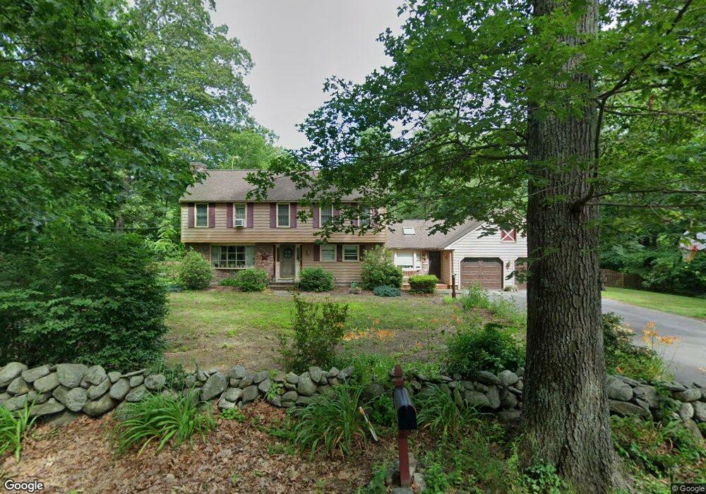
480 Forest St Dunstable, MA 01827
Estimated Value: $654,076 - $739,000
3
Beds
2
Baths
2,563
Sq Ft
$273/Sq Ft
Est. Value
About This Home
This home is located at 480 Forest St, Dunstable, MA 01827 and is currently estimated at $699,519, approximately $272 per square foot. 480 Forest St is a home located in Middlesex County with nearby schools including Groton Dunstable Regional High School.
Ownership History
Date
Name
Owned For
Owner Type
Purchase Details
Closed on
Dec 14, 2020
Sold by
Hughes Jonathan M and Hughes Ginger D
Bought by
Hughes Rental Prop Llc
Current Estimated Value
Purchase Details
Closed on
Aug 13, 1998
Sold by
Ellis John E and Ellis Ann Marie
Bought by
Hughes Jonathan M and Hughes Ginger D
Home Financials for this Owner
Home Financials are based on the most recent Mortgage that was taken out on this home.
Original Mortgage
$162,400
Interest Rate
6.94%
Mortgage Type
Purchase Money Mortgage
Purchase Details
Closed on
Jun 30, 1989
Sold by
Duggan John J
Bought by
Hughes Jonathan M
Home Financials for this Owner
Home Financials are based on the most recent Mortgage that was taken out on this home.
Original Mortgage
$127,500
Interest Rate
10.56%
Mortgage Type
Purchase Money Mortgage
Create a Home Valuation Report for This Property
The Home Valuation Report is an in-depth analysis detailing your home's value as well as a comparison with similar homes in the area
Home Values in the Area
Average Home Value in this Area
Purchase History
We collect this data history from publicly available records. To have your information removed, we recommend requesting removal directly through your county’s website.
| Date | Buyer | Sale Price | Title Company |
|---|---|---|---|
| Hughes Rental Prop Llc | -- | None Available | |
| Hughes Jonathan M | $203,000 | -- | |
| Hughes Jonathan M | $170,000 | -- |
Source: Public Records
Mortgage History
We collect this data history from publicly available records. To have your information removed, we recommend requesting removal directly through your county’s website.
| Date | Status | Borrower | Loan Amount |
|---|---|---|---|
| Previous Owner | Hughes Jonathan M | $280,000 | |
| Previous Owner | Hughes Jonathan M | $162,400 | |
| Previous Owner | Hughes Jonathan M | $127,500 |
Source: Public Records
Tax History
| Year | Tax Paid | Tax Assessment Tax Assessment Total Assessment is a certain percentage of the fair market value that is determined by local assessors to be the total taxable value of land and additions on the property. | Land | Improvement |
|---|---|---|---|---|
| 2025 | $7,976 | $580,100 | $212,200 | $367,900 |
| 2024 | $7,580 | $543,000 | $195,900 | $347,100 |
| 2023 | $7,572 | $505,800 | $195,900 | $309,900 |
| 2022 | $6,991 | $458,400 | $195,900 | $262,500 |
| 2021 | $6,879 | $419,200 | $179,600 | $239,600 |
| 2020 | $6,893 | $409,300 | $179,600 | $229,700 |
| 2019 | $6,747 | $395,500 | $179,600 | $215,900 |
| 2018 | $6,653 | $379,300 | $179,500 | $199,800 |
| 2017 | $6,372 | $374,400 | $179,500 | $194,900 |
| 2016 | $6,029 | $364,300 | $171,300 | $193,000 |
| 2015 | $5,740 | $343,100 | $143,600 | $199,500 |
| 2014 | $5,411 | $343,100 | $143,600 | $199,500 |
Source: Public Records
Map
Nearby Homes
- 0 Lowell St
- 41 Chestnut Rd
- 160 Westford Rd
- 153 Off Pond St
- 13 Stone Ridge Rd
- 43 Flint Rd
- 0 Dunstable Rd
- 12 Massapoag Way
- 54 Depot St
- 17 Centercrest Dr
- 14 Whispering Pines Rd
- 13 Farmhouse Row Unit 13
- 46 Pawtucket Blvd Unit 34
- 7 Lazy Day Dr Unit 7
- 1 Summer Village Rd
- 473 High St
- 11 Strawberry Bank Rd Unit U17
- 11 Strawberry Bank Rd Unit 5
- 22 Merrimac Way Unit B
- 67 Cherry Hollow Rd Unit U110
Your Personal Tour Guide
Ask me questions while you tour the home.