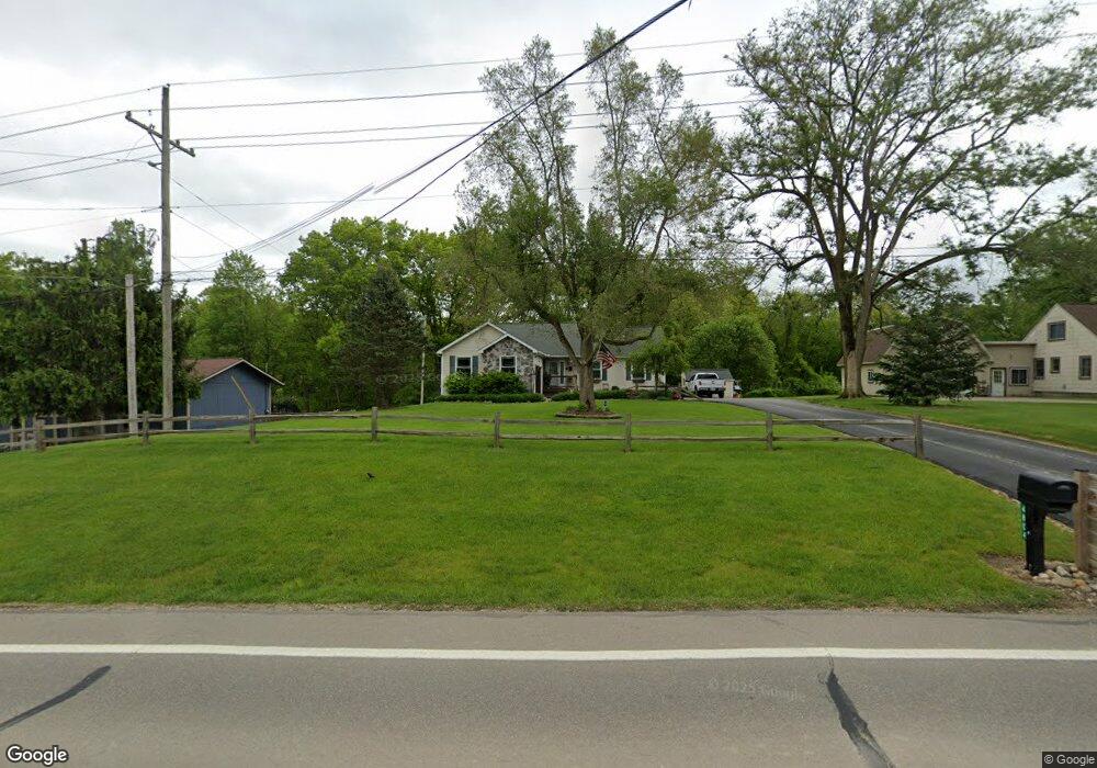
4804 Ormond Rd Davisburg, MI 48350
Estimated Value: $263,000 - $319,000
3
Beds
2
Baths
1,344
Sq Ft
$222/Sq Ft
Est. Value
About This Home
This home is located at 4804 Ormond Rd, Davisburg, MI 48350 and is currently estimated at $297,960, approximately $221 per square foot. 4804 Ormond Rd is a home located in Oakland County with nearby schools including Holly High School.
Ownership History
Date
Name
Owned For
Owner Type
Purchase Details
Closed on
Aug 5, 2021
Sold by
Moore Christopher Bruce and Moore Bonnie Ellen
Bought by
Moore Christopher Bruce and Moore Christopher Bruce
Current Estimated Value
Purchase Details
Closed on
Feb 25, 2020
Sold by
Moore Christopher Bruce and Moore Bonnie Ellen
Bought by
Moore Christopher Bruce and Moore Bonne Ellen
Purchase Details
Closed on
Jan 6, 2017
Sold by
Moore Christopher Bruce and Moore Bonnie Ellen
Bought by
Moore Christopher Bruce and Moore Craig Robert
Purchase Details
Closed on
Jun 30, 1998
Sold by
Kramer Steven Thomas
Bought by
Moore Christopher B
Home Financials for this Owner
Home Financials are based on the most recent Mortgage that was taken out on this home.
Original Mortgage
$141,865
Interest Rate
7.03%
Purchase Details
Closed on
Nov 17, 1994
Sold by
Saliba Const Co
Bought by
Kramer Stephen T and Kramer L
Create a Home Valuation Report for This Property
The Home Valuation Report is an in-depth analysis detailing your home's value as well as a comparison with similar homes in the area
Home Values in the Area
Average Home Value in this Area
Purchase History
| Date | Buyer | Sale Price | Title Company |
|---|---|---|---|
| Moore Christopher Bruce | -- | None Listed On Document | |
| Moore Christopher Bruce | -- | None Listed On Document | |
| Moore Christopher Bruce | -- | None Available | |
| Moore Christopher Bruce | -- | None Available | |
| Moore Christopher B | $166,900 | -- | |
| Kramer Stephen T | $120,000 | -- |
Source: Public Records
Mortgage History
| Date | Status | Borrower | Loan Amount |
|---|---|---|---|
| Previous Owner | Moore Christopher B | $141,865 |
Source: Public Records
Tax History
| Year | Tax Paid | Tax Assessment Tax Assessment Total Assessment is a certain percentage of the fair market value that is determined by local assessors to be the total taxable value of land and additions on the property. | Land | Improvement |
|---|---|---|---|---|
| 2025 | $2,314 | $129,630 | $0 | $0 |
| 2024 | $1,606 | $124,170 | $0 | $0 |
| 2023 | $1,532 | $112,030 | $0 | $0 |
| 2022 | $2,081 | $91,560 | $0 | $0 |
| 2021 | $1,919 | $91,820 | $0 | $0 |
| 2020 | $1,402 | $98,200 | $0 | $0 |
| 2018 | $1,854 | $88,000 | $12,400 | $75,600 |
| 2015 | -- | $73,300 | $0 | $0 |
| 2014 | -- | $64,000 | $0 | $0 |
| 2011 | -- | $56,000 | $0 | $0 |
Source: Public Records
Map
Nearby Homes
- 13180 Woodland Trail
- 12100 Woodland Trail
- 5567 Birch Ln
- 5744 Hidden Lane Ct
- 3667 Falcons Nest
- 4930 Fox Chase Dr Unit 3
- 5705 Lake Grove Dr
- 5691 Lake Grove Dr
- 12120 Shaffer Rd
- 5275 Lake Grove Dr
- 12335 Big Lake Rd
- 5115 Allingham Dr
- 4904 Lake Grove Dr
- 11661 Shaffer Rd
- 8600 Eagle Rd
- 4408 Hartley
- 4640 Melanie Ln
- 11999 Scenic Valley
- 6828 Country Lane Dr Unit 4
- 4370 Leroy Ct
- 4810 Ormond Rd
- 4808 Ormond Rd
- 4750 Ormond Rd
- 13125 Woodland Trail
- 4968 Ormond Rd Unit Bldg-Unit
- 4968 Ormond Rd
- 4785 Ormond Rd
- 13284 Neal Rd
- 13339 Neal Rd
- 13312 Neal Rd
- 4735 Ormond Rd
- 13106 Woodland Trail
- 4990 Ormond Rd
- 13340 Neal Rd
- 13180 Woodland Trail
- 4812 Ormond Rd
- 13055 Woodland Trail
- 4630 Ormond Rd
- 13351 Neal Rd
- 4685 Ormond Rd
Your Personal Tour Guide
Ask me questions while you tour the home.