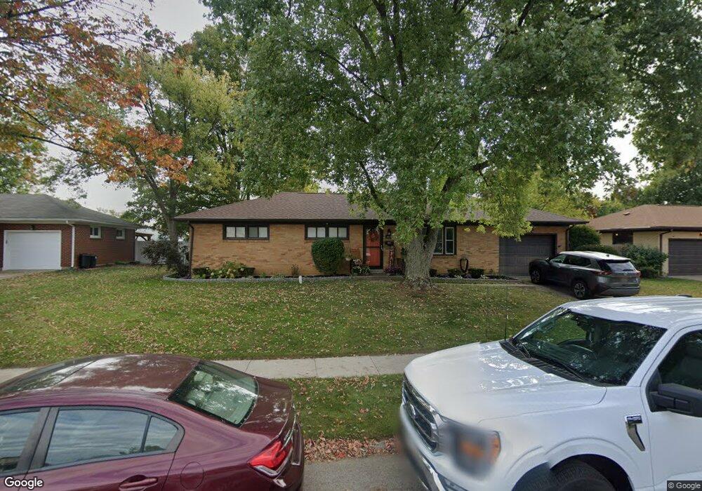
4804 Westmont Dr Springfield, OH 45503
Estimated Value: $182,000 - $202,000
3
Beds
1
Bath
1,175
Sq Ft
$165/Sq Ft
Est. Value
About This Home
This home is located at 4804 Westmont Dr, Springfield, OH 45503 and is currently estimated at $193,373, approximately $164 per square foot. 4804 Westmont Dr is a home located in Clark County with nearby schools including Northridge Elementary School, Kenton Ridge Middle & High School, and Emmanuel Christian Academy.
Ownership History
Date
Name
Owned For
Owner Type
Purchase Details
Closed on
Aug 24, 2007
Sold by
Horne Deborah J
Bought by
Welliver Linda S
Current Estimated Value
Home Financials for this Owner
Home Financials are based on the most recent Mortgage that was taken out on this home.
Original Mortgage
$90,816
Outstanding Balance
$57,026
Interest Rate
6.77%
Mortgage Type
Purchase Money Mortgage
Estimated Equity
$136,347
Purchase Details
Closed on
Jan 9, 1996
Sold by
Butts Richard E
Bought by
Horne Deborah J
Home Financials for this Owner
Home Financials are based on the most recent Mortgage that was taken out on this home.
Original Mortgage
$15,000
Interest Rate
7.41%
Mortgage Type
New Conventional
Purchase Details
Closed on
Aug 26, 1991
Create a Home Valuation Report for This Property
The Home Valuation Report is an in-depth analysis detailing your home's value as well as a comparison with similar homes in the area
Home Values in the Area
Average Home Value in this Area
Purchase History
We collect this data history from publicly available records. To have your information removed, we recommend requesting removal directly through your county’s website.
| Date | Buyer | Sale Price | Title Company |
|---|---|---|---|
| Welliver Linda S | $89,000 | None Available | |
| Horne Deborah J | $69,900 | -- | |
| -- | $52,000 | -- |
Source: Public Records
Mortgage History
We collect this data history from publicly available records. To have your information removed, we recommend requesting removal directly through your county’s website.
| Date | Status | Borrower | Loan Amount |
|---|---|---|---|
| Open | Welliver Linda S | $90,816 | |
| Previous Owner | Horne Deborah J | $15,000 |
Source: Public Records
Tax History
| Year | Tax Paid | Tax Assessment Tax Assessment Total Assessment is a certain percentage of the fair market value that is determined by local assessors to be the total taxable value of land and additions on the property. | Land | Improvement |
|---|---|---|---|---|
| 2025 | $1,972 | $58,480 | $17,290 | $41,190 |
| 2024 | $1,907 | $45,030 | $10,050 | $34,980 |
| 2023 | $1,907 | $45,030 | $10,050 | $34,980 |
| 2022 | $1,914 | $45,030 | $10,050 | $34,980 |
| 2021 | $1,596 | $31,860 | $7,440 | $24,420 |
| 2020 | $1,598 | $31,860 | $7,440 | $24,420 |
| 2019 | $1,628 | $31,860 | $7,440 | $24,420 |
| 2018 | $1,462 | $27,470 | $9,500 | $17,970 |
| 2017 | $1,253 | $27,941 | $9,503 | $18,438 |
| 2016 | $1,244 | $27,941 | $9,503 | $18,438 |
| 2015 | $1,322 | $27,573 | $9,135 | $18,438 |
| 2014 | $1,321 | $27,573 | $9,135 | $18,438 |
| 2013 | $1,291 | $27,573 | $9,135 | $18,438 |
Source: Public Records
Map
Nearby Homes
- 1052 Cheyenne Ave Unit 1052
- 954 Forest Edge Ave
- 4528 W Ridgewood Rd
- 5145 Ridgewood Rd W
- 1309 Richmoor Rd
- 1341 Student Ave
- 4512 Ridgewood Rd E
- 4890 Highlander Ln
- 4250 Midfield St
- 4480 Tacoma St
- 4732 Lehigh Dr
- 4385 Helena Ct
- 1415 Montego Dr
- 4642 Laredo St
- 4811 Middle Urbana Rd
- 1902 Erika Dr
- 5195 Burton Dr
- 5235 Middle Urbana Rd
- 841 Willow Rd
- 1738 Berwick Dr Unit 107
- 4810 Westmont Dr
- 4738 Curtis Dr
- 4740 Curtis Dr
- 4816 Westmont Dr
- 4807 Curtis Dr
- 4747 Curtis Dr
- 4813 Curtis Dr
- 4749 Westmont Dr
- 4805 Westmont Dr
- 4824 Westmont Dr
- 4811 Westmont Dr
- 4821 Curtis Dr
- 4737 Curtis Dr
- 4817 Westmont Dr
- 4734 Curtis Dr
- 4739 Curtis Dr
- 4825 Curtis Dr
- 4830 Westmont Dr
- 4825 Westmont Dr
- 4741 Curtis Dr
Your Personal Tour Guide
Ask me questions while you tour the home.