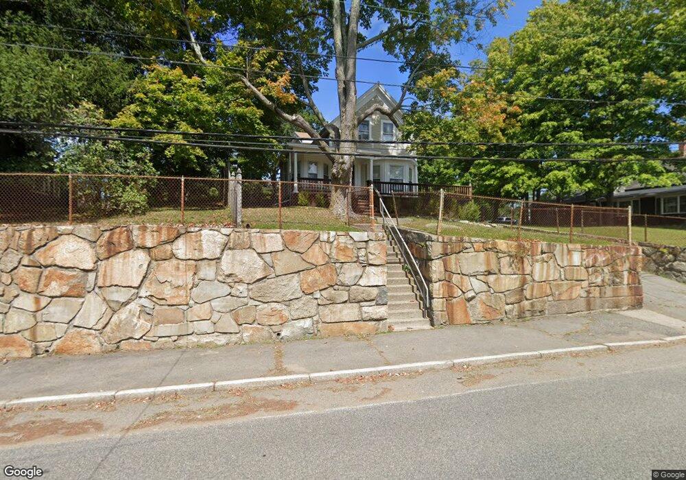
482 Broad St Weymouth, MA 02188
East Weymouth NeighborhoodEstimated Value: $451,000 - $830,000
4
Beds
3
Baths
2,244
Sq Ft
$290/Sq Ft
Est. Value
About This Home
This home is located at 482 Broad St, Weymouth, MA 02188 and is currently estimated at $651,023, approximately $290 per square foot. 482 Broad St is a home located in Norfolk County with nearby schools including Abigail Adams Middle School, Academy Avenue Elementary School, and Weymouth Middle School Chapman.
Ownership History
Date
Name
Owned For
Owner Type
Purchase Details
Closed on
Jan 13, 2011
Sold by
Us Bk
Bought by
Bailey Michael S
Current Estimated Value
Home Financials for this Owner
Home Financials are based on the most recent Mortgage that was taken out on this home.
Original Mortgage
$202,071
Outstanding Balance
$142,411
Interest Rate
5.5%
Mortgage Type
FHA
Estimated Equity
$508,612
Purchase Details
Closed on
Mar 10, 2010
Sold by
Grenon Wendy L and Us Bk
Bought by
Us Bk
Create a Home Valuation Report for This Property
The Home Valuation Report is an in-depth analysis detailing your home's value as well as a comparison with similar homes in the area
Home Values in the Area
Average Home Value in this Area
Purchase History
| Date | Buyer | Sale Price | Title Company |
|---|---|---|---|
| Bailey Michael S | $190,000 | -- | |
| Us Bk | $212,500 | -- |
Source: Public Records
Mortgage History
| Date | Status | Borrower | Loan Amount |
|---|---|---|---|
| Open | Bailey Michael S | $202,071 |
Source: Public Records
Tax History
| Year | Tax Paid | Tax Assessment Tax Assessment Total Assessment is a certain percentage of the fair market value that is determined by local assessors to be the total taxable value of land and additions on the property. | Land | Improvement |
|---|---|---|---|---|
| 2025 | $5,272 | $522,000 | $210,200 | $311,800 |
| 2024 | $5,107 | $497,300 | $200,200 | $297,100 |
| 2023 | $4,945 | $473,200 | $185,400 | $287,800 |
| 2022 | $4,815 | $420,200 | $171,700 | $248,500 |
| 2021 | $4,577 | $389,900 | $171,700 | $218,200 |
| 2020 | $4,439 | $372,400 | $171,700 | $200,700 |
| 2019 | $4,329 | $357,200 | $165,000 | $192,200 |
| 2018 | $4,193 | $335,400 | $157,200 | $178,200 |
| 2017 | $3,910 | $305,200 | $149,700 | $155,500 |
| 2016 | $3,758 | $293,600 | $144,000 | $149,600 |
| 2015 | $3,615 | $280,200 | $144,000 | $136,200 |
| 2014 | $3,463 | $260,400 | $134,000 | $126,400 |
Source: Public Records
Map
Nearby Homes
- 270 Middle St
- 370 Broad St
- 148 Chard St
- 575 Broad St Unit 315
- 575 Broad St Unit 306
- 575 Broad St Unit 215
- 67 Charles St
- 71 Charles St
- 201 Lake St Unit 30
- 951 Commercial St
- 5 Endicott St
- 425 East St
- 26 Wingate Rd
- 30 Puritan Rd
- 144 Lake Shore Dr
- 165 Lake Shore Dr
- 29 Church St Unit 22
- 209 Lake Shore Dr
- 1297 Pleasant St
- 80 Manzanetta Ave
- 490 Broad St
- 478 Broad St
- 21 Broad Street Place Unit 23
- 21-23 Broad Street Place
- 15 Broad Street Place
- 487 Broad St
- 496 Broad St
- 477 Broad St
- 25 Broad Street Place
- 470 Broad St
- 481 Broad St
- 493 Broad St
- 29 Broad Street Place Unit 31
- 497 Broad St
- 35 Broad Street Place
- 469 Broad St
- 498 Broad St
- 16 Broad Street Place
- 28 Broad Street Place
- 10 Broad Street Place
Your Personal Tour Guide
Ask me questions while you tour the home.