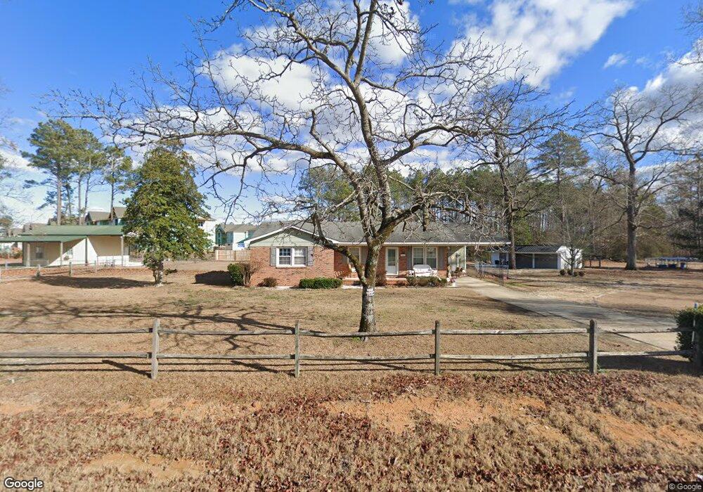
482 Brock Rd Raeford, NC 28376
Estimated Value: $193,671 - $218,000
About This Home
This home is located at 482 Brock Rd, Raeford, NC 28376 and is currently estimated at $207,668, approximately $183 per square foot. 482 Brock Rd is a home with nearby schools including Upchurch Elementary School, East Hoke Middle, and Hoke County High.
Ownership History
We collect this data history from publicly available records. To have your information removed, we recommend requesting removal directly through your county’s website.
Purchase Details
Home Financials for this Owner
Home Financials are based on the most recent Mortgage that was taken out on this home.Home Values in the Area
Average Home Value in this Area
Purchase History
We collect this data history from publicly available records. To have your information removed, we recommend requesting removal directly through your county’s website.
| Date | Buyer | Sale Price | Title Company |
|---|---|---|---|
| $126,000 | None Available |
Mortgage History
We collect this data history from publicly available records. To have your information removed, we recommend requesting removal directly through your county’s website.
| Date | Status | Borrower | Loan Amount |
|---|---|---|---|
| Open | $115,900 |
Tax History
We collect this data history from publicly available records. To have your information removed, we recommend requesting removal directly through your county’s website.
| Year | Tax Paid | Tax Assessment Tax Assessment Total Assessment is a certain percentage of the fair market value that is determined by local assessors to be the total taxable value of land and additions on the property. | Land | Improvement |
|---|---|---|---|---|
| 2025 | $963 | $102,860 | $31,340 | $71,520 |
| 2024 | $963 | $102,860 | $31,340 | $71,520 |
| 2023 | $963 | $102,860 | $31,340 | $71,520 |
| 2022 | $947 | $102,860 | $31,340 | $71,520 |
| 2021 | $928 | $98,130 | $27,840 | $70,290 |
| 2020 | $942 | $98,130 | $27,840 | $70,290 |
| 2019 | $942 | $98,130 | $27,840 | $70,290 |
| 2018 | $569 | $98,130 | $27,840 | $70,290 |
| 2017 | $569 | $98,130 | $27,840 | $70,290 |
| 2016 | $560 | $98,130 | $27,840 | $70,290 |
| 2015 | $560 | $98,130 | $27,840 | $70,290 |
| 2014 | $404 | $81,280 | $18,850 | $62,430 |
| 2013 | -- | $75,250 | $15,080 | $60,170 |
Map
- 0 Brock Rd Unit 764330
- 0 Brock Rd Unit 764384
- 203 Drew St
- 286 Peaceford Ave
- 343 Fountain Grove Dr
- 780 Wayside Rd
- 155 Tellmont St
- 136 Dellmar Dr
- 601 Wedgefield Dr
- 284 Weston Woods St
- 107 Hollow Ln
- 119 Flag Ln
- 549 Woodberry Cir
- 108 Woodland Ct
- 1701 O'Bannon Dr
- 142 Cloverwood Ln
- 196 Independence Dr
- 139 Thornbird Dr
- 376 Woodberry Cir
- 1548 Clan Campbell Dr
- 122 Wedgefield Dr
- 116 Wedgefield Dr
- 136 Peaceford Ave
- 152 Wedgefield Dr
- 119 Wedgefield Dr
- 141 Wedgefield Dr
- 143 Peaceford Ave
- 143 Peaceford Lot 201 Ave
- 155 Wedgefield Dr
- 116 Fountain Grove Dr
- 161 Peaceford Ave
- 130 Fountain Grove Dr
- 173 Wedgefield Dr
- 526 Brock Rd
- 181 Peaceford Ave
- 146 Fountain Grove Dr
- 193 Wedgefield (Lt 5) Dr
- 193 Wedgefield Dr
- 190 Peaceford Ave
- 162 Fountain Grove Dr
Ask me questions while you tour the home.