Estimated Value: $171,000 - $310,000
2
Beds
2
Baths
1,165
Sq Ft
$202/Sq Ft
Est. Value
About This Home
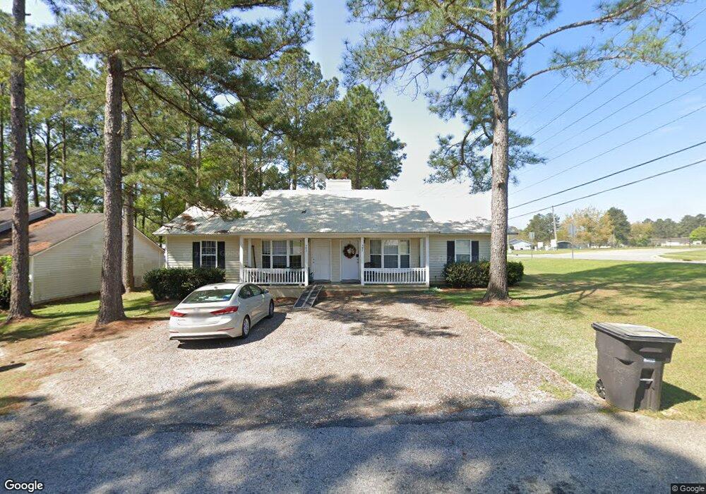
This home is located at 483 Pebblebrook Dr, Cairo, GA 39828 and is currently estimated at $235,472, approximately $202 per square foot. 483 Pebblebrook Dr is a home located in Grady County with nearby schools including Cairo High School.
Ownership History
Date
Name
Owned For
Owner Type
Purchase Details
Closed on
Aug 1, 2022
Sold by
Southern Georgia Home Rentals Llc
Bought by
Wiregrass Rentals Llc
Current Estimated Value
Purchase Details
Closed on
Jun 26, 2007
Sold by
Kelso William R
Bought by
Cbk Holding Llc
Home Financials for this Owner
Home Financials are based on the most recent Mortgage that was taken out on this home.
Original Mortgage
$97,000
Interest Rate
6.35%
Mortgage Type
New Conventional
Purchase Details
Closed on
Jun 4, 2007
Sold by
Kelso Carol
Bought by
Kelso William R and Cbk Holding Llc
Home Financials for this Owner
Home Financials are based on the most recent Mortgage that was taken out on this home.
Original Mortgage
$97,000
Interest Rate
6.35%
Mortgage Type
New Conventional
Purchase Details
Closed on
May 23, 2007
Sold by
Cbk Holdings Llc
Bought by
Kelson William P
Home Financials for this Owner
Home Financials are based on the most recent Mortgage that was taken out on this home.
Original Mortgage
$97,000
Interest Rate
6.35%
Mortgage Type
New Conventional
Purchase Details
Closed on
Jun 18, 2004
Sold by
Carroll Shane C
Bought by
Cbk Holdings Llc
Create a Home Valuation Report for This Property
The Home Valuation Report is an in-depth analysis detailing your home's value as well as a comparison with similar homes in the area
Purchase History
| Date | Buyer | Sale Price | Title Company |
|---|---|---|---|
| Wiregrass Rentals Llc | -- | -- | |
| Cbk Holding Llc | -- | -- | |
| Kelso William R | -- | -- | |
| Kelson William P | -- | -- | |
| Cbk Holdings Llc | $142,500 | -- |
Source: Public Records
Mortgage History
| Date | Status | Borrower | Loan Amount |
|---|---|---|---|
| Previous Owner | Cbk Holding Llc | $97,000 |
Source: Public Records
Tax History
| Year | Tax Paid | Tax Assessment Tax Assessment Total Assessment is a certain percentage of the fair market value that is determined by local assessors to be the total taxable value of land and additions on the property. | Land | Improvement |
|---|---|---|---|---|
| 2025 | $2,702 | $89,758 | $6,000 | $83,758 |
| 2024 | $2,702 | $81,048 | $6,000 | $75,048 |
| 2023 | $1,620 | $43,771 | $2,400 | $41,371 |
| 2022 | $1,685 | $43,771 | $2,400 | $41,371 |
| 2021 | $1,690 | $43,771 | $2,400 | $41,371 |
| 2020 | $1,694 | $43,771 | $2,400 | $41,371 |
| 2019 | $1,694 | $43,771 | $2,400 | $41,371 |
| 2018 | $1,610 | $43,771 | $2,400 | $41,371 |
| 2017 | $1,549 | $43,771 | $2,400 | $41,371 |
| 2016 | $1,328 | $36,720 | $2,400 | $34,320 |
| 2015 | $1,315 | $36,720 | $2,400 | $34,320 |
| 2014 | $1,316 | $36,720 | $2,400 | $34,320 |
| 2013 | -- | $32,703 | $2,400 | $30,303 |
Source: Public Records
Map
Nearby Homes
- 408 Bay Tree Rd NE
- 0 20th St NE
- 00 20th St NE
- 66 22nd St NE
- 0 State Route 188
- 00 State Route 188
- 2690 U S 84
- 79 27th St NE
- 78.6 Ac Strickland Rd
- 711 2nd Ave NE
- 21 24th St NE
- 00 Blackberry Ln
- 00 Meridian Rd
- 00 Cuffhead Rd
- 00 Union Hill Rd
- 592 20th St SE
- 2975 U S 84
- 4761 Hadley Ferry Rd
- 481 4th St SE
- 309 3rd St SE
- 483 Pebblebrook Dr Unit A&B
- 483 Pebble Brook Dr Unit A&B
- 483 Pebble Brook Dr
- 473 Pebblebrook Dr
- 484 Pebblebrook Dr
- 474 Pebblebrook Dr
- 480 20th St NE
- 469 Pebblebrook Dr
- 466 Pebblebrook Dr
- 472 20th St NE Unit A & B
- 467 Pebblebrook Dr
- 470 20th St NE
- 470 20th St NE Unit A & B
- 465 Pebble Brook Dr
- 485 Kerri Anne Dr
- 483 Kerri Anne Dr
- 481 Kerri Anne Dr
- 465 Pebblebrook Dr
- 479 Kerri Anne Dr
- 477 Kerri Anne Dr
Your Personal Tour Guide
Ask me questions while you tour the home.