Estimated Value: $543,206 - $612,000
4
Beds
4
Baths
4,246
Sq Ft
$137/Sq Ft
Est. Value
About This Home
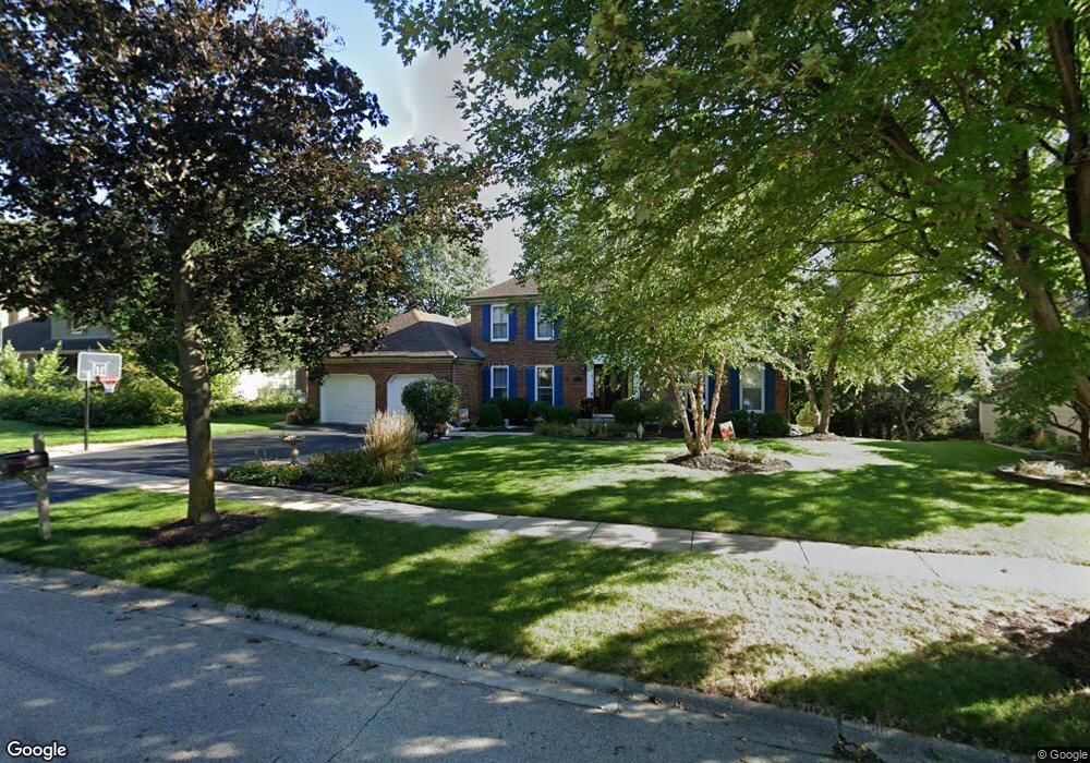
This home is located at 485 Bristol Way, Cary, IL 60013 and is currently estimated at $583,802, approximately $137 per square foot. 485 Bristol Way is a home located in McHenry County with nearby schools including Three Oaks Elementary School, Cary Jr High School, and Cary-Grove High School.
Ownership History
Date
Name
Owned For
Owner Type
Purchase Details
Closed on
Mar 20, 2012
Sold by
Agar G Leslie and Agar Ann S
Bought by
Kosiba Anthony and Kosiba Erica
Current Estimated Value
Home Financials for this Owner
Home Financials are based on the most recent Mortgage that was taken out on this home.
Original Mortgage
$234,000
Outstanding Balance
$161,354
Interest Rate
3.95%
Mortgage Type
New Conventional
Estimated Equity
$422,448
Purchase Details
Closed on
May 15, 2007
Sold by
Camphouse James R and Camphouse Maureen E
Bought by
Agar G Leslie and Agar Ann S
Home Financials for this Owner
Home Financials are based on the most recent Mortgage that was taken out on this home.
Original Mortgage
$405,000
Interest Rate
9.47%
Mortgage Type
Purchase Money Mortgage
Create a Home Valuation Report for This Property
The Home Valuation Report is an in-depth analysis detailing your home's value as well as a comparison with similar homes in the area
Home Values in the Area
Average Home Value in this Area
Purchase History
We collect this data history from publicly available records. To have your information removed, we recommend requesting removal directly through your county’s website.
| Date | Buyer | Sale Price | Title Company |
|---|---|---|---|
| Kosiba Anthony | $260,000 | Baird & Warner Title Service | |
| Agar G Leslie | $450,000 | Heritage Title Company |
Source: Public Records
Mortgage History
We collect this data history from publicly available records. To have your information removed, we recommend requesting removal directly through your county’s website.
| Date | Status | Borrower | Loan Amount |
|---|---|---|---|
| Open | Kosiba Anthony | $234,000 | |
| Previous Owner | Agar G Leslie | $405,000 |
Source: Public Records
Tax History
| Year | Tax Paid | Tax Assessment Tax Assessment Total Assessment is a certain percentage of the fair market value that is determined by local assessors to be the total taxable value of land and additions on the property. | Land | Improvement |
|---|---|---|---|---|
| 2024 | $11,941 | $149,798 | $22,207 | $127,591 |
| 2023 | $11,661 | $133,975 | $19,861 | $114,114 |
| 2022 | $13,312 | $148,163 | $31,411 | $116,752 |
| 2021 | $12,704 | $138,031 | $29,263 | $108,768 |
| 2020 | $12,337 | $133,145 | $28,227 | $104,918 |
| 2019 | $12,105 | $127,436 | $27,017 | $100,419 |
| 2018 | $11,431 | $117,724 | $24,958 | $92,766 |
| 2017 | $11,227 | $110,903 | $23,512 | $87,391 |
| 2016 | $11,160 | $104,017 | $22,052 | $81,965 |
| 2013 | -- | $86,658 | $20,572 | $66,086 |
Source: Public Records
Map
Nearby Homes
- 680 Spruce Tree Dr
- 321 Bryan Dr
- 1405 Elk Trail
- 0000 Newbold Rd
- 842 Pin Oak Cir
- 611 E Main Street Rd
- 705 Spring Beach Way
- 309 Three Oaks Rd
- 110 Courtney Ln
- 106 Sherwood Dr
- Lot 10 Grove Ln
- Lot 11 Grove Ln
- LOT 02 Three Oaks Rd
- 602 Birch Ln
- 305 Circle Rd
- 8120 Gage Ln
- 911 Johnson St
- 200 Wildwood Ln
- 300 Opatrny Dr Unit 222
- 300 Opatrny Dr Unit 130
- 491 Bristol Way
- 481 Bristol Way
- 495 Bristol Way
- 475 Bristol Way
- 486 Bristol Way
- 490 Bristol Way
- 471 Bristol Way
- 496 Bristol Way Unit 2
- 815 Wildrose Dr
- 800 Wildrose Dr
- 470 Bristol Way
- 465 Bristol Way
- 810 Wildrose Dr Unit 2
- 825 Wildrose Dr
- 800 S Rawson Bridge Rd
- 466 Bristol Way
- 461 Bristol Way
- 820 Wildrose Dr
- 840 S Rawson Bridge Rd
- 835 Wildrose Dr
Your Personal Tour Guide
Ask me questions while you tour the home.