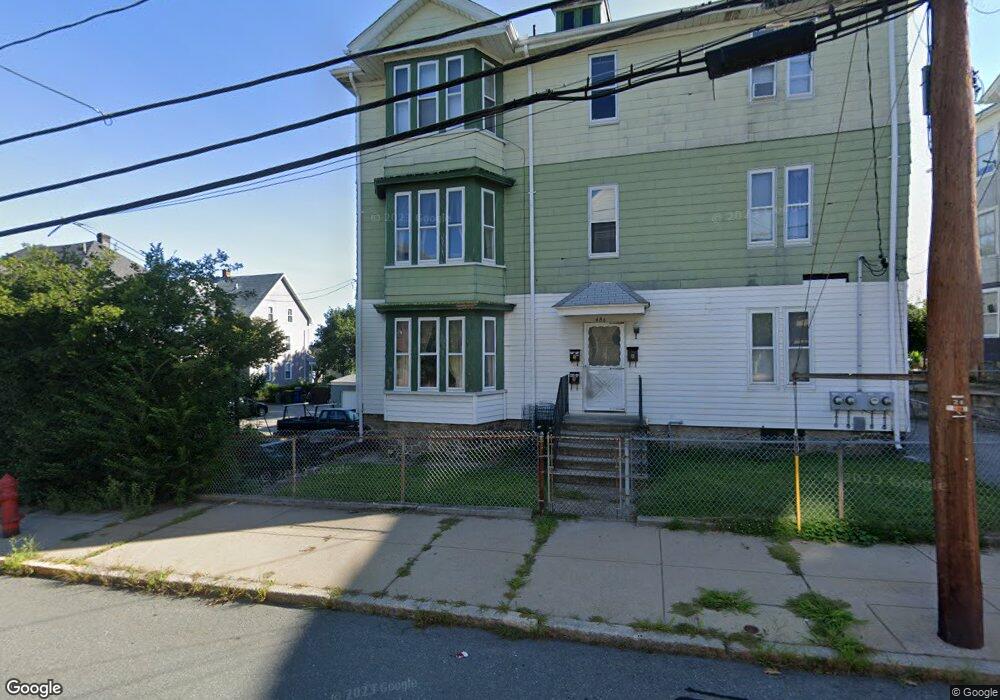
486 Bernon St Woonsocket, RI 02895
Bernon District NeighborhoodEstimated Value: $519,000 - $603,000
About This Home
This home is located at 486 Bernon St, Woonsocket, RI 02895 and is currently estimated at $554,667, approximately $124 per square foot. 486 Bernon St is a home located in Providence County with nearby schools including Woonsocket High School, Rise Prep Mayoral Academy Middle School, and Founders Academy.
Ownership History
We collect this data history from publicly available records. To have your information removed, we recommend requesting removal directly through your county’s website.
Purchase Details
Home Values in the Area
Average Home Value in this Area
Purchase History
We collect this data history from publicly available records. To have your information removed, we recommend requesting removal directly through your county’s website.
| Date | Buyer | Sale Price | Title Company |
|---|---|---|---|
| -- | -- |
Mortgage History
We collect this data history from publicly available records. To have your information removed, we recommend requesting removal directly through your county’s website.
| Date | Status | Borrower | Loan Amount |
|---|---|---|---|
| Open | $26,500 | ||
| Closed | $42,000 |
Tax History
We collect this data history from publicly available records. To have your information removed, we recommend requesting removal directly through your county’s website.
| Year | Tax Paid | Tax Assessment Tax Assessment Total Assessment is a certain percentage of the fair market value that is determined by local assessors to be the total taxable value of land and additions on the property. | Land | Improvement |
|---|---|---|---|---|
| 2025 | $5,847 | $520,700 | $88,900 | $431,800 |
| 2024 | $4,189 | $288,100 | $90,500 | $197,600 |
| 2023 | $4,028 | $288,100 | $90,500 | $197,600 |
| 2022 | $4,028 | $288,100 | $90,500 | $197,600 |
| 2021 | $3,838 | $161,600 | $36,600 | $125,000 |
| 2020 | $3,878 | $161,600 | $36,600 | $125,000 |
| 2018 | $3,891 | $161,600 | $36,600 | $125,000 |
| 2017 | $4,178 | $138,800 | $40,400 | $98,400 |
| 2016 | $4,419 | $138,800 | $40,400 | $98,400 |
| 2015 | $5,077 | $138,800 | $40,400 | $98,400 |
| 2014 | $4,992 | $143,200 | $44,400 | $98,800 |
Map
- 222 Grove St
- 510 Bernon St
- 23 Paradis Ave
- 24 Paradis Ave
- 60 Greene St
- 222 Carrington Ave
- 25 Union St
- 35 Greene St
- 219 Crawford St
- 78 Saint Joseph St
- 36 Pine St
- 346 Carrington Ave
- 148 Bernon St Unit 7
- 99 Allen St Unit 105
- 180 Allen St Unit 101
- 180 Allen St Unit 104
- 50 Jackson St
- 410 Carrington Ave
- 869 Bernon St
- 304 Getchell Ave
- 252 Grove St
- 256 Grove St
- 256 Grove St Unit 3
- 238 Grove St
- 254 Grove St
- 230 Grove St
- 49 Wilson Ave Unit 1
- 37 Wilson Ave
- 498 Bernon St
- 212 Grove St
- 31 Wilson Ave
- 216 Grove St
- 249 Grove St
- 223 Grove St
- 0 Cottage St Unit 454609
- 0 Cottage St Unit 760354
- 0 Cottage St Unit 452284
- 0 Cottage St Unit 995996
- 0 Cottage St Unit 1296818
- 0 Cottage St Unit 945601
Ask me questions while you tour the home.