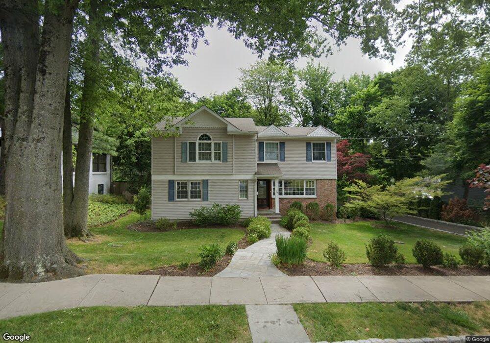
49 High St Summit, NJ 07901
Summit AreaEstimated Value: $1,221,000 - $1,597,000
About This Home
This home is located at 49 High St, Summit, NJ 07901 and is currently estimated at $1,408,523, approximately $518 per square foot. 49 High St is a home located in Union County with nearby schools including L C Johnson Summit Middle School, Summit Sr High School, and Oak Knoll School of the Holy Child.
Ownership History
We collect this data history from publicly available records. To have your information removed, we recommend requesting removal directly through your county’s website.
Purchase Details
Home Financials for this Owner
Home Financials are based on the most recent Mortgage that was taken out on this home.Purchase Details
Purchase Details
Purchase Details
Purchase Details
Purchase Details
Purchase Details
Home Values in the Area
Average Home Value in this Area
Purchase History
We collect this data history from publicly available records. To have your information removed, we recommend requesting removal directly through your county’s website.
| Date | Buyer | Sale Price | Title Company |
|---|---|---|---|
| -- | None Available | ||
| $800,000 | -- | ||
| $800,000 | -- | ||
| $729,500 | -- | ||
| $587,000 | -- | ||
| -- | -- | ||
| -- | Chicago Title Insurance Co |
Mortgage History
We collect this data history from publicly available records. To have your information removed, we recommend requesting removal directly through your county’s website.
| Date | Status | Borrower | Loan Amount |
|---|---|---|---|
| Closed | $215,000 |
Tax History
We collect this data history from publicly available records. To have your information removed, we recommend requesting removal directly through your county’s website.
| Year | Tax Paid | Tax Assessment Tax Assessment Total Assessment is a certain percentage of the fair market value that is determined by local assessors to be the total taxable value of land and additions on the property. | Land | Improvement |
|---|---|---|---|---|
| 2026 | $14,482 | $323,900 | $175,600 | $148,300 |
| 2025 | $14,482 | $323,900 | $175,600 | $148,300 |
| 2024 | $14,015 | $323,900 | $175,600 | $148,300 |
| 2023 | $14,015 | $323,900 | $175,600 | $148,300 |
| 2022 | $13,873 | $323,900 | $175,600 | $148,300 |
| 2021 | $13,983 | $323,900 | $175,600 | $148,300 |
| 2020 | $14,122 | $323,900 | $175,600 | $148,300 |
| 2019 | $14,138 | $323,900 | $175,600 | $148,300 |
| 2018 | $14,048 | $323,900 | $175,600 | $148,300 |
| 2017 | $14,138 | $323,900 | $175,600 | $148,300 |
| 2016 | $13,931 | $323,900 | $175,600 | $148,300 |
| 2015 | $13,659 | $323,900 | $175,600 | $148,300 |
| 2014 | $13,306 | $323,900 | $175,600 | $148,300 |
Map
- 610 Springfield Ave
- 68-86 New England Ave Unit 32
- 66 New England Ave Unit 13
- 10 Fairview Ave
- 33 Edgar St
- 27 Pine Grove Ave
- 390 Morris Ave Unit 28
- 13 Edgar St
- 40 Prospect St
- 67 Tulip St
- 718 Springfield Ave
- 27 Bedford Rd
- 18 Colony Dr
- 38 Valley View Ave
- 23 Euclid Ave
- 115 Woodland Ave
- 768 Springfield Ave Unit B3
- 89 Beechwood Rd
- 11 Euclid Ave Unit 6C
- 133 Summit Ave Unit 43
- 53 High St
- 51 High St
- 48 High St
- 50 High St
- 52 High St
- 96 New England Ave Unit 16
- 96 New England Ave Unit 3
- 96 New England Ave Unit 17
- 96 New England Ave Unit 4
- 54 High St
- 605 Springfield Ave
- 100 New England Ave
- 56 High St
- 609 Springfield Ave
- 46 High St
- 60 High St
- 69 New England Ave Unit F
- 69 New England Ave Unit B
- 73 New England Ave Unit B
- 75 New England Ave Unit D
Ask me questions while you tour the home.