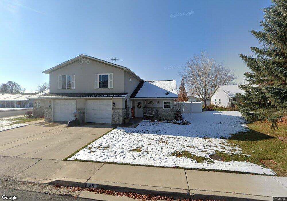
49 N 370 E American Fork, UT 84003
Estimated Value: $359,000 - $377,000
2
Beds
2
Baths
1,450
Sq Ft
$254/Sq Ft
Est. Value
About This Home
This home is located at 49 N 370 E, American Fork, UT 84003 and is currently estimated at $368,003, approximately $253 per square foot. 49 N 370 E is a home located in Utah County with nearby schools including Forbes Elementary School, American Fork Junior High School, and American Fork High School.
Ownership History
Date
Name
Owned For
Owner Type
Purchase Details
Closed on
Sep 12, 2025
Sold by
Adams Bette
Bought by
Bette Dean Adams Trust and Adams
Current Estimated Value
Purchase Details
Closed on
Jul 13, 2006
Sold by
Alsop Glenna S and Robinson Linda
Bought by
Adams Bette
Purchase Details
Closed on
Aug 15, 2001
Sold by
Rasmussen Larry A
Bought by
Alsop Glenna S
Purchase Details
Closed on
Oct 15, 1999
Sold by
Rasmussen Larry A
Bought by
Rasmussen Larry A and Larry A Rasmussen Family Trust
Home Financials for this Owner
Home Financials are based on the most recent Mortgage that was taken out on this home.
Original Mortgage
$89,600
Interest Rate
7.77%
Create a Home Valuation Report for This Property
The Home Valuation Report is an in-depth analysis detailing your home's value as well as a comparison with similar homes in the area
Home Values in the Area
Average Home Value in this Area
Purchase History
| Date | Buyer | Sale Price | Title Company |
|---|---|---|---|
| Bette Dean Adams Trust | -- | United West Title | |
| Adams Bette | -- | Equity Title Insurance Agen | |
| Alsop Glenna S | -- | First American Title Insuran | |
| Rasmussen Larry A | -- | First American Title Co | |
| Rasmussen Larry A | -- | First American Title Co |
Source: Public Records
Mortgage History
| Date | Status | Borrower | Loan Amount |
|---|---|---|---|
| Previous Owner | Rasmussen Larry A | $89,600 |
Source: Public Records
Tax History
| Year | Tax Paid | Tax Assessment Tax Assessment Total Assessment is a certain percentage of the fair market value that is determined by local assessors to be the total taxable value of land and additions on the property. | Land | Improvement |
|---|---|---|---|---|
| 2025 | $1,832 | $205,700 | -- | -- |
| 2024 | $1,832 | $203,555 | $0 | $0 |
| 2023 | $1,746 | $205,700 | $0 | $0 |
| 2022 | $1,490 | $173,195 | $0 | $0 |
| 2021 | $1,334 | $242,200 | $87,700 | $154,500 |
| 2020 | $1,297 | $228,500 | $87,700 | $140,800 |
| 2019 | $1,164 | $212,000 | $87,700 | $124,300 |
| 2018 | $1,109 | $193,200 | $87,700 | $105,500 |
| 2017 | $1,112 | $104,500 | $0 | $0 |
| 2016 | $966 | $84,370 | $0 | $0 |
| 2015 | $989 | $81,950 | $0 | $0 |
| 2014 | $908 | $74,250 | $0 | $0 |
Source: Public Records
Map
Nearby Homes
Your Personal Tour Guide
Ask me questions while you tour the home.