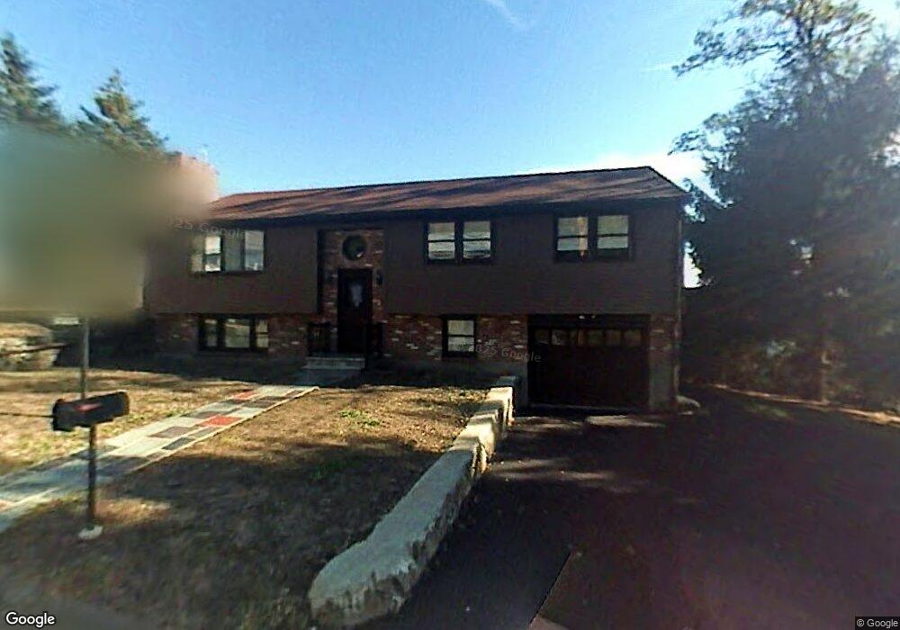
49 Phillips Cir Waltham, MA 02452
North Waltham NeighborhoodEstimated Value: $834,519 - $911,000
3
Beds
3
Baths
1,843
Sq Ft
$477/Sq Ft
Est. Value
About This Home
This home is located at 49 Phillips Cir, Waltham, MA 02452 and is currently estimated at $879,380, approximately $477 per square foot. 49 Phillips Cir is a home located in Middlesex County with nearby schools including Northeast Elementary School, John F Kennedy Middle School, and Waltham Sr High School.
Ownership History
Date
Name
Owned For
Owner Type
Purchase Details
Closed on
Nov 21, 2025
Sold by
49 Phillips Circle Nt and Annecchiarico
Bought by
Watson Marjorie
Current Estimated Value
Purchase Details
Closed on
Jun 28, 2013
Sold by
Annecchiarico David and Annecchiarico Ann M
Bought by
49 Phillips Circle Nt and Annecchiarico
Purchase Details
Closed on
Jun 7, 2013
Sold by
Dav Ann Rt and Annehiarico
Bought by
Annehiarico David and Annehiarico Ann M
Purchase Details
Closed on
Apr 9, 1974
Bought by
49 Phillips Cir Nt
Create a Home Valuation Report for This Property
The Home Valuation Report is an in-depth analysis detailing your home's value as well as a comparison with similar homes in the area
Home Values in the Area
Average Home Value in this Area
Purchase History
We collect this data history from publicly available records. To have your information removed, we recommend requesting removal directly through your county’s website.
| Date | Buyer | Sale Price | Title Company |
|---|---|---|---|
| Watson Marjorie | -- | -- | |
| 49 Phillips Circle Nt | -- | -- | |
| 49 Phillips Circle Nt | -- | -- | |
| Annehiarico David | -- | -- | |
| Annehiarico David | -- | -- | |
| 49 Phillips Cir Nt | -- | -- |
Source: Public Records
Tax History
| Year | Tax Paid | Tax Assessment Tax Assessment Total Assessment is a certain percentage of the fair market value that is determined by local assessors to be the total taxable value of land and additions on the property. | Land | Improvement |
|---|---|---|---|---|
| 2025 | $7,086 | $721,600 | $432,300 | $289,300 |
| 2024 | $6,714 | $696,500 | $412,100 | $284,400 |
| 2023 | $6,646 | $644,000 | $374,600 | $269,400 |
| 2022 | $6,975 | $626,100 | $367,100 | $259,000 |
| 2021 | $6,738 | $595,200 | $352,100 | $243,100 |
| 2020 | $6,510 | $544,800 | $329,700 | $215,100 |
| 2019 | $6,621 | $523,000 | $315,600 | $207,400 |
| 2018 | $5,779 | $458,300 | $292,200 | $166,100 |
| 2017 | $5,427 | $432,100 | $266,000 | $166,100 |
| 2016 | $5,151 | $420,800 | $254,700 | $166,100 |
| 2015 | $5,278 | $402,000 | $228,500 | $173,500 |
Source: Public Records
Map
Nearby Homes
- 66 Phillips Cir
- 45 Chase Rd
- 49 Hollace St
- 60 Agassiz Ave
- 56 Agassiz Ave
- 65 S Cottage Rd Unit 119
- 3 Meadows Ln
- 58 Madison Rd
- 139 Sycamore St Unit 139
- 100 Lexington St Unit A2
- 100 Lexington St Unit B8
- 56 Ralph St Unit 3
- 123 White St
- 23 Pierce Rd
- 78 Barbara Rd Unit 1
- 126 White St Unit 126
- 38 Grant Ave
- 128 Carey Ave Unit 1
- 258 Lexington St
- 174 Forest St
- 60 Phillips Cir
- 50 Phillips Cir
- 30 Tip Top Terrace
- 34 Tip Top Terrace
- 72 Phillips Cir
- 26 Tip Top Terrace
- 40 Phillips Cir
- 61 Phillips Cir
- 29 Tip Top Terrace
- 76 Phillips Cir
- 31 Phillips Cir
- 20 Tip Top Terrace
- 67 Phillips Cir
- 19 Tip Top Terrace
- 21 Phillips Cir
- 30 Phillips Cir
- 84 Phillips Cir
- 71 Phillips Cir
- 11 Phillips Cir
- 94 Phillips Cir
Your Personal Tour Guide
Ask me questions while you tour the home.