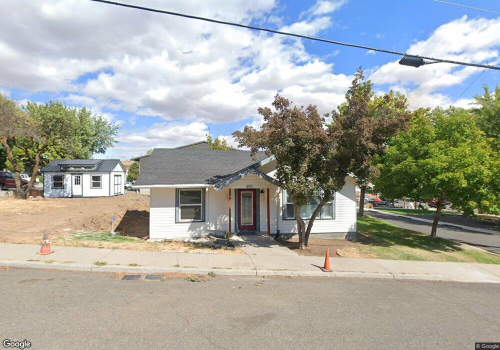
490 6th St Maupin, OR 97037
Estimated Value: $247,746 - $324,000
2
Beds
1
Bath
903
Sq Ft
$306/Sq Ft
Est. Value
About This Home
This home is located at 490 6th St, Maupin, OR 97037 and is currently estimated at $276,687, approximately $306 per square foot. 490 6th St is a home located in Wasco County with nearby schools including South Wasco County Elementary School and South Wasco County High School.
Ownership History
Date
Name
Owned For
Owner Type
Purchase Details
Closed on
Dec 20, 2014
Sold by
Taylor Kellee L and Taylor Michael W
Bought by
Biesenthal Ashley D Woodside and Biesenthal Jeffrey R
Current Estimated Value
Home Financials for this Owner
Home Financials are based on the most recent Mortgage that was taken out on this home.
Original Mortgage
$81,680
Outstanding Balance
$62,085
Interest Rate
3.87%
Mortgage Type
New Conventional
Estimated Equity
$214,602
Purchase Details
Closed on
May 14, 2013
Sold by
Taylor Kellee L and Taylor Michael W
Bought by
Taylor Kellee L and Taylor Michael W
Create a Home Valuation Report for This Property
The Home Valuation Report is an in-depth analysis detailing your home's value as well as a comparison with similar homes in the area
Purchase History
| Date | Buyer | Sale Price | Title Company |
|---|---|---|---|
| Biesenthal Ashley D Woodside | $105,000 | Amerititel | |
| Taylor Kellee L | -- | None Available |
Source: Public Records
Mortgage History
| Date | Status | Borrower | Loan Amount |
|---|---|---|---|
| Open | Biesenthal Ashley D Woodside | $81,680 |
Source: Public Records
Tax History
| Year | Tax Paid | Tax Assessment Tax Assessment Total Assessment is a certain percentage of the fair market value that is determined by local assessors to be the total taxable value of land and additions on the property. | Land | Improvement |
|---|---|---|---|---|
| 2025 | $1,673 | $92,389 | -- | -- |
| 2024 | $1,545 | $89,699 | -- | -- |
| 2023 | $1,557 | $87,087 | $0 | $0 |
| 2022 | $1,522 | $137,939 | $0 | $0 |
| 2021 | $1,465 | $132,644 | $0 | $0 |
| 2020 | $1,374 | $129,436 | $0 | $0 |
| 2019 | $1,335 | $120,231 | $0 | $0 |
| 2018 | $1,259 | $75,121 | $0 | $0 |
| 2017 | $1,259 | $72,933 | $0 | $0 |
| 2016 | $1,225 | $70,809 | $0 | $0 |
Source: Public Records
Map
Nearby Homes
- 510 Grant Ave
- 605 Grant Ave
- 501 Deschutes Ave
- 407 Dufur Ave
- 299 4th St
- 614 Staats Ave
- 624 Staats Ave
- 390 Elrod Place
- 507 Elrod Ave
- 99 3rd St
- 804 Riverside St
- 322 Alan Ln
- 210 Hartman Ave
- 1206 U S 197
- 0 U S 197
- 1504 Fish Tail Rd
- 1515 Fish Tail Rd
- 0 George Jackson Rd Unit 22438833
- 55264 Paulson Rd
- 0 Unit 499242286
Your Personal Tour Guide
Ask me questions while you tour the home.