Estimated Value: $268,000 - $312,000
4
Beds
2
Baths
1,530
Sq Ft
$185/Sq Ft
Est. Value
About This Home
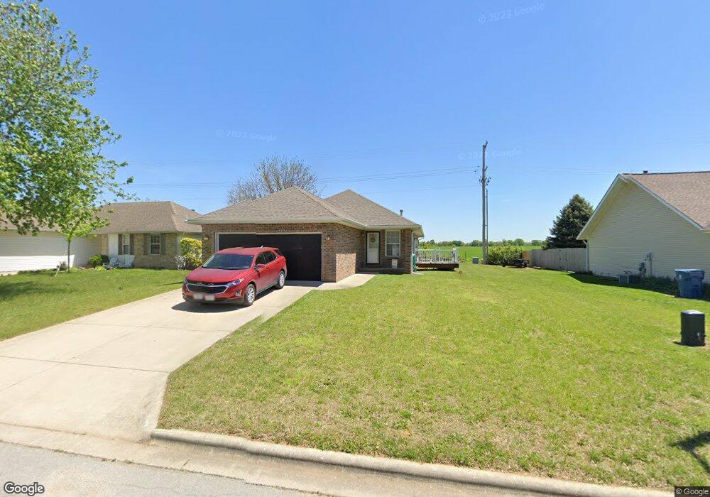
This home is located at 4914 N 9th St, Ozark, MO 65721 and is currently estimated at $282,645, approximately $184 per square foot. 4914 N 9th St is a home located in Christian County with nearby schools including North Elementary School, Ozark Middle School, and Ozark Junior High School.
Ownership History
Date
Name
Owned For
Owner Type
Purchase Details
Closed on
Jun 20, 2008
Sold by
Moody Kenton and Noody Elsie
Bought by
Eslinger Linda Mae
Current Estimated Value
Home Financials for this Owner
Home Financials are based on the most recent Mortgage that was taken out on this home.
Original Mortgage
$100,000
Outstanding Balance
$62,846
Interest Rate
5.99%
Mortgage Type
New Conventional
Estimated Equity
$219,799
Create a Home Valuation Report for This Property
The Home Valuation Report is an in-depth analysis detailing your home's value as well as a comparison with similar homes in the area
Home Values in the Area
Average Home Value in this Area
Purchase History
| Date | Buyer | Sale Price | Title Company |
|---|---|---|---|
| Eslinger Linda Mae | -- | None Available |
Source: Public Records
Mortgage History
| Date | Status | Borrower | Loan Amount |
|---|---|---|---|
| Open | Eslinger Linda Mae | $100,000 |
Source: Public Records
Tax History
| Year | Tax Paid | Tax Assessment Tax Assessment Total Assessment is a certain percentage of the fair market value that is determined by local assessors to be the total taxable value of land and additions on the property. | Land | Improvement |
|---|---|---|---|---|
| 2025 | $1,822 | $30,970 | -- | -- |
| 2024 | $1,822 | $29,150 | -- | -- |
| 2023 | $1,822 | $29,150 | $0 | $0 |
| 2022 | $1,736 | $27,720 | $0 | $0 |
| 2021 | $1,681 | $27,720 | $0 | $0 |
| 2020 | $1,526 | $25,420 | $0 | $0 |
| 2019 | $1,526 | $25,420 | $0 | $0 |
| 2018 | $1,384 | $23,220 | $0 | $0 |
| 2017 | $1,384 | $23,220 | $0 | $0 |
| 2016 | $1,374 | $23,430 | $0 | $0 |
| 2015 | $1,374 | $23,430 | $23,430 | $0 |
| 2014 | $1,361 | $23,480 | $0 | $0 |
| 2013 | $13 | $23,480 | $0 | $0 |
| 2011 | $13 | $46,960 | $0 | $0 |
Source: Public Records
Map
Nearby Homes
- 936 W Turnberry Blvd
- 905 W Brookshire Ct
- 5106 N 13th St
- 4410 N 8th St
- 1329 W Meadowbrooke Dr
- 4314 Morgan Ct
- 4708-4710 N 15th St
- 303 E Pintail Dr
- 4501 N 16th St
- 162 E Melton Rd
- 478 E Melton Rd
- 1834 E Skyline
- 1748 E Skyline
- 1822 E Skyline
- 886 E Melton Rd
- 1476 E Peartree Dr
- 3409 Brinnsfield Dr
- 1103 E Chesapeake Dr
- 409 W Landsdowne Dr
- 3307 N 10th St
Your Personal Tour Guide
Ask me questions while you tour the home.