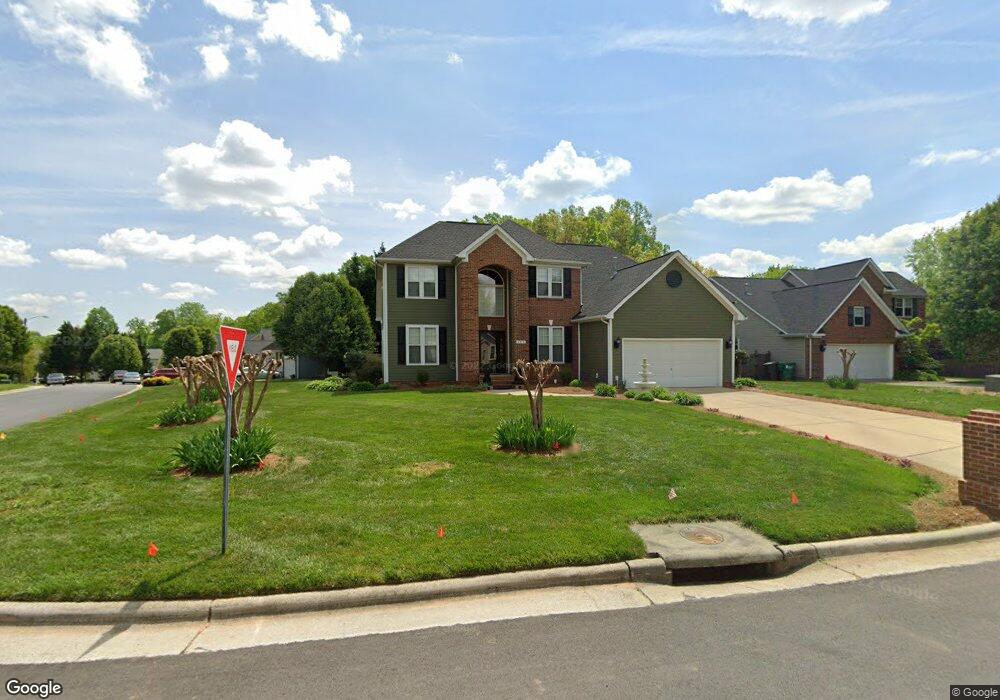
4918 Devane Ct High Point, NC 27265
Sandy Ridge NeighborhoodEstimated Value: $338,000 - $422,000
4
Beds
3
Baths
2,577
Sq Ft
$146/Sq Ft
Est. Value
About This Home
This home is located at 4918 Devane Ct, High Point, NC 27265 and is currently estimated at $377,348, approximately $146 per square foot. 4918 Devane Ct is a home located in Guilford County with nearby schools including Colfax Elementary School, Southwest Guilford Middle School, and Southwest Guilford High School.
Create a Home Valuation Report for This Property
The Home Valuation Report is an in-depth analysis detailing your home's value as well as a comparison with similar homes in the area
Home Values in the Area
Average Home Value in this Area
Map
Nearby Homes
- 4615 Owls View Ct
- 8003 Clinard Farms Rd
- 2138 Alamar Dr
- 809 Quailmeadow Ln
- 8774 Bame Rd
- 8012 Tam Oshanter Dr
- 1351 Grant Haven Ct
- 1597 Oakbluffs Dr
- 4625 Meadowside Terrace
- 4617 Dry Creek Ct
- 4743 Willowstone Dr
- 4737 Willowstone Dr
- 1247 Blackberry Ridge Rd
- 1563 Oakbluffs Dr
- 2210 Starfall Dr
- 1554 Barnstable Ct
- 4715 Willowstone Dr
- 4713 Willowstone Dr
- 1552 Barnstable Ct
- 1556 Oakbluffs Dr
- 3308 Dairy Point Dr
- 3312 Dairy Point Dr
- 4914 Devane Ct
- 3316 Dairy Point Dr
- 3309 Dairy Point Dr
- 3313 Dairy Point Dr
- 4910 Devane Ct
- 3305 Dairy Point Dr
- 3320 Dairy Point Dr
- 3317 Dairy Point Dr
- 3301 Dairy Point Dr
- 3300 Dairy Point Dr
- 4907 Brian Hollars Ct
- 4911 Devane Ct
- 4915 Devane Ct
- 4903 Brian Hollars Ct
- 3325 Dairy Point Dr
- 3329 Dairy Point Dr
- 4900 Brian Hollars Ct
- 4904 Brian Hollars Ct
Your Personal Tour Guide
Ask me questions while you tour the home.