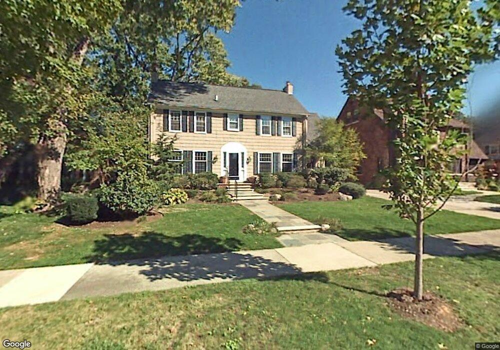
496 Lincoln Rd Grosse Pointe, MI 48230
Estimated Value: $657,600 - $770,000
Studio
--
Bath
2,201
Sq Ft
$328/Sq Ft
Est. Value
About This Home
This home is located at 496 Lincoln Rd, Grosse Pointe, MI 48230 and is currently estimated at $722,650, approximately $328 per square foot. 496 Lincoln Rd is a home located in Wayne County with nearby schools including Richard Elementary School, Brownell Middle School, and Grosse Pointe South High School.
Ownership History
Date
Name
Owned For
Owner Type
Purchase Details
Closed on
Feb 16, 2022
Sold by
Shimmel Amy Carol
Bought by
Shimmel Thomas Reid
Current Estimated Value
Purchase Details
Closed on
Sep 28, 2007
Sold by
Gray Bryce D and Gray Melissa J
Bought by
Shimmel Thomas R
Purchase Details
Closed on
May 14, 2003
Sold by
Shrilla Paul M and Shirilla Joan J
Bought by
Gray Bryce D
Create a Home Valuation Report for This Property
The Home Valuation Report is an in-depth analysis detailing your home's value as well as a comparison with similar homes in the area
Home Values in the Area
Average Home Value in this Area
Purchase History
| Date | Buyer | Sale Price | Title Company |
|---|---|---|---|
| Shimmel Thomas Reid | -- | -- | |
| Shimmel Thomas R | $388,000 | Greco | |
| Gray Bryce D | $484,537 | Metropolitan Title Company |
Source: Public Records
Tax History
| Year | Tax Paid | Tax Assessment Tax Assessment Total Assessment is a certain percentage of the fair market value that is determined by local assessors to be the total taxable value of land and additions on the property. | Land | Improvement |
|---|---|---|---|---|
| 2025 | $6,237 | $308,000 | $0 | $0 |
| 2024 | $6,027 | $315,600 | $0 | $0 |
| 2023 | $5,748 | $281,800 | $0 | $0 |
| 2022 | $8,319 | $264,100 | $0 | $0 |
| 2021 | $7,888 | $261,600 | $0 | $0 |
| 2019 | $8,193 | $234,200 | $0 | $0 |
| 2018 | $4,989 | $205,100 | $0 | $0 |
| 2017 | $5,267 | $202,700 | $0 | $0 |
| 2016 | $7,508 | $181,800 | $0 | $0 |
| 2015 | $14,238 | $176,100 | $0 | $0 |
| 2013 | $13,793 | $147,400 | $0 | $0 |
| 2012 | -- | $134,700 | $0 | $0 |
Source: Public Records
Map
Nearby Homes
- 180 Fisher Rd
- 577 Washington Rd
- 355 Lincoln Rd
- 450 University Place
- 467 University Place
- 83 Meadow Ln
- 35 Mckinley Place
- 29 Fisher Rd
- 277 Lincoln Rd
- 59 Hall Place
- 516 Neff Ln
- 379 Lakeland St
- 296 Rivard Blvd
- 242 Lewiston Rd
- 17680 E Jefferson Ave
- 285 Mcmillan Rd
- 693 Saint Clair Ave
- 703 1/2 Saint Clair St
- 789 Lakeland St
- 771 Saint Clair Ave
Your Personal Tour Guide
Ask me questions while you tour the home.