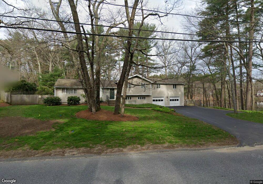
499 Dutton Rd Sudbury, MA 01776
Estimated Value: $1,003,000 - $1,082,000
About This Home
This home is located at 499 Dutton Rd, Sudbury, MA 01776 and is currently estimated at $1,033,600, approximately $369 per square foot. 499 Dutton Rd is a home located in Middlesex County with nearby schools including Peter Noyes Elementary School, Ephraim Curtis Middle School, and Lincoln-Sudbury Regional High School.
Ownership History
We collect this data history from publicly available records. To have your information removed, we recommend requesting removal directly through your county’s website.
Purchase Details
Home Financials for this Owner
Home Financials are based on the most recent Mortgage that was taken out on this home.Home Values in the Area
Average Home Value in this Area
Purchase History
We collect this data history from publicly available records. To have your information removed, we recommend requesting removal directly through your county’s website.
| Date | Buyer | Sale Price | Title Company |
|---|---|---|---|
| $490,000 | -- | ||
| $490,000 | -- |
Mortgage History
We collect this data history from publicly available records. To have your information removed, we recommend requesting removal directly through your county’s website.
| Date | Status | Borrower | Loan Amount |
|---|---|---|---|
| Open | $392,000 | ||
| Closed | $392,000 | ||
| Previous Owner | $161,000 | ||
| Previous Owner | $92,000 |
Tax History
We collect this data history from publicly available records. To have your information removed, we recommend requesting removal directly through your county’s website.
| Year | Tax Paid | Tax Assessment Tax Assessment Total Assessment is a certain percentage of the fair market value that is determined by local assessors to be the total taxable value of land and additions on the property. | Land | Improvement |
|---|---|---|---|---|
| 2025 | $12,274 | $838,400 | $403,600 | $434,800 |
| 2024 | $11,856 | $811,500 | $391,800 | $419,700 |
| 2023 | $11,681 | $740,700 | $356,100 | $384,600 |
| 2022 | $11,077 | $613,700 | $326,800 | $286,900 |
| 2021 | $10,601 | $563,000 | $326,800 | $236,200 |
| 2020 | $10,387 | $563,000 | $326,800 | $236,200 |
| 2019 | $10,083 | $563,000 | $326,800 | $236,200 |
| 2018 | $9,460 | $527,600 | $330,600 | $197,000 |
| 2017 | $8,913 | $502,400 | $319,200 | $183,200 |
| 2016 | $8,685 | $487,900 | $307,000 | $180,900 |
Map
- 51 Atkinson Ln
- 17 Brentwood Rd
- 153 Pratts Mill Rd
- 419 Hudson Rd
- 9 Center St
- 9 Priest Rd
- 30 Harness Ln
- 10 East St
- 16 Richard Ave
- 15 Ronald Rd
- 23 Basswood Ave
- 26 Maplewood Ave
- 24 Thornberry Ln
- 64 Pinewood Ave
- 65 Fox Run Rd
- 23 Birchwood Ave
- 7 Saddle Ridge Rd
- 24 Birchwood Ave
- 5 Partridge Ln
- 11 Axdell Rd
- 493 Dutton Rd
- 506 Dutton Rd
- 489 Dutton Rd
- 215 Pratts Mill Rd
- 212 Pratts Mill Rd Lot 1
- 212 Pratts Mill Rd
- 210 Pratts Mill Rd
- 486 Dutton Rd
- 481 Dutton Rd
- 211 Pratts Mill Rd
- 480 Dutton Rd
- 520 Dutton Rd
- 207 Pratts Mill Rd
- 516 Dutton Rd
- 47 Raynor Rd
- 8 Barton Dr
- 14 Barton Dr
- 12 Magnolia Rd
- 20 Barton Dr
- 474 Dutton Rd
Ask me questions while you tour the home.