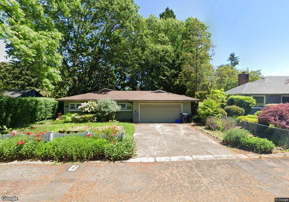
499 Walnut Ln Eugene, OR 97401
Harlow NeighborhoodEstimated Value: $482,000 - $590,000
3
Beds
2
Baths
1,656
Sq Ft
$333/Sq Ft
Est. Value
About This Home
This home is located at 499 Walnut Ln, Eugene, OR 97401 and is currently estimated at $550,899, approximately $332 per square foot. 499 Walnut Ln is a home located in Lane County with nearby schools including Holt Elementary School, Monroe Middle School, and Sheldon High School.
Ownership History
Date
Name
Owned For
Owner Type
Purchase Details
Closed on
Nov 17, 2018
Sold by
Dmiceli John V and Dmeceli Catherine A
Bought by
Dimiceli John V and Dimiceli Catrine A
Current Estimated Value
Purchase Details
Closed on
Jul 5, 2007
Sold by
Richard Shannon
Bought by
Dimiceli John and Di Miceli Catherine A
Home Financials for this Owner
Home Financials are based on the most recent Mortgage that was taken out on this home.
Original Mortgage
$220,150
Interest Rate
6.41%
Mortgage Type
Purchase Money Mortgage
Purchase Details
Closed on
Dec 19, 2001
Sold by
Overland Roberta J
Bought by
Richard Shannon
Home Financials for this Owner
Home Financials are based on the most recent Mortgage that was taken out on this home.
Original Mortgage
$164,415
Interest Rate
6.51%
Create a Home Valuation Report for This Property
The Home Valuation Report is an in-depth analysis detailing your home's value as well as a comparison with similar homes in the area
Home Values in the Area
Average Home Value in this Area
Purchase History
| Date | Buyer | Sale Price | Title Company |
|---|---|---|---|
| Dimiceli John V | -- | None Available | |
| Dimiceli John | $314,500 | First American Title | |
| Richard Shannon | $169,500 | American Title Group |
Source: Public Records
Mortgage History
| Date | Status | Borrower | Loan Amount |
|---|---|---|---|
| Previous Owner | Dimiceli John | $220,150 | |
| Previous Owner | Richard Shannon | $164,415 |
Source: Public Records
Tax History
| Year | Tax Paid | Tax Assessment Tax Assessment Total Assessment is a certain percentage of the fair market value that is determined by local assessors to be the total taxable value of land and additions on the property. | Land | Improvement |
|---|---|---|---|---|
| 2025 | $5,229 | $268,387 | -- | -- |
| 2024 | $5,164 | $260,570 | -- | -- |
| 2023 | $5,164 | $252,981 | $0 | $0 |
| 2022 | $4,838 | $245,613 | $0 | $0 |
| 2021 | $4,544 | $238,460 | $0 | $0 |
| 2020 | $4,560 | $231,515 | $0 | $0 |
| 2019 | $4,404 | $224,772 | $0 | $0 |
| 2018 | $4,146 | $211,870 | $0 | $0 |
| 2017 | $3,960 | $211,870 | $0 | $0 |
| 2016 | $3,806 | $205,699 | $0 | $0 |
| 2015 | $3,713 | $199,708 | $0 | $0 |
| 2014 | $3,591 | $193,891 | $0 | $0 |
Source: Public Records
Map
Nearby Homes
- 2746 Harlow Rd
- 2994 Dapple Way
- 2872 Suffolk Ct
- 600 Cherry Dr Unit 8
- 600 Cherry Dr Unit 3
- 394 Cherry Dr
- 280 Regal Ct
- 2746 Norbert Ln
- 327 Rustic Place Unit 35
- 347 Rustic Place Unit 14
- 367 Rustic Place
- 2345 Pioneer Pike
- 280 Roan Dr
- 950 Coburg Rd
- 349 van Duyn St
- 1090 Corydon St
- 820 Lariat Dr
- 825 Waverly St
- 2250 Turnberry Ct
- 2084 Eastwood Ln
Your Personal Tour Guide
Ask me questions while you tour the home.