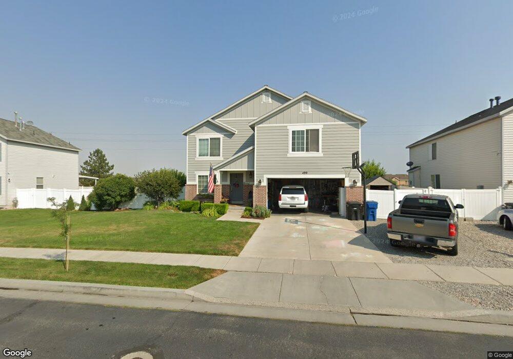
499 Wheat Dr Tooele, UT 84074
Estimated Value: $467,000 - $501,000
5
Beds
3
Baths
2,774
Sq Ft
$174/Sq Ft
Est. Value
About This Home
This home is located at 499 Wheat Dr, Tooele, UT 84074 and is currently estimated at $483,221, approximately $174 per square foot. 499 Wheat Dr is a home located in Tooele County with nearby schools including Stansbury Park Elementary School, Clarke N. Johnsen Junior High School, and Stansbury High School.
Ownership History
Date
Name
Owned For
Owner Type
Purchase Details
Closed on
Dec 19, 2023
Sold by
Berry Michael K
Bought by
Berry Michael K and Berry Amy R
Current Estimated Value
Home Financials for this Owner
Home Financials are based on the most recent Mortgage that was taken out on this home.
Original Mortgage
$140,000
Outstanding Balance
$134,306
Interest Rate
7.44%
Mortgage Type
Credit Line Revolving
Estimated Equity
$348,915
Purchase Details
Closed on
Oct 11, 2006
Sold by
Harmer Michale D and Harmer Noel K
Bought by
Berry Michael K and Berry Amy R
Home Financials for this Owner
Home Financials are based on the most recent Mortgage that was taken out on this home.
Original Mortgage
$32,925
Interest Rate
6.44%
Mortgage Type
Stand Alone Second
Create a Home Valuation Report for This Property
The Home Valuation Report is an in-depth analysis detailing your home's value as well as a comparison with similar homes in the area
Home Values in the Area
Average Home Value in this Area
Purchase History
| Date | Buyer | Sale Price | Title Company |
|---|---|---|---|
| Berry Michael K | -- | First American Title Insurance | |
| Berry Michael K | -- | First American Title | |
| Berry Michael K | -- | Equity Title Tooele |
Source: Public Records
Mortgage History
| Date | Status | Borrower | Loan Amount |
|---|---|---|---|
| Open | Berry Michael K | $140,000 | |
| Previous Owner | Berry Michael K | $32,925 |
Source: Public Records
Tax History
| Year | Tax Paid | Tax Assessment Tax Assessment Total Assessment is a certain percentage of the fair market value that is determined by local assessors to be the total taxable value of land and additions on the property. | Land | Improvement |
|---|---|---|---|---|
| 2025 | $3,590 | $453,814 | $110,400 | $343,414 |
| 2024 | $4,059 | $260,751 | $60,720 | $200,031 |
| 2023 | $4,059 | $263,285 | $79,200 | $184,085 |
| 2022 | $3,091 | $248,023 | $53,592 | $194,431 |
| 2021 | $2,731 | $181,031 | $45,342 | $135,689 |
| 2020 | $2,654 | $307,641 | $60,560 | $247,081 |
| 2019 | $2,426 | $276,491 | $60,560 | $215,931 |
| 2018 | $2,310 | $252,243 | $25,000 | $227,243 |
| 2017 | $2,090 | $241,422 | $25,000 | $216,422 |
| 2016 | $1,775 | $117,256 | $13,750 | $103,506 |
| 2015 | $1,775 | $111,398 | $0 | $0 |
| 2014 | -- | $111,398 | $0 | $0 |
Source: Public Records
Map
Nearby Homes
- 6842 Bigelow Dr
- 507 Frost Ln
- 501 Water Wheel Ln
- 42 Millpond
- 112 Crystal Bay Dr
- 54 W Porter Way
- 54 W Porter Way Unit 1304
- 6545 N Valley Point Way
- 33 E Delgada Ln
- 6757 N Star Discovery Way Unit 1309
- 6799 N Star Discovery Way Unit 1312
- 845 Lakeview
- 6412 N Wild Mare Way Unit 1022
- 1006 W Peregrine Dr
- 540 W Lefty Ln
- 160 Country Club Dr
- 257 W Palomino Way
- 1262 E Highline Rd
- 285 W Palomino Way
- 337 W Wrangler Cove
- 509 Wheat Dr
- 489 Wheat Dr
- 479 Wheat Dr
- 490 Wheat Dr
- 519 Wheat Dr
- 502 Wheat Dr
- 474 Wheat Dr
- 469 Wheat Dr
- 6790 Greenfield Ln
- 503 Benson Rd
- 6778 Greenfield Ln
- 513 Benson Rd
- 6766 Greenfield Ln
- 6823 Bigelow Dr
- 6800 N Bowker Dr
- 491 Benson Rd
- 6822 Bigelow Dr
- 6804 N Bowker Dr
- 6824 Bigelow Dr
- 6804 N Bowker Dr
Your Personal Tour Guide
Ask me questions while you tour the home.