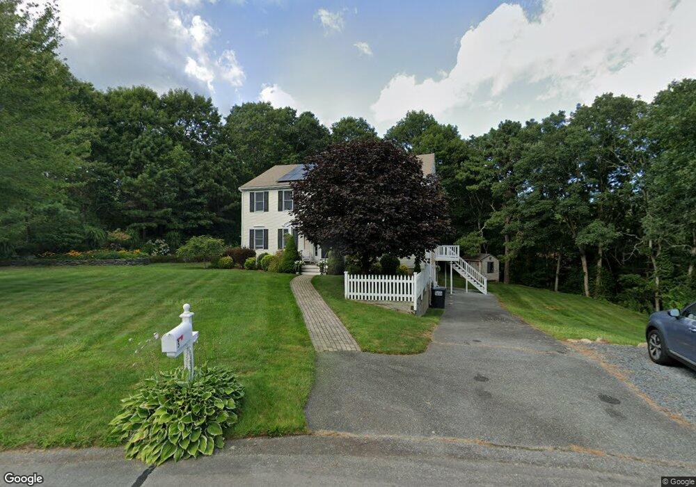
5 Laurel Cir Forestdale, MA 02644
Forestdale NeighborhoodEstimated Value: $728,379 - $820,000
4
Beds
4
Baths
2,688
Sq Ft
$293/Sq Ft
Est. Value
About This Home
This home is located at 5 Laurel Cir, Forestdale, MA 02644 and is currently estimated at $787,595, approximately $293 per square foot. 5 Laurel Cir is a home located in Barnstable County with nearby schools including Sandwich Middle High School and Sandwich Montessori School.
Ownership History
Date
Name
Owned For
Owner Type
Purchase Details
Closed on
Sep 9, 2005
Sold by
Menard Michael
Bought by
Rothera Kristen and Rothera Michael J
Current Estimated Value
Home Financials for this Owner
Home Financials are based on the most recent Mortgage that was taken out on this home.
Original Mortgage
$380,000
Outstanding Balance
$194,943
Interest Rate
5.79%
Mortgage Type
Purchase Money Mortgage
Estimated Equity
$592,652
Purchase Details
Closed on
Apr 7, 2000
Sold by
Household Fin Corp 2
Bought by
Menard Michael
Home Financials for this Owner
Home Financials are based on the most recent Mortgage that was taken out on this home.
Original Mortgage
$118,600
Interest Rate
8.3%
Mortgage Type
Purchase Money Mortgage
Purchase Details
Closed on
Oct 6, 1999
Sold by
Stott Ricky and Stott Patti L
Bought by
Household Finc Corp 2
Purchase Details
Closed on
Jul 13, 1990
Sold by
Leblanc Anna
Bought by
Stott Ricky
Create a Home Valuation Report for This Property
The Home Valuation Report is an in-depth analysis detailing your home's value as well as a comparison with similar homes in the area
Home Values in the Area
Average Home Value in this Area
Purchase History
| Date | Buyer | Sale Price | Title Company |
|---|---|---|---|
| Rothera Kristen | $469,000 | -- | |
| Menard Michael | $124,900 | -- | |
| Household Finc Corp 2 | $116,000 | -- | |
| Stott Ricky | $130,000 | -- |
Source: Public Records
Mortgage History
| Date | Status | Borrower | Loan Amount |
|---|---|---|---|
| Open | Rothera Kristen | $380,000 | |
| Previous Owner | Menard Michael | $118,600 | |
| Previous Owner | Stott Ricky | $151,200 | |
| Previous Owner | Stott Ricky | $25,000 |
Source: Public Records
Tax History
| Year | Tax Paid | Tax Assessment Tax Assessment Total Assessment is a certain percentage of the fair market value that is determined by local assessors to be the total taxable value of land and additions on the property. | Land | Improvement |
|---|---|---|---|---|
| 2025 | $7,282 | $688,900 | $157,200 | $531,700 |
| 2024 | $7,220 | $668,500 | $140,400 | $528,100 |
| 2023 | $6,990 | $607,800 | $127,600 | $480,200 |
| 2022 | $6,633 | $504,000 | $116,500 | $387,500 |
| 2021 | $6,282 | $456,200 | $111,400 | $344,800 |
| 2020 | $6,298 | $440,100 | $113,000 | $327,100 |
| 2019 | $5,939 | $414,700 | $108,000 | $306,700 |
| 2018 | $5,609 | $392,500 | $107,100 | $285,400 |
| 2017 | $5,527 | $370,200 | $103,600 | $266,600 |
| 2016 | $5,193 | $358,900 | $100,400 | $258,500 |
| 2015 | $5,200 | $350,900 | $97,200 | $253,700 |
Source: Public Records
Map
Nearby Homes
- 21 Green Acres Ln
- 16 Route 130
- 4 Faith Ln
- 39 Massachusetts 130
- 8 W Crossfield Rd
- 19 Emerald Way
- 1 Lighthouse Ln
- 32 Pimlico Pond Rd
- 20 Anchor Dr
- 27 Craft Rd
- 8 Pickerel Way
- 21 Grand Oak Rd
- 99 Route 130
- 13 Checkerberry Ln
- 24 East Rd
- 86 Greenville Dr
- 93 Deerfield Rd
- 35 Ashumet Rd Unit 14A
- 35 Ashumet Rd Unit 5B
- 35 Ashumet Rd Unit 12A
Your Personal Tour Guide
Ask me questions while you tour the home.