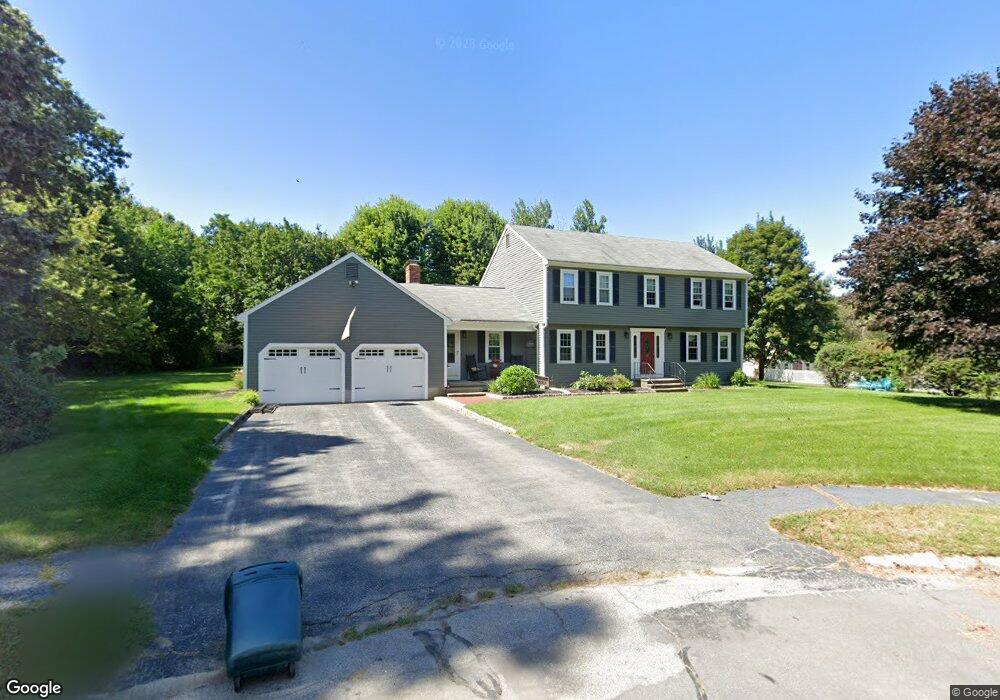
5 Laurel Rd Blackstone, MA 01504
Blackstone AreaEstimated Value: $638,000 - $1,060,000
About This Home
This home is located at 5 Laurel Rd, Blackstone, MA 01504 and is currently estimated at $761,506, approximately $325 per square foot. 5 Laurel Rd is a home located in Worcester County with nearby schools including Blackstone-Millville Regional High School and Bethany Christian Academy.
Ownership History
We collect this data history from publicly available records. To have your information removed, we recommend requesting removal directly through your county’s website.
Purchase Details
Purchase Details
Purchase Details
Home Values in the Area
Average Home Value in this Area
Purchase History
We collect this data history from publicly available records. To have your information removed, we recommend requesting removal directly through your county’s website.
| Date | Buyer | Sale Price | Title Company |
|---|---|---|---|
| $369,900 | -- | ||
| $315,000 | -- | ||
| $467,537 | -- |
Mortgage History
We collect this data history from publicly available records. To have your information removed, we recommend requesting removal directly through your county’s website.
| Date | Status | Borrower | Loan Amount |
|---|---|---|---|
| Open | $229,000 | ||
| Closed | $30,000 | ||
| Closed | $230,000 | ||
| Previous Owner | $257,000 | ||
| Previous Owner | $257,000 | ||
| Previous Owner | $260,000 | ||
| Closed | $176,000 |
Tax History
We collect this data history from publicly available records. To have your information removed, we recommend requesting removal directly through your county’s website.
| Year | Tax Paid | Tax Assessment Tax Assessment Total Assessment is a certain percentage of the fair market value that is determined by local assessors to be the total taxable value of land and additions on the property. | Land | Improvement |
|---|---|---|---|---|
| 2025 | $8,151 | $539,800 | $187,000 | $352,800 |
| 2024 | $8,121 | $497,300 | $204,400 | $292,900 |
| 2023 | $7,781 | $480,900 | $204,400 | $276,500 |
| 2022 | $7,584 | $423,700 | $168,300 | $255,400 |
| 2021 | $7,494 | $400,300 | $165,900 | $234,400 |
| 2020 | $15,698 | $401,800 | $164,700 | $237,100 |
| 2019 | $7,371 | $389,800 | $152,700 | $237,100 |
| 2018 | $7,051 | $361,800 | $146,100 | $215,700 |
| 2017 | $3,515 | $347,500 | $146,100 | $201,400 |
| 2016 | $6,672 | $345,000 | $134,700 | $210,300 |
| 2015 | $6,656 | $341,700 | $137,100 | $204,600 |
Map
- 280 Blackstone St
- 13 King Philip Path
- 16 King Philip Path
- 14 Lundvall Rd
- 98 Indian Run Rd
- 187 Blackstone St
- 61 Scott Hill Blvd
- 11 Quail Run Rd
- 89 Elm St
- 10 Cemetery St
- 28 Vincent Rd
- 62 North St
- 7 Whitman Cir Unit 7
- 162 Blackstone St
- 3 Whitman Cir Unit 3
- 1 Whitman Cir Unit 1
- 0 North St Unit 73440626
- 29 Overlook Dr
- 23 Bellstone Dr
- Lot 4 Pickering Rd
Ask me questions while you tour the home.