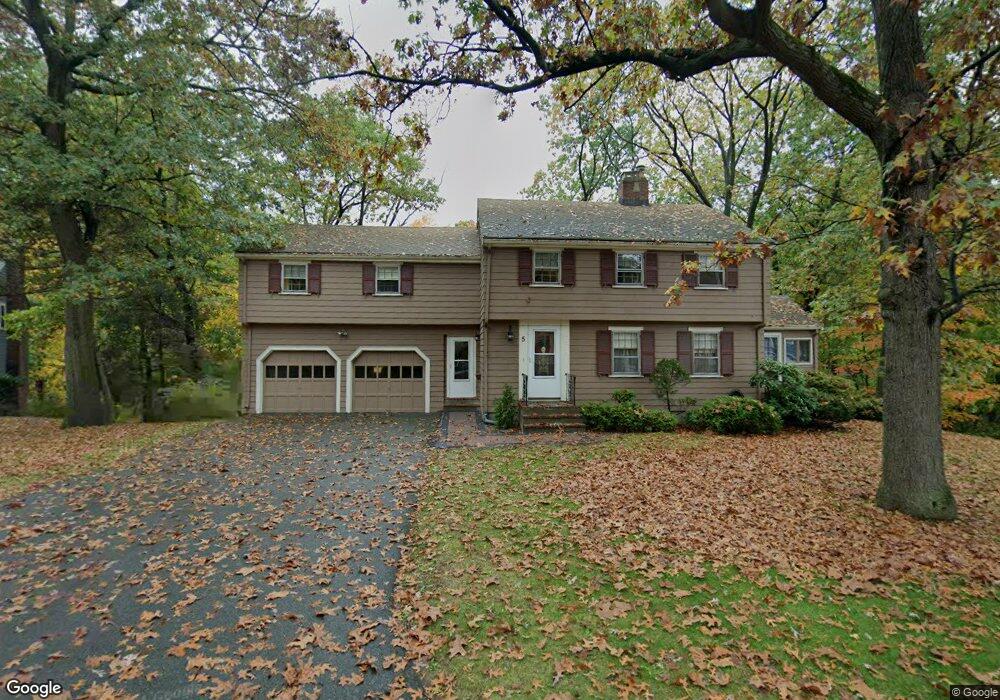
5 Macintosh Rd Reading, MA 01867
Reading AreaEstimated Value: $1,202,417 - $1,329,000
About This Home
This home is located at 5 Macintosh Rd, Reading, MA 01867 and is currently estimated at $1,260,604, approximately $453 per square foot. 5 Macintosh Rd is a home located in Middlesex County with nearby schools including Joshua Eaton Elementary School, Walter S. Parker Middle School, and Reading Memorial High School.
Ownership History
We collect this data history from publicly available records. To have your information removed, we recommend requesting removal directly through your county’s website.
Purchase Details
Purchase Details
Purchase Details
Home Values in the Area
Average Home Value in this Area
Purchase History
We collect this data history from publicly available records. To have your information removed, we recommend requesting removal directly through your county’s website.
| Date | Buyer | Sale Price | Title Company |
|---|---|---|---|
| -- | -- | ||
| -- | -- | ||
| -- | -- |
Mortgage History
We collect this data history from publicly available records. To have your information removed, we recommend requesting removal directly through your county’s website.
| Date | Status | Borrower | Loan Amount |
|---|---|---|---|
| Previous Owner | $129,000 | ||
| Previous Owner | $200,000 |
Tax History
We collect this data history from publicly available records. To have your information removed, we recommend requesting removal directly through your county’s website.
| Year | Tax Paid | Tax Assessment Tax Assessment Total Assessment is a certain percentage of the fair market value that is determined by local assessors to be the total taxable value of land and additions on the property. | Land | Improvement |
|---|---|---|---|---|
| 2025 | $11,432 | $1,003,700 | $592,600 | $411,100 |
| 2024 | $11,572 | $987,400 | $583,000 | $404,400 |
| 2023 | $10,890 | $865,000 | $510,700 | $354,300 |
| 2022 | $10,877 | $816,000 | $481,800 | $334,200 |
| 2021 | $7,378 | $744,200 | $440,900 | $303,300 |
| 2020 | $9,871 | $707,600 | $419,200 | $288,400 |
| 2019 | $9,955 | $664,900 | $393,900 | $271,000 |
| 2018 | $6,499 | $622,200 | $368,600 | $253,600 |
| 2017 | $8,558 | $610,000 | $361,400 | $248,600 |
| 2016 | $8,784 | $605,800 | $327,900 | $277,900 |
| 2015 | $8,134 | $553,300 | $299,500 | $253,800 |
| 2014 | $8,075 | $547,800 | $296,500 | $251,300 |
Map
- 18 Gleason Rd
- 148 South St
- 15 George St
- 84 Curtis St
- 5 Concord Rd
- 23 Augustus Ct Unit 4003
- 57 Augustus Ct Unit 4006
- 7 Dewey Ave
- 443 Summer Ave
- 36 Abigail Way Unit 1009
- 62 Abigail Way Unit 1006
- 62 Abigail Way Unit 4006
- 62 Abigail Way Unit 4007
- 293 Woburn St
- 8 Berkeley St
- 24 Pinevale Ave
- 20 Pinevale Ave
- 120 North St
- 2 O'Connor Ln
- 13 Percy Ave
Ask me questions while you tour the home.