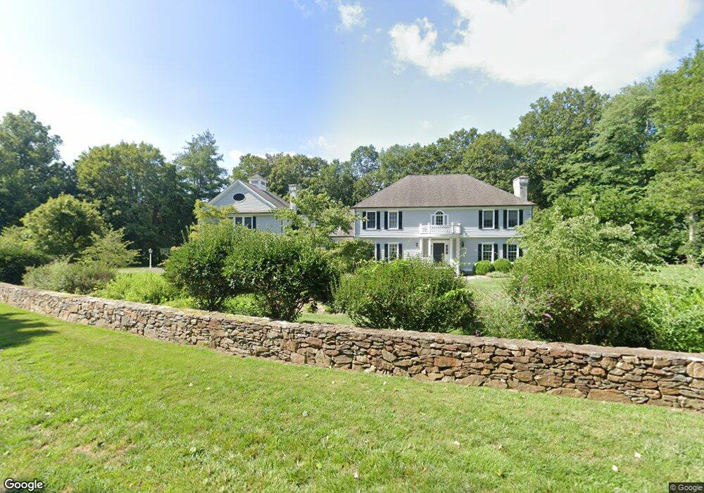
5 Pheasant Hill Rd Weston, CT 06883
Estimated Value: $1,965,000 - $2,277,000
About This Home
This home is located at 5 Pheasant Hill Rd, Weston, CT 06883 and is currently estimated at $2,088,888, approximately $344 per square foot. 5 Pheasant Hill Rd is a home located in Fairfield County with nearby schools including Hurlbutt Elementary School, Weston Intermediate School, and Weston Middle School.
Ownership History
We collect this data history from publicly available records. To have your information removed, we recommend requesting removal directly through your county’s website.
Purchase Details
Purchase Details
Purchase Details
Home Values in the Area
Average Home Value in this Area
Purchase History
We collect this data history from publicly available records. To have your information removed, we recommend requesting removal directly through your county’s website.
| Date | Buyer | Sale Price | Title Company |
|---|---|---|---|
| $1,080,000 | -- | ||
| $800,000 | -- | ||
| $865,000 | -- |
Mortgage History
We collect this data history from publicly available records. To have your information removed, we recommend requesting removal directly through your county’s website.
| Date | Status | Borrower | Loan Amount |
|---|---|---|---|
| Open | $690,000 | ||
| Closed | $210,000 |
Tax History
We collect this data history from publicly available records. To have your information removed, we recommend requesting removal directly through your county’s website.
| Year | Tax Paid | Tax Assessment Tax Assessment Total Assessment is a certain percentage of the fair market value that is determined by local assessors to be the total taxable value of land and additions on the property. | Land | Improvement |
|---|---|---|---|---|
| 2025 | $31,697 | $1,326,220 | $236,180 | $1,090,040 |
| 2024 | $31,126 | $1,326,220 | $236,180 | $1,090,040 |
| 2023 | $29,586 | $894,910 | $236,180 | $658,730 |
| 2022 | $29,505 | $894,910 | $236,180 | $658,730 |
| 2021 | $29,460 | $894,910 | $236,180 | $658,730 |
| 2020 | $28,968 | $894,910 | $236,180 | $658,730 |
| 2019 | $29,028 | $896,750 | $236,180 | $660,570 |
| 2018 | $29,713 | $1,011,000 | $262,900 | $748,100 |
| 2017 | $29,228 | $1,011,000 | $262,900 | $748,100 |
| 2016 | $28,874 | $1,011,000 | $262,900 | $748,100 |
| 2015 | $29,076 | $1,011,000 | $262,900 | $748,100 |
| 2014 | $28,551 | $1,011,000 | $262,900 | $748,100 |
Map
- 10 Pheasant Hill Rd
- 290 Lyons Plain Rd
- 274 Lyons Plain Rd
- 42 Blueberry Hill Rd
- 195 Steep Hill Rd
- 198 Steep Hill Rd
- 52 Valley Forge Rd
- 16 Pilgrim Ln
- 27 Hackberry Hill Rd
- 23 Old Stage Coach Rd
- 38 Old Redding Rd
- 85-95 Old Easton Turnpike
- 22 Hill Farm Rd
- 6 Winthrop Hills
- 18 Cartbridge Rd
- 18 Old Kings Hwy
- 214 Good Hill Rd
- B Bridge Rd
- 34 Laurel Lake W
- 32 Steep Hill Rd
- 15 Pheasant Hill Rd
- 16 Pheasant Hill Rd
- 273 Lyons Plain Rd
- 283 Lyons Plain Rd
- 275 Lyons Plain Rd
- 4 Blueberry Hill Rd
- 284 Lyons Plain Rd
- 286 Lyons Plain Rd
- 24 Pheasant Hill Rd
- 267 Lyons Plain Rd
- 2 Blueberry Hill Rd
- 2 Blueberry Hill Rd Unit R
- 27 Pheasant Hill Rd
- 282 Lyons Plain Rd
- 282 Lyons Plain Rd
- 298 Lyons Plain Rd
- 8 Blueberry Hill Rd
- 28 Pheasant Hill Rd
- 35 11 O Clock Rd
- 296 Lyons Plain Rd
Ask me questions while you tour the home.