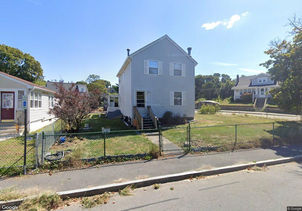
5 Union St Quincy, MA 02169
Quincy Point NeighborhoodEstimated Value: $702,432 - $773,000
3
Beds
2
Baths
1,516
Sq Ft
$482/Sq Ft
Est. Value
About This Home
This home is located at 5 Union St, Quincy, MA 02169 and is currently estimated at $730,108, approximately $481 per square foot. 5 Union St is a home located in Norfolk County with nearby schools including Point Webster Middle School, Clifford H. Marshall Elementary School, and Quincy High School.
Ownership History
Date
Name
Owned For
Owner Type
Purchase Details
Closed on
Feb 2, 2010
Sold by
Kwong Joel C and Kwong Jenny D
Bought by
Ap Balanced T and Yu Leo R
Current Estimated Value
Purchase Details
Closed on
Jul 30, 2003
Sold by
Chiu Alan Y and Chiu Carrie
Bought by
Kwong Joel C and Kwong Jenny D
Home Financials for this Owner
Home Financials are based on the most recent Mortgage that was taken out on this home.
Original Mortgage
$296,000
Interest Rate
5.28%
Mortgage Type
Purchase Money Mortgage
Purchase Details
Closed on
Jan 25, 1993
Sold by
Kevlou Rt
Bought by
Y-Chiu Alan and Chiu Carrie
Home Financials for this Owner
Home Financials are based on the most recent Mortgage that was taken out on this home.
Original Mortgage
$105,700
Interest Rate
8.15%
Mortgage Type
Purchase Money Mortgage
Purchase Details
Closed on
Feb 25, 1991
Sold by
Cipriano Santais and Cipriano Sue
Bought by
Kevlou Rt
Create a Home Valuation Report for This Property
The Home Valuation Report is an in-depth analysis detailing your home's value as well as a comparison with similar homes in the area
Home Values in the Area
Average Home Value in this Area
Purchase History
| Date | Buyer | Sale Price | Title Company |
|---|---|---|---|
| Ap Balanced T | $313,400 | -- | |
| Kwong Joel C | $370,000 | -- | |
| Y-Chiu Alan | $151,000 | -- | |
| Kevlou Rt | $43,750 | -- |
Source: Public Records
Mortgage History
| Date | Status | Borrower | Loan Amount |
|---|---|---|---|
| Previous Owner | Kevlou Rt | $225,000 | |
| Previous Owner | Kwong Joel C | $296,000 | |
| Previous Owner | Kevlou Rt | $65,000 | |
| Previous Owner | Kevlou Rt | $105,700 |
Source: Public Records
Tax History
| Year | Tax Paid | Tax Assessment Tax Assessment Total Assessment is a certain percentage of the fair market value that is determined by local assessors to be the total taxable value of land and additions on the property. | Land | Improvement |
|---|---|---|---|---|
| 2025 | $7,393 | $641,200 | $283,000 | $358,200 |
| 2024 | $6,918 | $613,800 | $269,500 | $344,300 |
| 2023 | $6,353 | $570,800 | $245,000 | $325,800 |
| 2022 | $6,578 | $549,100 | $222,800 | $326,300 |
| 2021 | $6,207 | $511,300 | $222,800 | $288,500 |
| 2020 | $6,000 | $482,700 | $210,100 | $272,600 |
| 2019 | $5,807 | $462,700 | $194,500 | $268,200 |
| 2018 | $5,133 | $384,800 | $176,900 | $207,900 |
| 2017 | $5,115 | $361,000 | $168,500 | $192,500 |
| 2016 | $4,762 | $331,600 | $153,100 | $178,500 |
| 2015 | $4,605 | $315,400 | $144,400 | $171,000 |
| 2014 | $4,467 | $300,600 | $144,400 | $156,200 |
Source: Public Records
Map
Nearby Homes
- 5 Main St
- 123 Elm St Unit D-12
- 62 South St Unit 7
- 35 Miller Stile Rd
- 44 Elm St
- 33 Elm St
- 72 Main St
- 17-19 Lowe St
- 2 Cliveden St Unit 601E
- 2 Cliveden St Unit 405E
- 66 Mcgrath Hwy Unit 502
- 66 Mcgrath Hwy Unit 411
- 66 Mcgrath Hwy Unit 404
- 66 Mcgrath Hwy Unit 507
- 59 Spear St Unit 301
- 59 Spear St Unit 202
- 51 Sumner St
- 18 Cliveden St Unit 406W
- 18 Cliveden St Unit 205W
- 18 Cliveden St Unit 201W
- 9 Union St
- 13 Union St
- 11 Union St
- 25 S Walnut St
- 38 S Walnut St
- 41 S Walnut St
- 41 S Walnut St Unit 2
- 41 S Walnut St
- 41 S Walnut St Unit 1
- 41 S Walnut St Unit 3
- 39 S Walnut St Unit 4
- 39 S Walnut St
- 39 S Walnut St Unit 3
- 18 S Walnut St
- 21 S Walnut St
- 21 S Walnut St Unit 1
- 21 S Walnut St Unit 10
- 21 S Walnut St Unit 11
- 14 Union St
- 14 Union St Unit 2
Your Personal Tour Guide
Ask me questions while you tour the home.