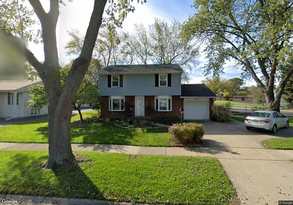
50 Cedar Dr Wheeling, IL 60090
Estimated Value: $331,000 - $424,000
About This Home
This home is located at 50 Cedar Dr, Wheeling, IL 60090 and is currently estimated at $389,792, approximately $243 per square foot. 50 Cedar Dr is a home located in Cook County with nearby schools including Eugene Field Elementary School, Jack London Middle School, and Buffalo Grove High School.
Ownership History
We collect this data history from publicly available records. To have your information removed, we recommend requesting removal directly through your county’s website.
Purchase Details
Purchase Details
Purchase Details
Purchase Details
Home Financials for this Owner
Home Financials are based on the most recent Mortgage that was taken out on this home.Purchase Details
Home Values in the Area
Average Home Value in this Area
Purchase History
We collect this data history from publicly available records. To have your information removed, we recommend requesting removal directly through your county’s website.
| Date | Buyer | Sale Price | Title Company |
|---|---|---|---|
| -- | Attorney | ||
| -- | Attorney | ||
| -- | -- | ||
| -- | -- | ||
| -- | -- |
Mortgage History
We collect this data history from publicly available records. To have your information removed, we recommend requesting removal directly through your county’s website.
| Date | Status | Borrower | Loan Amount |
|---|---|---|---|
| Closed | $126,000 |
Tax History
We collect this data history from publicly available records. To have your information removed, we recommend requesting removal directly through your county’s website.
| Year | Tax Paid | Tax Assessment Tax Assessment Total Assessment is a certain percentage of the fair market value that is determined by local assessors to be the total taxable value of land and additions on the property. | Land | Improvement |
|---|---|---|---|---|
| 2025 | $7,719 | $33,001 | $9,347 | $23,654 |
| 2024 | $7,719 | $29,000 | $7,789 | $21,211 |
| 2023 | $7,301 | $29,000 | $7,789 | $21,211 |
| 2022 | $7,301 | $29,000 | $7,789 | $21,211 |
| 2021 | $5,978 | $22,128 | $5,971 | $16,157 |
| 2020 | $5,970 | $22,128 | $5,971 | $16,157 |
| 2019 | $6,088 | $24,752 | $5,971 | $18,781 |
| 2018 | $5,967 | $22,535 | $5,192 | $17,343 |
| 2017 | $5,884 | $22,535 | $5,192 | $17,343 |
| 2016 | $6,685 | $22,535 | $5,192 | $17,343 |
| 2015 | $6,779 | $21,647 | $4,413 | $17,234 |
| 2014 | $6,631 | $21,647 | $4,413 | $17,234 |
| 2013 | $6,103 | $21,647 | $4,413 | $17,234 |
Map
- 1011 Beverly Dr
- 34 Berkshire Dr
- 640 Mchenry Rd Unit 408
- 481 Sussex Ct
- 459 Sussex Ct
- 495 Mchenry Rd Unit 1B
- 300 E Dundee Rd Unit 102A
- 300 E Dundee Rd Unit 310
- 1052 Southbury Ln Unit 1
- 1102 Woodbury Ln Unit D1
- 571 Fairway View Dr Unit 3K
- 1101 Anthony Rd
- 175 Lake Blvd Unit 302
- 175 Lake Blvd Unit 12
- 175 Lake Blvd Unit 349
- 1507 Acorn Ct Unit 1787O
- 586 Fairway View Dr Unit 2C
- 575 Greystone Ln Unit A2
- 290 E Norman Ln
- 200 Lake Blvd Unit 415
- 49 Saint Armand Ln
- 100 Saint Armand Ln
- 45 Saint Armand Ln
- 101 Chestnut Ln
- 104 Saint Armand Ln
- 101 Saint Armand Ln
- 49 Cedar Dr
- 48 Cedar Dr
- 41 Saint Armand Ln
- 47 Cedar Dr
- 108 Saint Armand Ln
- 111 Chestnut Ln
- 105 Saint Armand Ln
- 46 Cedar Dr
- 45 Cedar Dr
- 2027 Beverly Dr
- 115 Chestnut Ln
- 1033 Beverly Dr
- 112 Saint Armand Ln
- 40 Saint Armand Ln
Ask me questions while you tour the home.