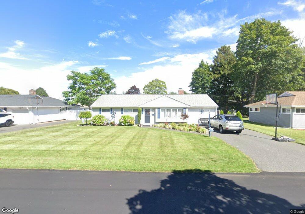
50 Garden Dr Riverside, RI 02915
Kent Heights NeighborhoodEstimated Value: $394,769 - $427,000
3
Beds
1
Bath
1,167
Sq Ft
$350/Sq Ft
Est. Value
About This Home
This home is located at 50 Garden Dr, Riverside, RI 02915 and is currently estimated at $407,942, approximately $349 per square foot. 50 Garden Dr is a home located in Providence County with nearby schools including East Providence High School, The Gordon School, and St Mary Academy-Bay View.
Ownership History
Date
Name
Owned For
Owner Type
Purchase Details
Closed on
Sep 10, 2020
Sold by
Bouvier Janice L
Bought by
Janice L Bouvier Ret
Current Estimated Value
Purchase Details
Closed on
Aug 2, 2019
Sold by
Richard A Masso T
Bought by
Bouvier Janice L
Purchase Details
Closed on
Jul 21, 2015
Sold by
Masso Richard A
Bought by
Masso Richard A
Purchase Details
Closed on
May 27, 2008
Sold by
Booker John and Booker Carrie
Bought by
Masso Richard A
Home Financials for this Owner
Home Financials are based on the most recent Mortgage that was taken out on this home.
Original Mortgage
$156,750
Interest Rate
5.94%
Mortgage Type
Purchase Money Mortgage
Create a Home Valuation Report for This Property
The Home Valuation Report is an in-depth analysis detailing your home's value as well as a comparison with similar homes in the area
Home Values in the Area
Average Home Value in this Area
Purchase History
| Date | Buyer | Sale Price | Title Company |
|---|---|---|---|
| Janice L Bouvier Ret | -- | None Available | |
| Bouvier Janice L | $227,000 | -- | |
| Masso Richard A | -- | -- | |
| Masso Richard A | $165,000 | -- |
Source: Public Records
Mortgage History
| Date | Status | Borrower | Loan Amount |
|---|---|---|---|
| Previous Owner | Masso Richard A | $156,750 | |
| Previous Owner | Masso Richard A | $162,000 | |
| Previous Owner | Masso Richard A | $156,750 |
Source: Public Records
Tax History
| Year | Tax Paid | Tax Assessment Tax Assessment Total Assessment is a certain percentage of the fair market value that is determined by local assessors to be the total taxable value of land and additions on the property. | Land | Improvement |
|---|---|---|---|---|
| 2025 | $4,720 | $361,100 | $138,200 | $222,900 |
| 2024 | $4,527 | $295,300 | $115,300 | $180,000 |
| 2023 | $4,359 | $295,300 | $115,300 | $180,000 |
| 2022 | $4,057 | $185,600 | $59,400 | $126,200 |
| 2021 | $3,958 | $184,100 | $58,000 | $126,100 |
| 2020 | $3,791 | $184,100 | $58,000 | $126,100 |
| 2019 | $3,686 | $184,100 | $58,000 | $126,100 |
| 2018 | $3,652 | $159,600 | $59,200 | $100,400 |
| 2017 | $3,570 | $159,600 | $59,200 | $100,400 |
| 2016 | $3,553 | $159,600 | $59,200 | $100,400 |
| 2015 | $3,440 | $149,900 | $52,300 | $97,600 |
| 2014 | $3,440 | $149,900 | $52,300 | $97,600 |
Source: Public Records
Map
Nearby Homes
- 32 Milburn Rd
- 53 Wampanoag Trail
- 34 Commack Rd
- 2919 Pawtucket Ave
- 2941 Pawtucket Ave
- 42 Mountain Ave
- 72 Allerton Ave
- 220 Vincent Ave
- 180 Grassmere Ave
- 77 Gardiner Ave
- 177 Dover Ave
- 52 Maxfield Ave
- 14 Maxfield Ave
- 74 Brookhaven Dr
- 30 Dover Ave
- 6 Fuller Ave
- 41 Whitcomb Rd
- 25 Bullocks Point Ave Unit 5C
- 14 Lottie Dr
- 10 Brightridge Ave
Your Personal Tour Guide
Ask me questions while you tour the home.