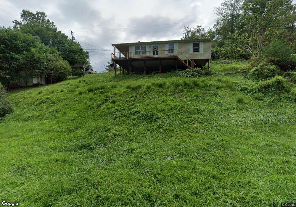
50 Hacker Ln Manchester, KY 40962
Estimated Value: $55,000 - $94,000
3
Beds
1
Bath
864
Sq Ft
$87/Sq Ft
Est. Value
About This Home
This home is located at 50 Hacker Ln, Manchester, KY 40962 and is currently estimated at $75,088, approximately $86 per square foot. 50 Hacker Ln is a home located in Clay County with nearby schools including Clay County High School and Manchester Christian Academy.
Ownership History
Date
Name
Owned For
Owner Type
Purchase Details
Closed on
Feb 6, 2026
Sold by
First National Bank Of Manchester
Bought by
House Shepherd Enterprises Ltd
Current Estimated Value
Purchase Details
Closed on
Nov 19, 2020
Sold by
Hacker Anthony Wayne and Hacker Tammy Carol
Bought by
Sams Jeffrey Michael and Collins Andrea Alicia
Home Financials for this Owner
Home Financials are based on the most recent Mortgage that was taken out on this home.
Original Mortgage
$39,871
Interest Rate
2.8%
Mortgage Type
Construction
Purchase Details
Closed on
Sep 13, 2019
Sold by
Hacker Anthony Wayne and Hacker Tammy Carol
Bought by
Sams Jeffrey Michael and Collins Andrea Alicia
Home Financials for this Owner
Home Financials are based on the most recent Mortgage that was taken out on this home.
Original Mortgage
$41,000
Interest Rate
3.7%
Mortgage Type
Land Contract Argmt. Of Sale
Purchase Details
Closed on
Oct 3, 2014
Sold by
Hacker Charles Gilbert and Hacker Cheryl
Bought by
Hacker Anthony Wayne
Create a Home Valuation Report for This Property
The Home Valuation Report is an in-depth analysis detailing your home's value as well as a comparison with similar homes in the area
Home Values in the Area
Average Home Value in this Area
Purchase History
| Date | Buyer | Sale Price | Title Company |
|---|---|---|---|
| House Shepherd Enterprises Ltd | $45,000 | None Listed On Document | |
| Sams Jeffrey Michael | $45,000 | None Available | |
| Sams Jeffrey Michael | $45,000 | None Available | |
| Hacker Anthony Wayne | $6,500 | None Available |
Source: Public Records
Mortgage History
| Date | Status | Borrower | Loan Amount |
|---|---|---|---|
| Previous Owner | Sams Jeffrey Michael | $39,871 | |
| Previous Owner | Sams Jeffrey Michael | $41,000 |
Source: Public Records
Tax History
| Year | Tax Paid | Tax Assessment Tax Assessment Total Assessment is a certain percentage of the fair market value that is determined by local assessors to be the total taxable value of land and additions on the property. | Land | Improvement |
|---|---|---|---|---|
| 2025 | $537 | $45,000 | $0 | $0 |
| 2024 | $538 | $45,000 | $0 | $0 |
| 2023 | $537 | $45,000 | $0 | $0 |
| 2022 | $531 | $45,000 | $0 | $0 |
| 2021 | $531 | $45,000 | $0 | $0 |
| 2020 | $528 | $45,000 | $0 | $0 |
| 2019 | $303 | $37,000 | $0 | $0 |
| 2018 | $297 | $26,000 | $0 | $0 |
| 2017 | $294 | $0 | $0 | $0 |
| 2016 | $279 | $0 | $0 | $0 |
| 2015 | $19 | $0 | $0 | $0 |
Source: Public Records
Map
Nearby Homes
- 239 Railroad Ave
- 00 Kentucky 11
- 8549 Us Highway 421
- 212 Town Branch Rd
- 69 Whispering Oaks Ln
- 0 Kentucky 11
- 00 Hwy 421 Richmond Rd
- 111 House Ave
- 9999 Memorial Dr
- 85 Blackwell Dr
- 799 Coal Hollow Rd
- 91 Jones St
- 6 Toby Rd
- 0 Colony Rd Unit Lot 2/ Section C
- 31, 32, 33 Justice Dr
- 601 Justice Dr
- 9999 S Highway 11
- 4229 U S 421
- 0 Chop Bottom Rd Unit 25414458
- 0 Hooker Rd
- 84 Hacker Sawmill Rd
- 31 Hacker Ln
- 10 Pennington Hill Rd
- 79 Hacker Ln
- 10 Smith Ave
- 205 Pennington Hill and Us 421 Hwy
- 55 Smith Ave
- 9 Smith Ave
- 47 Pennington Hill Rd
- 31 Pennington Hill Rd
- 270 Pennington Hill Rd
- 270 Pennington Hill Rd
- 299 Pennington Hill Rd
- 270 Pennington Hill Rd
- 275 Pennington Hill Rd
- 75 Pennington Hill Rd
- 36 Water Tower Rd
- 35 Water Tower Rd
- 15 Water Tower Rd
- 17 Water Tower Rd
Your Personal Tour Guide
Ask me questions while you tour the home.