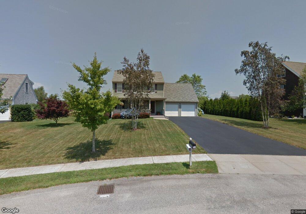
50 John Kesson Ln Middletown, RI 02842
Estimated Value: $713,934 - $987,000
3
Beds
2
Baths
1,792
Sq Ft
$452/Sq Ft
Est. Value
About This Home
This home is located at 50 John Kesson Ln, Middletown, RI 02842 and is currently estimated at $809,734, approximately $451 per square foot. 50 John Kesson Ln is a home located in Newport County with nearby schools including Middletown High School, All Saints STEAM Academy, and The Pennfield School.
Ownership History
Date
Name
Owned For
Owner Type
Purchase Details
Closed on
Jul 2, 1999
Sold by
Horan Building Inc
Bought by
Corr Stephen T and Corr Jeannine
Current Estimated Value
Home Financials for this Owner
Home Financials are based on the most recent Mortgage that was taken out on this home.
Original Mortgage
$145,000
Interest Rate
7.19%
Mortgage Type
Purchase Money Mortgage
Create a Home Valuation Report for This Property
The Home Valuation Report is an in-depth analysis detailing your home's value as well as a comparison with similar homes in the area
Home Values in the Area
Average Home Value in this Area
Purchase History
| Date | Buyer | Sale Price | Title Company |
|---|---|---|---|
| Corr Stephen T | $183,500 | -- |
Source: Public Records
Mortgage History
| Date | Status | Borrower | Loan Amount |
|---|---|---|---|
| Open | Corr Stephen T | $134,000 | |
| Closed | Corr Stephen T | $145,000 |
Source: Public Records
Tax History
| Year | Tax Paid | Tax Assessment Tax Assessment Total Assessment is a certain percentage of the fair market value that is determined by local assessors to be the total taxable value of land and additions on the property. | Land | Improvement |
|---|---|---|---|---|
| 2025 | $7,659 | $649,600 | $327,000 | $322,600 |
| 2024 | $7,314 | $649,600 | $327,000 | $322,600 |
| 2023 | $5,731 | $455,200 | $221,000 | $234,200 |
| 2022 | $5,472 | $455,200 | $221,000 | $234,200 |
| 2021 | $5,472 | $455,200 | $221,000 | $234,200 |
| 2020 | $5,145 | $373,900 | $166,000 | $207,900 |
| 2018 | $5,141 | $373,900 | $166,000 | $207,900 |
| 2016 | $5,476 | $355,100 | $149,400 | $205,700 |
| 2015 | $5,341 | $355,100 | $149,400 | $205,700 |
| 2014 | $5,404 | $336,300 | $128,300 | $208,000 |
| 2013 | $5,283 | $336,300 | $128,300 | $208,000 |
Source: Public Records
Map
Nearby Homes
- 4 Phillips Ave
- 103 Gossets Turn Dr
- 188 Greene Ln
- 11 Roy Ave
- 10 J h Dwyer Dr
- 48 Rebels Way
- 11 Barton Ln
- 0 Revolution Way
- 546 Jepson Ln
- 39 Almy Knoll Terrace
- 0 Revolution Way
- 163 Revolution Way
- 206 Revolution Way
- 1505 Fairway Dr
- 1304 Fairway Dr
- 171 Revolution Way
- 222 Rolling Hill Rd
- 219 Rolling Hill Rd Unit 219
- 136 Corporate Place
- 37 Lawton Brook Ln
- 40 John Kesson Ln
- 64 John Kesson Ln
- 47 John Kesson Ln
- 76 John Kesson Ln
- 30 John Kesson Ln
- 61 John Kesson Ln
- 35 John Kesson Ln
- 71 John Kesson Ln
- 16 Evelin Cir
- 86 John Kesson Ln
- 25 John Kesson Ln
- 81 John Kesson Ln
- 26 Evelin Cir
- 1837 W Main Rd
- 18 John Kesson Ln
- 15 John Kesson Ln
- 90 Pasture Farm Dr
- 36 Evelin Cir
- 91 John Kesson Ln
- 0 John Kesson Ln
Your Personal Tour Guide
Ask me questions while you tour the home.