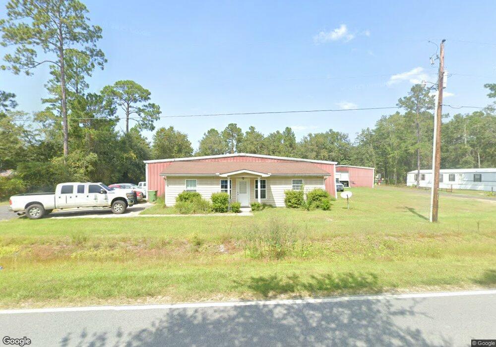
500 Broadhurst Rd Screven, GA 31560
Estimated Value: $228,178
Studio
--
Bath
9,635
Sq Ft
$24/Sq Ft
Est. Value
About This Home
This home is located at 500 Broadhurst Rd, Screven, GA 31560 and is currently estimated at $228,178, approximately $23 per square foot. 500 Broadhurst Rd is a home located in Wayne County with nearby schools including Screven Elementary School, Arthur Williams Middle School, and Wayne County High School.
Ownership History
Date
Name
Owned For
Owner Type
Purchase Details
Closed on
Jan 26, 2022
Sold by
Jesup Lot One Llc
Bought by
Boyette Holdings Llc
Current Estimated Value
Home Financials for this Owner
Home Financials are based on the most recent Mortgage that was taken out on this home.
Original Mortgage
$160,000
Outstanding Balance
$125,240
Interest Rate
2.79%
Mortgage Type
Cash
Estimated Equity
$102,938
Purchase Details
Closed on
Sep 8, 2016
Bought by
Jesup Lot One Llc
Purchase Details
Closed on
Sep 20, 2005
Sold by
Nix Thomas J
Bought by
Fultz William E
Purchase Details
Closed on
Jan 1, 2003
Bought by
Nix Thomas J
Purchase Details
Closed on
Jul 1, 1990
Create a Home Valuation Report for This Property
The Home Valuation Report is an in-depth analysis detailing your home's value as well as a comparison with similar homes in the area
Purchase History
| Date | Buyer | Sale Price | Title Company |
|---|---|---|---|
| Boyette Holdings Llc | $200,000 | -- | |
| Jesup Lot One Llc | $105,000 | -- | |
| Fultz William E | $8,000 | -- | |
| Nix Thomas J | -- | -- | |
| -- | $2,000 | -- |
Source: Public Records
Mortgage History
| Date | Status | Borrower | Loan Amount |
|---|---|---|---|
| Open | Boyette Holdings Llc | $160,000 |
Source: Public Records
Tax History
| Year | Tax Paid | Tax Assessment Tax Assessment Total Assessment is a certain percentage of the fair market value that is determined by local assessors to be the total taxable value of land and additions on the property. | Land | Improvement |
|---|---|---|---|---|
| 2025 | $2,965 | $94,574 | $3,307 | $91,267 |
| 2024 | $2,757 | $90,750 | $3,307 | $87,443 |
| 2023 | $3,042 | $86,999 | $3,307 | $83,692 |
| 2022 | $2,553 | $81,078 | $3,183 | $77,895 |
| 2021 | $2,734 | $81,078 | $3,183 | $77,895 |
| 2020 | $2,828 | $81,078 | $3,183 | $77,895 |
| 2019 | $2,913 | $81,078 | $3,183 | $77,895 |
| 2018 | $2,913 | $81,078 | $3,183 | $77,895 |
| 2017 | $1,299 | $129,172 | $3,183 | $125,989 |
| 2016 | $3,865 | $129,172 | $3,183 | $125,989 |
| 2014 | $3,875 | $129,172 | $3,183 | $125,989 |
| 2013 | -- | $129,171 | $3,183 | $125,988 |
Source: Public Records
Map
Nearby Homes
- 868 Broadhurst Rd W
- 109 Joyner St
- 307 Blocker St
- 102 Highsmith Ave
- 391 S Forks Rd
- 0 Dale Mill Rd
- 79 Tula Ln
- 9009 Waycross Hwy
- 59 Enoch Moody Rd
- 4106 Old Screven Rd
- 7132 Waycross Hwy
- 6940 Oak Crossing Rd
- 1517 Granny Crosby Rd
- 362 Crosby Ln
- TRACT 2 Loggan Ln
- TRACT 1 Loggan Ln
- 0 Rogers Break Unit 1656131
- 6064 U S 301
- 675 Foxwood Cir
- 6005 Chancey Rd
- 123 Wright St
- 62-15 Broadhurst Rd W
- 62-12 Broadhurst Rd W
- 62-13 Broadhurst Rd W
- 62-14 Broadhurst Rd W
- 62-2-INC Broadhurst Rd W
- 937 Broadhurst Rd W
- 409 Jones St
- 124 Wright St
- 523 Broadhurst Rd
- 127 Wright St
- 126 Wright St
- 514 Brown St
- 411 Jones St
- 519 Brown St
- 104 Brown St
- 0 Jones St
- 0 Brown St
- 222 Jones St
- 328 Brown St
Your Personal Tour Guide
Ask me questions while you tour the home.