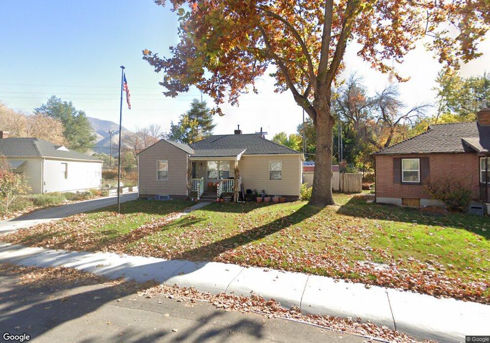
500 S Brookside Dr Springville, UT 84663
East Hobble Creek NeighborhoodEstimated Value: $378,000 - $458,000
About This Home
This home is located at 500 S Brookside Dr, Springville, UT 84663 and is currently estimated at $419,910, approximately $214 per square foot. 500 S Brookside Dr is a home located in Utah County with nearby schools including Brookside School, Springville Junior High School, and Springville High School.
Ownership History
We collect this data history from publicly available records. To have your information removed, we recommend requesting removal directly through your county’s website.
Purchase Details
Purchase Details
Home Financials for this Owner
Home Financials are based on the most recent Mortgage that was taken out on this home.Purchase Details
Home Financials for this Owner
Home Financials are based on the most recent Mortgage that was taken out on this home.Purchase Details
Purchase Details
Purchase Details
Home Financials for this Owner
Home Financials are based on the most recent Mortgage that was taken out on this home.Home Values in the Area
Average Home Value in this Area
Purchase History
We collect this data history from publicly available records. To have your information removed, we recommend requesting removal directly through your county’s website.
| Date | Buyer | Sale Price | Title Company |
|---|---|---|---|
| -- | None Listed On Document | ||
| -- | Provo Land Title Co | ||
| -- | First American Title Co | ||
| -- | -- | ||
| -- | -- | ||
| -- | -- |
Mortgage History
We collect this data history from publicly available records. To have your information removed, we recommend requesting removal directly through your county’s website.
| Date | Status | Borrower | Loan Amount |
|---|---|---|---|
| Previous Owner | $145,000 | ||
| Previous Owner | $105,346 | ||
| Previous Owner | $107,120 |
Tax History
We collect this data history from publicly available records. To have your information removed, we recommend requesting removal directly through your county’s website.
| Year | Tax Paid | Tax Assessment Tax Assessment Total Assessment is a certain percentage of the fair market value that is determined by local assessors to be the total taxable value of land and additions on the property. | Land | Improvement |
|---|---|---|---|---|
| 2025 | $1,867 | $207,515 | -- | -- |
| 2024 | $1,867 | $191,235 | $0 | $0 |
| 2023 | $1,783 | $182,820 | $0 | $0 |
| 2022 | $1,995 | $200,970 | $0 | $0 |
| 2021 | $1,793 | $281,100 | $94,800 | $186,300 |
| 2020 | $1,651 | $251,000 | $79,000 | $172,000 |
| 2019 | $1,477 | $228,600 | $79,000 | $149,600 |
| 2018 | $1,421 | $209,700 | $75,500 | $134,200 |
| 2017 | $1,257 | $98,560 | $0 | $0 |
| 2016 | $1,128 | $86,735 | $0 | $0 |
| 2015 | $1,032 | $81,070 | $0 | $0 |
| 2014 | $1,028 | $80,245 | $0 | $0 |
Map
- 883 E 700 S
- 88 C St
- 899 E 800 S
- 763 E 800 South St
- 763 E 800 South St Unit 16
- 647 Swenson Ave Unit 4
- 645 Swenson Ave Unit 3
- 647 Swenson Ave Unit 1
- 677 E 800 South St
- 615 E 700 S
- 949 S 1060 E
- 630 E 800 St S
- 480 Averett Ave
- 551 E Walnut Glen St
- 1035 Hillcrest Dr
- 626 E 800 St S Unit 16
- 1361 E 400 S
- 409 S 400 E
- 557 S 1470 E
- 1539 E 450 S
- 500 Brookside Dr
- 488 Brookside Dr
- 518 Brookside Dr
- 470 Brookside Dr
- 530 Brookside Dr
- 451 Brookside Dr
- 452 Brookside Dr
- 541 Brookside Dr
- 785 S Weight Ave
- 417 Brookside Dr
- 558 Brookside Dr
- 417 S Brookside Dr
- 436 Brookside Dr
- 561 Brookside Dr
- 401 Brookside Dr
- 422 Brookside Dr
- 572 Brookside Dr
- 154 C St
- 140 C St
- 408 Brookside Dr
Ask me questions while you tour the home.