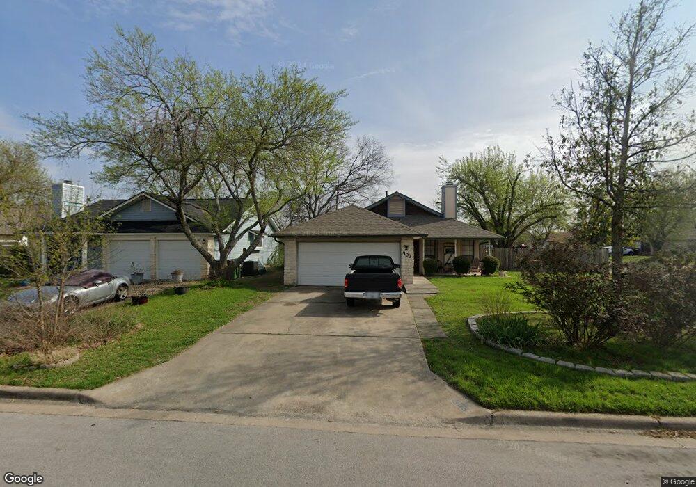
503 Edwards Dr Round Rock, TX 78664
Stony Point NeighborhoodEstimated Value: $310,715 - $378,000
About This Home
This home is located at 503 Edwards Dr, Round Rock, TX 78664 and is currently estimated at $332,679, approximately $224 per square foot. 503 Edwards Dr is a home located in Williamson County with nearby schools including Union Hill Elementary School, Hernandez Middle School, and Stony Point High IB World School.
Ownership History
We collect this data history from publicly available records. To have your information removed, we recommend requesting removal directly through your county’s website.
Purchase Details
Home Financials for this Owner
Home Financials are based on the most recent Mortgage that was taken out on this home.Home Values in the Area
Average Home Value in this Area
Purchase History
We collect this data history from publicly available records. To have your information removed, we recommend requesting removal directly through your county’s website.
| Date | Buyer | Sale Price | Title Company |
|---|---|---|---|
| -- | Gracy |
Mortgage History
We collect this data history from publicly available records. To have your information removed, we recommend requesting removal directly through your county’s website.
| Date | Status | Borrower | Loan Amount |
|---|---|---|---|
| Open | $121,500 |
Tax History
We collect this data history from publicly available records. To have your information removed, we recommend requesting removal directly through your county’s website.
| Year | Tax Paid | Tax Assessment Tax Assessment Total Assessment is a certain percentage of the fair market value that is determined by local assessors to be the total taxable value of land and additions on the property. | Land | Improvement |
|---|---|---|---|---|
| 2025 | $4,289 | $325,518 | -- | -- |
| 2024 | $4,289 | $295,925 | -- | -- |
| 2023 | $3,748 | $269,023 | $0 | $0 |
| 2022 | $4,638 | $244,566 | $0 | $0 |
| 2021 | $4,991 | $222,333 | $52,000 | $200,620 |
| 2020 | $4,563 | $202,121 | $48,521 | $180,928 |
| 2019 | $4,242 | $183,746 | $44,482 | $181,476 |
| 2018 | $3,523 | $167,042 | $35,738 | $170,279 |
| 2017 | $3,578 | $151,856 | $33,400 | $154,031 |
| 2016 | $3,252 | $138,051 | $33,400 | $123,705 |
| 2015 | $2,478 | $125,501 | $30,200 | $120,588 |
| 2014 | $2,478 | $114,092 | $0 | $0 |
Map
- 1910 Andover Dr
- 2006 Farnswood Dr
- 1904 Heathwood Cir
- 515 Sierra Cove
- 609 Clearwater Trail
- 526 Dennis Dr
- 2008 Meadow Brook Dr
- 1610 Karen Cove
- 2429A Curry Loop
- 1105 Spring Breeze Cove
- 1008 Longmeadow Dr
- 1512 W Mesa Park Dr
- 2251 Ada Ln
- 1107 Long Meadow Dr
- 1509 Merrell Cove
- 1481 E Old Settlers Blvd Unit 1801
- 1481 E Old Settlers Blvd Unit 1502
- 1103 Green Meadow Dr
- 2417 Hallie Ln
- 2409 Hallie Ln
- 508 Edwards Dr
- 511 Edwards Dr
- 509 Edwards Dr
- 506 Edwards Dr
- 512 Edwards Dr
- 513 Edwards Dr
- 507 Edwards Dr
- 1217 Gregory Ln Unit 1219
- 1219 Gregory Ln Unit 1219
- 1219 Gregory Ln
- 504 Edwards Dr
- 515 Edwards Dr
- 514 Edwards Dr
- 505 Edwards Dr
- 503 Gregory Ct
- 500 Egger Cove
- 501 Gregory Ct Unit 503
- 502 Egger Cove
- 517 Edwards Dr
- 1215 Gregory Ln
Ask me questions while you tour the home.