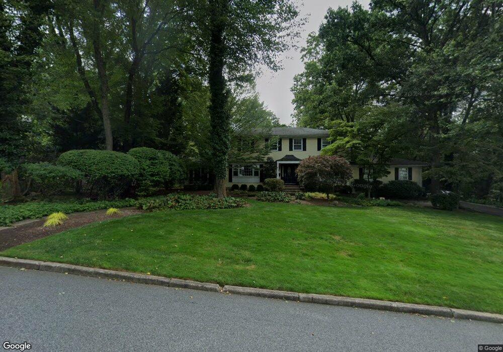
503 Mark Rd Allendale, NJ 07401
Estimated Value: $1,556,000 - $1,728,654
About This Home
This home is located at 503 Mark Rd, Allendale, NJ 07401 and is currently estimated at $1,616,414, approximately $467 per square foot. 503 Mark Rd is a home located in Bergen County with nearby schools including Hillside Elementary School, Brookside Elementary School, and Northern Highlands Reg High School.
Ownership History
We collect this data history from publicly available records. To have your information removed, we recommend requesting removal directly through your county’s website.
Purchase Details
Home Financials for this Owner
Home Financials are based on the most recent Mortgage that was taken out on this home.Purchase Details
Purchase Details
Home Financials for this Owner
Home Financials are based on the most recent Mortgage that was taken out on this home.Purchase Details
Home Financials for this Owner
Home Financials are based on the most recent Mortgage that was taken out on this home.Home Values in the Area
Average Home Value in this Area
Purchase History
We collect this data history from publicly available records. To have your information removed, we recommend requesting removal directly through your county’s website.
| Date | Buyer | Sale Price | Title Company |
|---|---|---|---|
| $1,075,000 | -- | ||
| $1,310,000 | -- | ||
| $1,310,000 | -- | ||
| -- | -- | ||
| -- | -- | ||
| $482,500 | -- |
Mortgage History
We collect this data history from publicly available records. To have your information removed, we recommend requesting removal directly through your county’s website.
| Date | Status | Borrower | Loan Amount |
|---|---|---|---|
| Open | $131,000 | ||
| Open | $729,000 | ||
| Previous Owner | $450,000 | ||
| Previous Owner | $325,000 |
Tax History
We collect this data history from publicly available records. To have your information removed, we recommend requesting removal directly through your county’s website.
| Year | Tax Paid | Tax Assessment Tax Assessment Total Assessment is a certain percentage of the fair market value that is determined by local assessors to be the total taxable value of land and additions on the property. | Land | Improvement |
|---|---|---|---|---|
| 2026 | $27,795 | $1,538,200 | $726,700 | $811,500 |
| 2025 | $27,432 | $1,369,200 | $653,200 | $716,000 |
| 2024 | $25,816 | $1,300,700 | $620,700 | $680,000 |
| 2023 | $25,514 | $1,174,000 | $510,000 | $664,000 |
| 2022 | $25,514 | $1,120,500 | $485,000 | $635,500 |
| 2021 | $25,054 | $1,066,600 | $447,100 | $619,500 |
| 2020 | $25,802 | $1,069,300 | $437,100 | $632,200 |
| 2019 | $25,118 | $1,069,300 | $437,100 | $632,200 |
| 2018 | $24,562 | $1,069,300 | $437,100 | $632,200 |
| 2017 | $24,466 | $1,069,300 | $437,100 | $632,200 |
| 2016 | $24,498 | $1,069,300 | $437,100 | $632,200 |
| 2015 | $24,006 | $1,069,300 | $437,100 | $632,200 |
| 2014 | $24,156 | $1,013,700 | $437,100 | $576,600 |
Map
- 111 Storms Dr
- 309 Windham Ct
- 184 Donny Brook Dr
- 22-1 Tamaron Dr
- 24 Pineview Dr
- 13-4 Tamaron Dr
- 11 Franklin St
- 210 Franklin Ave
- 24 Vanderbeck Ln
- 17 Appert Terrace
- 114 Crescent Ave
- 296 Birch Pkwy
- 444 Lake Rd
- 381 Lawrence Ct
- 176 Park Ave
- 77 White Pond Rd
- 20 Cambridge Dr
- 416C Bromley Place
- 15 Old Oak Dr
- 95 Edison St
- 504 Paul Ave
- 601 Brookside Ave
- 483 Mark Rd
- 498 Mark Rd
- 617 Brookside Ave
- 484 Paul Ave
- 514 Mark Rd
- 478 Mark Rd
- 530 Mark Rd
- 465 Mark Rd
- 466 Paul Ave
- 574 Brookside Ave
- 576 Brookside Ave
- 509 Paul Ave
- 493 Paul Ave
- 545 Brookside Ave
- 578 Brookside Ave Unit 578A
- 649 Brookside Ave
- 570 Brookside Ave
- 460 Mark Rd
Ask me questions while you tour the home.