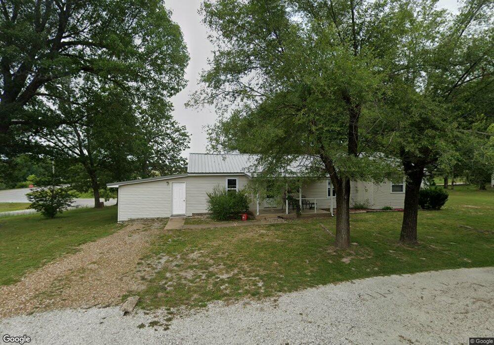
503 S Pear St Buffalo, MO 65622
Estimated Value: $156,000 - $163,777
3
Beds
1
Bath
1,496
Sq Ft
$106/Sq Ft
Est. Value
About This Home
This home is located at 503 S Pear St, Buffalo, MO 65622 and is currently estimated at $159,194, approximately $106 per square foot. 503 S Pear St is a home located in Dallas County with nearby schools including Buffalo High School.
Ownership History
Date
Name
Owned For
Owner Type
Purchase Details
Closed on
Jun 5, 2020
Sold by
Wingo Charles David and Wingo Judy Ellen
Bought by
Skinner Dennis and Skinner Nancy
Current Estimated Value
Home Financials for this Owner
Home Financials are based on the most recent Mortgage that was taken out on this home.
Original Mortgage
$23,000
Outstanding Balance
$20,247
Interest Rate
3.3%
Mortgage Type
New Conventional
Estimated Equity
$138,947
Purchase Details
Closed on
Nov 14, 2016
Sold by
Mayes Devene Lynn
Bought by
Mayes Leslie Scott
Purchase Details
Closed on
Aug 21, 2012
Sold by
Tsavincis Crystal
Bought by
Uriega Alejandro
Purchase Details
Closed on
Jan 19, 2010
Sold by
Elliott Stacia and Uriega Alejandro
Bought by
Uriega Alejandro
Create a Home Valuation Report for This Property
The Home Valuation Report is an in-depth analysis detailing your home's value as well as a comparison with similar homes in the area
Home Values in the Area
Average Home Value in this Area
Purchase History
| Date | Buyer | Sale Price | Title Company |
|---|---|---|---|
| Skinner Dennis | -- | None Available | |
| Mayes Leslie Scott | -- | None Available | |
| Uriega Alejandro | -- | None Available | |
| Uriega Alejandro | -- | None Available |
Source: Public Records
Mortgage History
| Date | Status | Borrower | Loan Amount |
|---|---|---|---|
| Open | Skinner Dennis | $23,000 |
Source: Public Records
Tax History
| Year | Tax Paid | Tax Assessment Tax Assessment Total Assessment is a certain percentage of the fair market value that is determined by local assessors to be the total taxable value of land and additions on the property. | Land | Improvement |
|---|---|---|---|---|
| 2025 | $416 | $9,350 | $0 | $0 |
| 2024 | $383 | $9,350 | $0 | $0 |
| 2023 | $378 | $8,530 | $0 | $0 |
| 2022 | $333 | $8,070 | $0 | $0 |
| 2021 | $334 | $7,450 | $0 | $0 |
| 2020 | $333 | $7,450 | $0 | $0 |
| 2019 | $333 | $7,450 | $0 | $0 |
| 2018 | $297 | $7,460 | $0 | $0 |
| 2017 | $297 | $7,460 | $0 | $0 |
| 2016 | $297 | $8,000 | $0 | $0 |
| 2015 | -- | $7,460 | $0 | $0 |
| 2014 | -- | $7,460 | $0 | $0 |
Source: Public Records
Map
Nearby Homes
- 502 S Maple St
- 316 S Maple St
- 652 S Locust St
- 305 W Main St
- 107 N Walnut St
- 203 E Madison St
- 117 W Madison St
- 515 S Oak St
- 000 Mill St Unit 2
- 000 Mill St Unit 1
- 115 Grant St
- 822 S Oak St
- 615 W Benton St
- 641 S Hickory St
- 701 N Pine St
- 607 N Locust St
- 824 S Spruce St
- 217 W Ramsey St
- 301 W Ramsey St
- 702 W Ramsey St
Your Personal Tour Guide
Ask me questions while you tour the home.