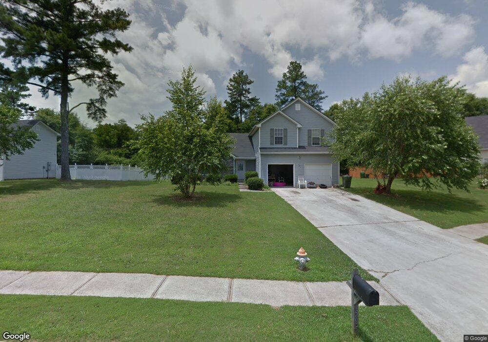
505 Michael Cir Monroe, GA 30655
Estimated Value: $297,000 - $329,000
Studio
1
Bath
2,047
Sq Ft
$155/Sq Ft
Est. Value
About This Home
This home is located at 505 Michael Cir, Monroe, GA 30655 and is currently estimated at $316,440, approximately $154 per square foot. 505 Michael Cir is a home located in Walton County with nearby schools including Atha Road Elementary School, Youth Middle School, and Walnut Grove High School.
Ownership History
Date
Name
Owned For
Owner Type
Purchase Details
Closed on
Feb 26, 2009
Sold by
Hud-Housing Of Urban Dev
Bought by
French William and French Sonja
Current Estimated Value
Purchase Details
Closed on
Aug 5, 2008
Sold by
Wells Fargo Bank Na
Bought by
Hud-Housing Of Urban Dev
Purchase Details
Closed on
Oct 31, 2001
Sold by
Scenic Homes
Bought by
Cox William E and Cox Katrina H
Home Financials for this Owner
Home Financials are based on the most recent Mortgage that was taken out on this home.
Original Mortgage
$127,850
Interest Rate
6.5%
Mortgage Type
FHA
Create a Home Valuation Report for This Property
The Home Valuation Report is an in-depth analysis detailing your home's value as well as a comparison with similar homes in the area
Home Values in the Area
Average Home Value in this Area
Purchase History
We collect this data history from publicly available records. To have your information removed, we recommend requesting removal directly through your county’s website.
| Date | Buyer | Sale Price | Title Company |
|---|---|---|---|
| French William | -- | -- | |
| Hud-Housing Of Urban Dev | -- | -- | |
| Wells Fargo Bank Na | $155,076 | -- | |
| Cox William E | $129,900 | -- |
Source: Public Records
Mortgage History
We collect this data history from publicly available records. To have your information removed, we recommend requesting removal directly through your county’s website.
| Date | Status | Borrower | Loan Amount |
|---|---|---|---|
| Previous Owner | Cox William E | $127,850 |
Source: Public Records
Tax History
| Year | Tax Paid | Tax Assessment Tax Assessment Total Assessment is a certain percentage of the fair market value that is determined by local assessors to be the total taxable value of land and additions on the property. | Land | Improvement |
|---|---|---|---|---|
| 2025 | $4,109 | $116,800 | $22,000 | $94,800 |
| 2024 | $3,830 | $112,520 | $22,000 | $90,520 |
| 2023 | $3,906 | $111,720 | $22,000 | $89,720 |
| 2022 | $3,342 | $89,480 | $17,200 | $72,280 |
| 2021 | $2,594 | $67,120 | $13,200 | $53,920 |
| 2020 | $2,470 | $62,280 | $12,400 | $49,880 |
| 2019 | $2,386 | $53,080 | $12,000 | $41,080 |
| 2018 | $2,090 | $53,080 | $12,000 | $41,080 |
| 2017 | $1,874 | $44,720 | $8,000 | $36,720 |
| 2016 | $1,882 | $45,640 | $8,000 | $37,640 |
| 2015 | $1,678 | $40,000 | $8,000 | $32,000 |
| 2014 | $1,408 | $32,560 | $0 | $0 |
Source: Public Records
Map
Nearby Homes
- 679 Michael Cir
- 675 Michael Cir
- 525 Michael Cir
- 720 Overlook Crest
- 661 Michael Cir
- 509 Mill Farm Ln
- 498 Michael Etchison Rd
- 509 Heritage Ridge Dr
- 605 Michael Cir
- 921 Horizon Ct
- 816 Mcdaniel St
- 250 Martin Luther King Junior Blvd
- 505 Breedlove Dr
- 506 Breedlove Dr
- 150 Mountain View Dr
- 1341 Armstead Cir
- 1269 Georgia 138
- 1271 Georgia 138
- 1309 Armistead Cir
- 1109 Clubview Ct
- 511 Michael Cir
- 509 Michael Cir
- 513 Michael Cir
- 880 Ashley Ct
- 515 Michael Cir
- 510 Michael Cir
- 503 Michael Cir
- 608 Michael Etchison Rd
- 514 Michael Cir
- 703 Overlook Crest
- 501 Michael Cir
- 618 Michael Etchison Rd
- 516 Michael Cir
- 519 Michael Cir
- 588 Michael Etchison Rd
- 705 Overlook Crest
- 875 Ashley Ct
- 518 Michael Cir
- 865 Ashley Ct
- 709 Overlook Crest
Your Personal Tour Guide
Ask me questions while you tour the home.