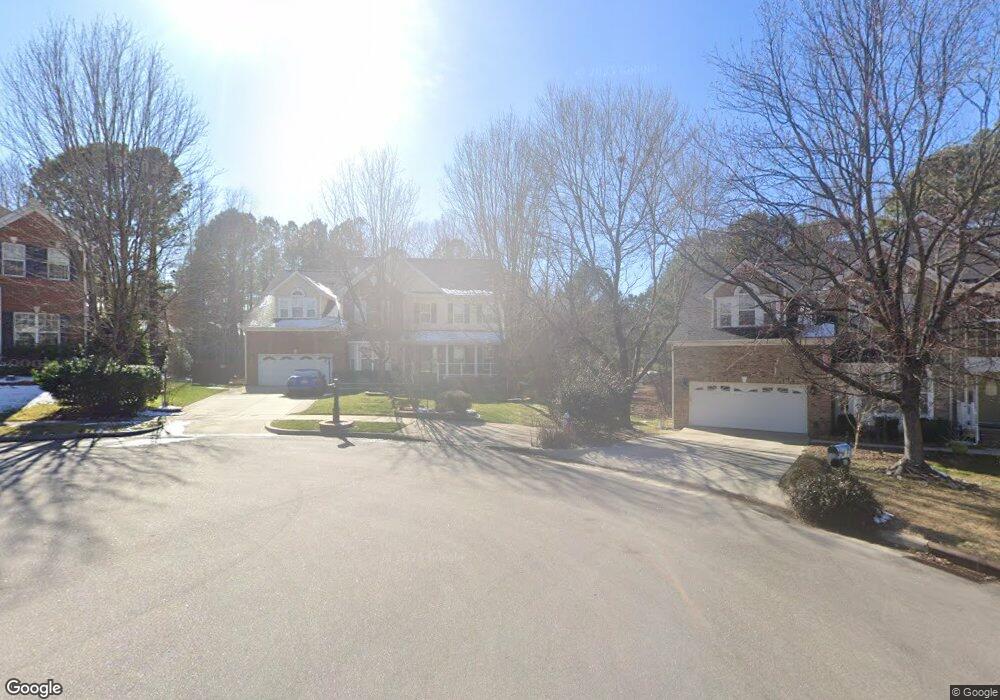
507 Normancrest Ct Cary, NC 27519
West Cary NeighborhoodEstimated Value: $1,013,000 - $1,076,000
Studio
4
Baths
4,482
Sq Ft
$233/Sq Ft
Est. Value
About This Home
This home is located at 507 Normancrest Ct, Cary, NC 27519 and is currently estimated at $1,042,223, approximately $232 per square foot. 507 Normancrest Ct is a home located in Wake County with nearby schools including Davis Drive Elementary, Davis Drive Middle, and Green Hope High.
Ownership History
Date
Name
Owned For
Owner Type
Purchase Details
Closed on
Feb 10, 2005
Sold by
K Hovnanian Homes Of North Carolina Inc
Bought by
Chandra Sunil S and Chandra Mita S
Current Estimated Value
Home Financials for this Owner
Home Financials are based on the most recent Mortgage that was taken out on this home.
Original Mortgage
$347,700
Outstanding Balance
$176,382
Interest Rate
5.72%
Mortgage Type
Fannie Mae Freddie Mac
Estimated Equity
$865,841
Create a Home Valuation Report for This Property
The Home Valuation Report is an in-depth analysis detailing your home's value as well as a comparison with similar homes in the area
Home Values in the Area
Average Home Value in this Area
Purchase History
| Date | Buyer | Sale Price | Title Company |
|---|---|---|---|
| Chandra Sunil S | $435,000 | -- |
Source: Public Records
Mortgage History
| Date | Status | Borrower | Loan Amount |
|---|---|---|---|
| Open | Chandra Sunil S | $347,700 | |
| Closed | Chandra Sunil S | $21,700 |
Source: Public Records
Tax History
| Year | Tax Paid | Tax Assessment Tax Assessment Total Assessment is a certain percentage of the fair market value that is determined by local assessors to be the total taxable value of land and additions on the property. | Land | Improvement |
|---|---|---|---|---|
| 2025 | $8,628 | $1,004,334 | $308,000 | $696,334 |
| 2024 | $8,325 | $990,499 | $308,000 | $682,499 |
Source: Public Records
Map
Nearby Homes
- 266 Joshua Glen Ln
- 146 Swan Quarter Dr
- 116 Love Valley Dr
- 324 Farrow Glen Loop
- 217 Old Dock Trail
- 126 Barnes Spring Ct
- 209 Plyersmill Rd
- 123 Streamview Dr
- 302 Halls Mill Dr
- 128 Wheatsbury Dr
- 308 Burgwin Wright Way
- 103 Jordan Creek Dr
- 306 Burgwin Wright Way
- 107 Somersby Ct
- 106 Stokesay Ct
- 111 Gingergate Dr
- 104 Foxcrest Ct
- 101 Haywood Hall Ln
- 100 Wentbridge Rd
- 120 Seymour Creek Dr
- 505 Normancrest Ct
- 506 Normancrest Ct
- 1071 Upchurch Farm Ln
- 1073 Upchurch Farm Ln
- 503 Normancrest Ct
- 1067 Upchurch Farm Ln
- 504 Normancrest Ct
- 1075 Upchurch Farm Ln
- 1065 Upchurch Farm Ln
- 379 Luke Meadow Ln
- 502 Normancrest Ct
- 377 Luke Meadow Ln
- 305 Casey Brook Ct
- 501 Normancrest Ct
- 375 Luke Meadow Ln
- 373 Luke Meadow Ln
- 1077 Upchurch Farm Ln
- 371 Luke Meadow Ln
- 1063 Upchurch Farm Ln
- 500 Normancrest Ct
Your Personal Tour Guide
Ask me questions while you tour the home.