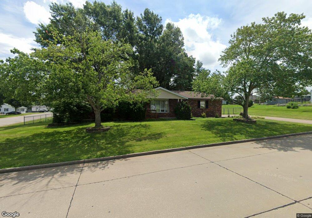
507 Smith St Perryville, MO 63775
Estimated Value: $188,000 - $221,000
3
Beds
2
Baths
1,056
Sq Ft
$192/Sq Ft
Est. Value
About This Home
This home is located at 507 Smith St, Perryville, MO 63775 and is currently estimated at $202,822, approximately $192 per square foot. 507 Smith St is a home with nearby schools including Perryville Elementary School, Perry County Middle School, and Perryville Senior High School.
Ownership History
Date
Name
Owned For
Owner Type
Purchase Details
Closed on
Sep 9, 2014
Sold by
Brent Dewilde and Brent Diana
Bought by
Freels Mervyn D and Freels Lurie A
Current Estimated Value
Home Financials for this Owner
Home Financials are based on the most recent Mortgage that was taken out on this home.
Original Mortgage
$40,000
Outstanding Balance
$12,180
Interest Rate
4.15%
Mortgage Type
New Conventional
Estimated Equity
$190,642
Purchase Details
Closed on
Apr 19, 2006
Bought by
Freels Mervyn D and Freels Lurie A
Create a Home Valuation Report for This Property
The Home Valuation Report is an in-depth analysis detailing your home's value as well as a comparison with similar homes in the area
Home Values in the Area
Average Home Value in this Area
Purchase History
We collect this data history from publicly available records. To have your information removed, we recommend requesting removal directly through your county’s website.
| Date | Buyer | Sale Price | Title Company |
|---|---|---|---|
| Freels Mervyn D | $50,000 | -- | |
| Freels Mervyn D | -- | -- |
Source: Public Records
Mortgage History
We collect this data history from publicly available records. To have your information removed, we recommend requesting removal directly through your county’s website.
| Date | Status | Borrower | Loan Amount |
|---|---|---|---|
| Open | Freels Mervyn D | $40,000 |
Source: Public Records
Tax History
| Year | Tax Paid | Tax Assessment Tax Assessment Total Assessment is a certain percentage of the fair market value that is determined by local assessors to be the total taxable value of land and additions on the property. | Land | Improvement |
|---|---|---|---|---|
| 2025 | $1,403 | $27,888 | $7,058 | $20,830 |
| 2024 | $1,332 | $25,645 | $6,336 | $19,309 |
| 2023 | $1,328 | $25,645 | $6,336 | $19,309 |
| 2022 | $1,275 | $24,589 | $5,280 | $19,309 |
| 2021 | $1,275 | $24,589 | $5,280 | $19,309 |
| 2020 | $1,183 | $22,611 | $4,950 | $17,661 |
| 2019 | $1,180 | $22,611 | $4,950 | $17,661 |
| 2018 | $977 | $21,534 | $4,473 | $17,061 |
| 2017 | $977 | $21,534 | $4,473 | $17,061 |
| 2016 | $977 | $19,268 | $3,777 | $15,491 |
| 2015 | -- | $19,268 | $3,777 | $15,491 |
| 2014 | -- | $17,817 | $3,273 | $14,544 |
Source: Public Records
Map
Nearby Homes
- 215 Doerr St
- 810 Trade Winds Dr
- 816 Ridge Dr
- 413 E Sainte Marie St
- 24 S Walnut St
- 712 Washington Ln
- 23/25/27 W Saint Joseph St
- 209 S Spring St
- 221 W Saint Joseph St
- 113 College St
- 423 N Pine St
- 814 Star St
- 65 Northside Dr
- 1841 N Main St
- 0 N Highway 51
- Lot 12,13,14 Dorothy Dr
- 1212 Grand Ave
- 1512 Old Saint Marys Rd
- 1426 Highway B
- 1608 Dogwood Ct
- 505 Saint Augustine St
- 0 Steven St Unit 14032639
- 0 Steven St Unit 78902
- 500 Saint Augustine St
- 501 Smith St
- 509 Saint Augustine St
- 506 Saint Augustine St
- 500 Doerr St
- 421 Smith St
- 602 Smith St
- 510 Saint Augustine St
- 600 Saint Augustine St
- 419 Smith St
- 416 Doerr St
- 507 Doerr St
- 501 Doerr St
- 400 Delaney St
- 409 Smith St
- 604 Saint Augustine St
- 417 Doerr St
Your Personal Tour Guide
Ask me questions while you tour the home.