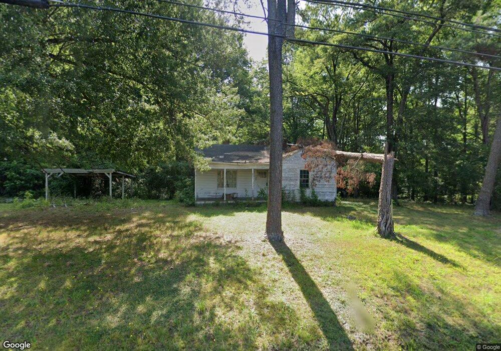
508 Moore Dr Lexington, NC 27292
Estimated Value: $44,000 - $135,000
2
Beds
1
Bath
1,044
Sq Ft
$81/Sq Ft
Est. Value
About This Home
This home is located at 508 Moore Dr, Lexington, NC 27292 and is currently estimated at $84,312, approximately $80 per square foot. 508 Moore Dr is a home located in Davidson County with nearby schools including South Lexington School, Lexington Middle School, and Lexington Senior High School.
Ownership History
Date
Name
Owned For
Owner Type
Purchase Details
Closed on
Jul 21, 2025
Sold by
Moody George Ray and Moody Travis Lee
Bought by
Scarborough Donald Eugene
Current Estimated Value
Home Financials for this Owner
Home Financials are based on the most recent Mortgage that was taken out on this home.
Original Mortgage
$100,000
Outstanding Balance
$83,803
Interest Rate
6.84%
Mortgage Type
Construction
Estimated Equity
$509
Purchase Details
Closed on
Feb 1, 1994
Create a Home Valuation Report for This Property
The Home Valuation Report is an in-depth analysis detailing your home's value as well as a comparison with similar homes in the area
Home Values in the Area
Average Home Value in this Area
Purchase History
| Date | Buyer | Sale Price | Title Company |
|---|---|---|---|
| Scarborough Donald Eugene | $45,000 | None Listed On Document | |
| Scarborough Donald Eugene | $45,000 | None Listed On Document | |
| -- | -- | -- |
Source: Public Records
Mortgage History
| Date | Status | Borrower | Loan Amount |
|---|---|---|---|
| Open | Scarborough Donald Eugene | $100,000 | |
| Closed | Scarborough Donald Eugene | $100,000 |
Source: Public Records
Tax History
| Year | Tax Paid | Tax Assessment Tax Assessment Total Assessment is a certain percentage of the fair market value that is determined by local assessors to be the total taxable value of land and additions on the property. | Land | Improvement |
|---|---|---|---|---|
| 2025 | $625 | $48,110 | $0 | $0 |
| 2024 | $625 | $48,110 | $0 | $0 |
| 2023 | $630 | $48,110 | $0 | $0 |
| 2022 | $625 | $48,110 | $0 | $0 |
| 2021 | $625 | $48,110 | $0 | $0 |
| 2020 | $461 | $35,740 | $0 | $0 |
| 2019 | $468 | $35,740 | $0 | $0 |
| 2018 | $468 | $35,740 | $0 | $0 |
| 2017 | $468 | $35,740 | $0 | $0 |
| 2016 | $468 | $35,740 | $0 | $0 |
| 2015 | $450 | $35,740 | $0 | $0 |
| 2014 | $489 | $38,790 | $0 | $0 |
Source: Public Records
Map
Nearby Homes
- 403 Farmer Ave
- 212 Mendota Ave
- 307 Washburn St
- 326 Washburn St
- 105 Mendota Ave
- 3 Linwood Rd
- 208 Aberdeen Dr
- 0000 S Main St
- 203 Reich St
- 865 Old Linwood Rd
- 354 Harper Mill Cir
- 345 Harper Mill Cir
- 358 Harper Mill Cir
- 361 Harper Mill Cir
- 366 Harper Mill Cir
- 373 Harper Mill Cir
- 370 Harper Mill Cir
- 401 Owens Ridge Way
- 412 Owens Ridge Way
- 153 Gurney Kerns Rd
Your Personal Tour Guide
Ask me questions while you tour the home.