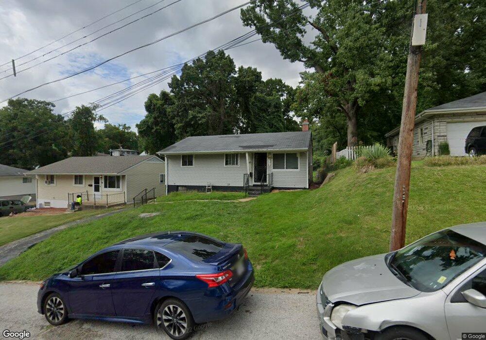
509 Robert Ave Ferguson, MO 63135
Estimated Value: $97,622 - $120,000
3
Beds
1
Bath
927
Sq Ft
$113/Sq Ft
Est. Value
About This Home
This home is located at 509 Robert Ave, Ferguson, MO 63135 and is currently estimated at $104,406, approximately $112 per square foot. 509 Robert Ave is a home located in St. Louis County with nearby schools including Lee Hamilton Elementary School, Ferguson Middle School, and McCluer High School.
Ownership History
Date
Name
Owned For
Owner Type
Purchase Details
Closed on
Sep 28, 2023
Sold by
Barron Deadra
Bought by
Hunt Dakendra
Current Estimated Value
Purchase Details
Closed on
Sep 27, 2023
Sold by
Barron George
Bought by
Barron Deadra
Purchase Details
Closed on
Jan 23, 2003
Sold by
Barron Deadra and Smith Yvonne
Bought by
Barron Deadra
Home Financials for this Owner
Home Financials are based on the most recent Mortgage that was taken out on this home.
Original Mortgage
$60,000
Interest Rate
10.85%
Create a Home Valuation Report for This Property
The Home Valuation Report is an in-depth analysis detailing your home's value as well as a comparison with similar homes in the area
Home Values in the Area
Average Home Value in this Area
Purchase History
| Date | Buyer | Sale Price | Title Company |
|---|---|---|---|
| Hunt Dakendra | -- | None Listed On Document | |
| Barron Deadra | -- | None Listed On Document | |
| Barron Deadra | -- | Commonwealth Land Title Ins |
Source: Public Records
Mortgage History
| Date | Status | Borrower | Loan Amount |
|---|---|---|---|
| Previous Owner | Barron Deadra | $60,000 |
Source: Public Records
Tax History
| Year | Tax Paid | Tax Assessment Tax Assessment Total Assessment is a certain percentage of the fair market value that is determined by local assessors to be the total taxable value of land and additions on the property. | Land | Improvement |
|---|---|---|---|---|
| 2025 | $1,155 | $21,680 | $2,340 | $19,340 |
| 2024 | $1,155 | $15,810 | $1,560 | $14,250 |
| 2023 | $1,155 | $15,810 | $1,560 | $14,250 |
| 2022 | $1,036 | $12,400 | $2,600 | $9,800 |
| 2021 | $1,003 | $12,400 | $2,600 | $9,800 |
| 2020 | $1,140 | $12,710 | $2,720 | $9,990 |
| 2019 | $1,118 | $12,710 | $2,720 | $9,990 |
| 2018 | $962 | $9,710 | $2,360 | $7,350 |
| 2017 | $943 | $9,710 | $2,360 | $7,350 |
| 2016 | $1,032 | $10,490 | $1,980 | $8,510 |
Source: Public Records
Map
Nearby Homes
- 700 N Elizabeth Ave
- 410 Robert Ave
- 820 N Elizabeth Ave
- 631 Robert Ave
- 705 Palace Ct
- 6 Sandringham Ln
- 400 Royal Ave
- 308 Superior Dr
- 212 Millman Dr
- 512 Coppinger Dr
- 7 Bromley Dr
- 127 Thoroughman Ave
- 919 Robert Ave
- 511 Averill Ave
- 35 Robert Ave
- 1007 Hutton Place
- 35 E Cardigan Dr
- 506 Averill Ave
- 62 W Cardigan Dr
- 1051 Smith Ave
- 501 Robert Ave
- 503 Robert Ave
- 515 Robert Ave
- 502 Robert Ave
- 701 Melcher Ave
- 705 Melcher Ave
- 504 Robert Ave
- 550 N Elizabeth Ave
- 709 Melcher Ave
- 708 N Elizabeth Ave
- 500 N Elizabeth Ave
- 619 Millman Dr
- 519 Robert Ave
- 606 Teston Dr
- 609 Teston Dr
- 523 Robert Ave
- 716 N Elizabeth Ave
- 605 Teston Dr
- 611 Millman Dr
- 602 Teston Dr
Your Personal Tour Guide
Ask me questions while you tour the home.