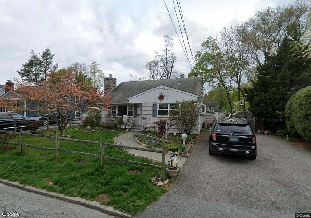
51 1st Ave Ossining, NY 10562
Estimated Value: $467,000 - $604,000
3
Beds
2
Baths
980
Sq Ft
$560/Sq Ft
Est. Value
About This Home
This home is located at 51 1st Ave, Ossining, NY 10562 and is currently estimated at $548,444, approximately $559 per square foot. 51 1st Ave is a home located in Westchester County with nearby schools including Park School, Roosevelt Elementary School, and Brookside Elementary School.
Ownership History
Date
Name
Owned For
Owner Type
Purchase Details
Closed on
Oct 6, 2006
Sold by
Burns Heida A
Bought by
Burns Heidi A
Current Estimated Value
Home Financials for this Owner
Home Financials are based on the most recent Mortgage that was taken out on this home.
Original Mortgage
$340,000
Outstanding Balance
$194,596
Interest Rate
6.29%
Mortgage Type
Stand Alone First
Estimated Equity
$353,848
Purchase Details
Closed on
Jan 24, 2003
Sold by
Burns Richard F and Burns Heidi A
Bought by
Burns Heidi A
Home Financials for this Owner
Home Financials are based on the most recent Mortgage that was taken out on this home.
Original Mortgage
$225,000
Interest Rate
6.25%
Mortgage Type
Purchase Money Mortgage
Purchase Details
Closed on
Dec 28, 1999
Sold by
Sichel Martin J and Sichel Laura
Bought by
Burns Richard F and Burns Heidi A
Home Financials for this Owner
Home Financials are based on the most recent Mortgage that was taken out on this home.
Original Mortgage
$201,432
Interest Rate
8.21%
Mortgage Type
FHA
Create a Home Valuation Report for This Property
The Home Valuation Report is an in-depth analysis detailing your home's value as well as a comparison with similar homes in the area
Home Values in the Area
Average Home Value in this Area
Purchase History
| Date | Buyer | Sale Price | Title Company |
|---|---|---|---|
| Burns Heidi A | -- | None Available | |
| Burns Heidi A | -- | The Judicial Title Ins Agenc | |
| Burns Richard F | $219,900 | -- |
Source: Public Records
Mortgage History
| Date | Status | Borrower | Loan Amount |
|---|---|---|---|
| Open | Burns Heidi A | $340,000 | |
| Closed | Burns Heidi A | $225,000 | |
| Previous Owner | Burns Richard F | $201,432 |
Source: Public Records
Tax History
| Year | Tax Paid | Tax Assessment Tax Assessment Total Assessment is a certain percentage of the fair market value that is determined by local assessors to be the total taxable value of land and additions on the property. | Land | Improvement |
|---|---|---|---|---|
| 2024 | $11,521 | $409,000 | $153,400 | $255,600 |
| 2023 | $11,117 | $385,300 | $153,400 | $231,900 |
| 2022 | $10,791 | $353,700 | $153,400 | $200,300 |
| 2021 | $9,219 | $315,800 | $153,400 | $162,400 |
| 2020 | $10,692 | $315,800 | $153,400 | $162,400 |
| 2019 | $10,537 | $301,800 | $153,400 | $148,400 |
| 2018 | $10,337 | $301,800 | $153,400 | $148,400 |
| 2017 | $1,573 | $296,000 | $153,400 | $142,600 |
| 2016 | $98,039 | $290,200 | $153,400 | $136,800 |
| 2015 | $7,428 | $16,750 | $4,400 | $12,350 |
| 2014 | $7,428 | $16,750 | $4,400 | $12,350 |
| 2013 | $7,428 | $16,750 | $4,400 | $12,350 |
Source: Public Records
Map
Nearby Homes
- 48 Pershing Ave
- 41 Croton Dam Rd
- 16 Robin St
- 7 Hawkes Ave
- 10 Pine Brook Rd
- 76 Hawkes Ave
- 42 Campwoods Grounds
- 19 Forest Ave
- 200 Route 9a
- 15 Marshall Place
- 42 Brooke View Dr
- 1C Calam Ave
- 1 Spring Pond Dr
- 40 Minkel Rd
- 15 Prospect Ave
- 132 Croton Ave
- 38 Terrace Ave
- 155 Club Ct
- 36 Watson Ave
- 8 Hudson Watch Dr
Your Personal Tour Guide
Ask me questions while you tour the home.