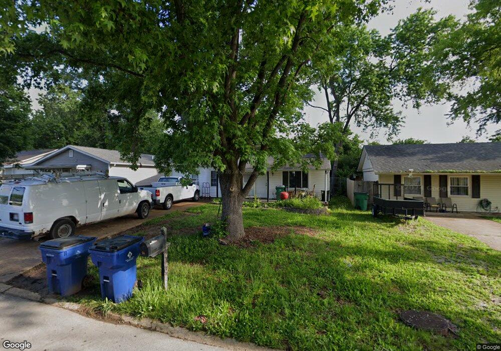
51 Cedar Ridge Dr Pacific, MO 63069
Estimated Value: $150,000 - $202,000
3
Beds
1
Bath
960
Sq Ft
$180/Sq Ft
Est. Value
About This Home
This home is located at 51 Cedar Ridge Dr, Pacific, MO 63069 and is currently estimated at $172,913, approximately $180 per square foot. 51 Cedar Ridge Dr is a home located in Franklin County with nearby schools including Pacific High School and St Bridget Elementary School.
Ownership History
Date
Name
Owned For
Owner Type
Purchase Details
Closed on
Nov 28, 2011
Sold by
Fannie Mae
Bought by
Thompson Raymond and Thompson Mary E
Current Estimated Value
Purchase Details
Closed on
Aug 18, 2011
Sold by
Claspill Drusilla A
Bought by
Federal National Mortgage Association
Purchase Details
Closed on
Apr 27, 2006
Sold by
Arflack Danny J and Arflack Debra J
Bought by
Claspill Drusilla A
Home Financials for this Owner
Home Financials are based on the most recent Mortgage that was taken out on this home.
Original Mortgage
$91,956
Interest Rate
6.33%
Mortgage Type
New Conventional
Create a Home Valuation Report for This Property
The Home Valuation Report is an in-depth analysis detailing your home's value as well as a comparison with similar homes in the area
Home Values in the Area
Average Home Value in this Area
Purchase History
| Date | Buyer | Sale Price | Title Company |
|---|---|---|---|
| Thompson Raymond | $52,500 | None Available | |
| Federal National Mortgage Association | $78,182 | None Available | |
| Claspill Drusilla A | -- | None Available |
Source: Public Records
Mortgage History
| Date | Status | Borrower | Loan Amount |
|---|---|---|---|
| Previous Owner | Claspill Drusilla A | $91,956 |
Source: Public Records
Tax History
| Year | Tax Paid | Tax Assessment Tax Assessment Total Assessment is a certain percentage of the fair market value that is determined by local assessors to be the total taxable value of land and additions on the property. | Land | Improvement |
|---|---|---|---|---|
| 2025 | $1,397 | $18,536 | $0 | $0 |
| 2024 | $1,397 | $16,847 | $0 | $0 |
| 2023 | $1,272 | $16,847 | $0 | $0 |
| 2022 | $1,098 | $15,819 | $0 | $0 |
| 2021 | $1,093 | $15,819 | $0 | $0 |
| 2020 | $1,019 | $14,738 | $0 | $0 |
| 2019 | $1,017 | $14,738 | $0 | $0 |
| 2018 | $824 | $11,698 | $0 | $0 |
| 2017 | $819 | $11,698 | $0 | $0 |
| 2016 | $811 | $11,476 | $0 | $0 |
| 2015 | $789 | $11,476 | $0 | $0 |
| 2014 | $780 | $11,539 | $0 | $0 |
Source: Public Records
Map
Nearby Homes
- 69 Cedar Ledge
- 668 #12 Highlands Ct Ct
- 667 #9 Highlands Rd
- 652 Ct
- 6827 Eagles Landing Ct
- 926 Wisdom Ln
- 6828 Eagles View Dr
- 2326 Silver Lake Estates Dr
- 1003 Mitchell Way
- 2235 Silver Lake Estates Dr
- 127 Phelan St
- 1829 Ridge Ln
- 1719 W Hawthorne Dr
- 122 Winter Wheat Trail
- 612 Cypress Dr
- 1980 Highway N
- 144 Winter Wheat Trail
- 1745 Lake Meade Dr
- 1632 Westlake Cir
- 1576 Westlake Cir
- 49 Cedar Ridge Dr
- 53 Cedar Ridge Dr
- 47 Cedar Ridge Dr
- 55 Cedar Ridge Dr
- 52 Cedar Ridge Dr
- 50 Cedar Ridge Dr
- 45 Cedar Ridge Dr
- 57 Cedar Ridge Dr
- 54 Cedar Ridge Dr
- 48 Cedar Ridge Dr
- 56 Cedar Ridge Dr
- 46 Cedar Ridge Dr
- 43 Cedar Ridge Dr
- 59 Cedar Ridge Dr
- 58 Cedar Ridge Dr
- 44 Cedar Ridge Dr
- 41 Cedar Ridge Dr
- 61 Cedar Ridge Dr
- 60 Cedar Ridge Dr
- 42 Cedar Ridge Dr
Your Personal Tour Guide
Ask me questions while you tour the home.