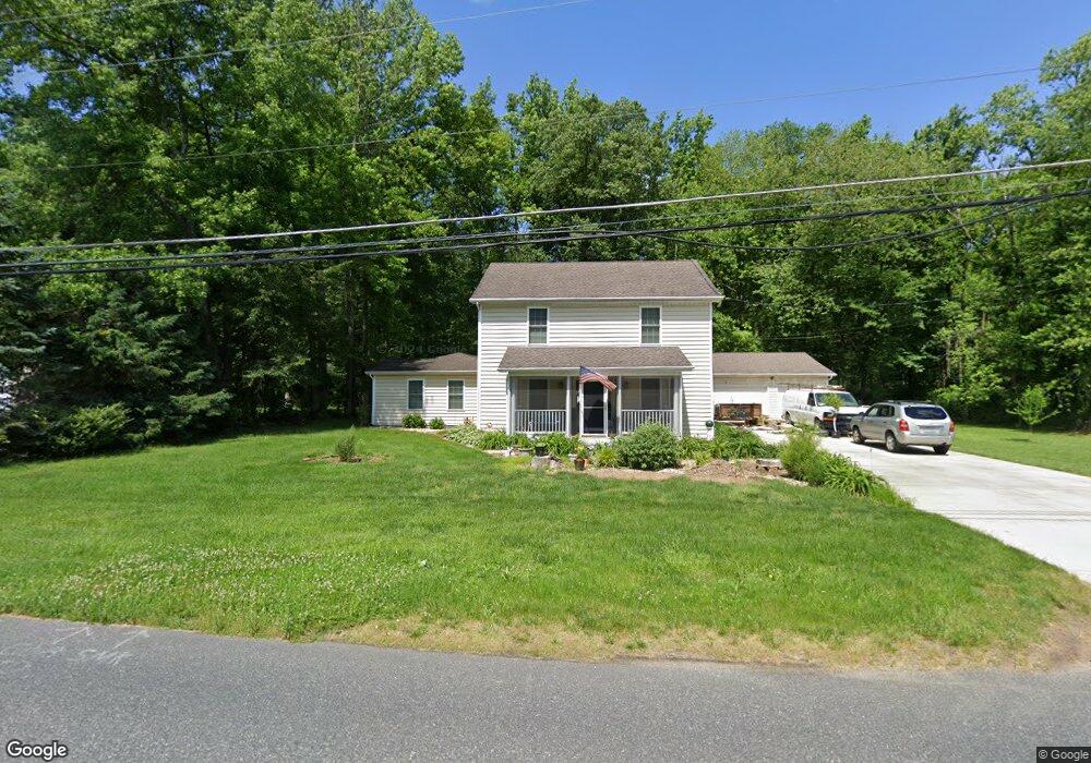
510 Maxa Rd Aberdeen, MD 21001
Estimated Value: $428,491 - $494,000
About This Home
This home is located at 510 Maxa Rd, Aberdeen, MD 21001 and is currently estimated at $460,623, approximately $191 per square foot. 510 Maxa Rd is a home located in Harford County with nearby schools including Roye-Williams Elementary School, Aberdeen Middle School, and Aberdeen High School.
Ownership History
We collect this data history from publicly available records. To have your information removed, we recommend requesting removal directly through your county’s website.
Purchase Details
Home Financials for this Owner
Home Financials are based on the most recent Mortgage that was taken out on this home.Purchase Details
Home Financials for this Owner
Home Financials are based on the most recent Mortgage that was taken out on this home.Purchase Details
Purchase Details
Home Financials for this Owner
Home Financials are based on the most recent Mortgage that was taken out on this home.Purchase Details
Home Financials for this Owner
Home Financials are based on the most recent Mortgage that was taken out on this home.Purchase Details
Purchase Details
Purchase Details
Home Values in the Area
Average Home Value in this Area
Purchase History
We collect this data history from publicly available records. To have your information removed, we recommend requesting removal directly through your county’s website.
| Date | Buyer | Sale Price | Title Company |
|---|---|---|---|
| $150,000 | None Available | ||
| $50,000 | First American Title Insuran | ||
| $237,645 | -- | ||
| $230,000 | -- | ||
| $230,000 | -- | ||
| $171,000 | -- | ||
| $75,000 | -- | ||
| $48,500 | -- |
Mortgage History
We collect this data history from publicly available records. To have your information removed, we recommend requesting removal directly through your county’s website.
| Date | Status | Borrower | Loan Amount |
|---|---|---|---|
| Open | $150,000 | ||
| Previous Owner | $150,000 | ||
| Previous Owner | $226,446 | ||
| Previous Owner | $226,446 | ||
| Closed | -- |
Tax History
We collect this data history from publicly available records. To have your information removed, we recommend requesting removal directly through your county’s website.
| Year | Tax Paid | Tax Assessment Tax Assessment Total Assessment is a certain percentage of the fair market value that is determined by local assessors to be the total taxable value of land and additions on the property. | Land | Improvement |
|---|---|---|---|---|
| 2025 | $3,135 | $350,067 | $0 | $0 |
| 2024 | $3,135 | $328,833 | $0 | $0 |
| 2023 | $2,932 | $307,600 | $71,500 | $236,100 |
| 2022 | $2,890 | $303,133 | $0 | $0 |
| 2021 | $1,479 | $298,667 | $0 | $0 |
| 2020 | $1,479 | $294,200 | $71,500 | $222,700 |
| 2019 | $2,786 | $277,067 | $0 | $0 |
| 2018 | $2,591 | $259,933 | $0 | $0 |
| 2017 | $2,420 | $242,800 | $0 | $0 |
| 2016 | -- | $242,800 | $0 | $0 |
| 2015 | $2,058 | $242,800 | $0 | $0 |
| 2014 | $2,058 | $255,300 | $0 | $0 |
Map
- 615 Southgate Rd
- 627 Northgate Rd
- 442 Bernice Terrace
- 607 Northgate Rd
- 650 Brenda Ln
- 0 Paradise Rd
- 713 Paul Dr
- 521 Beards Hill Rd
- 774 Everist Dr
- 721 Everist Dr
- 434 Woodcrest Dr
- 449 Grasmere Ln
- 610 Colaine Dr
- 413 Grasmere Dr
- 301 Kendrick Dr
- 812 Long Dr Unit F
- 102 Graceford Dr
- 405 Devonshire Ct
- 631 W Bel Air Ave
- 753 Gilbert Rd
- 600 Maxa Rd
- 506 Maxa Rd
- 505 Maxa Rd
- 621 Beards Hill Rd
- 701 Beards Hill Rd
- 622 Southgate Rd
- 617 Southgate Rd
- 709 Beards Hill Rd
- 619B Beards Hill Rd
- 619 Beards Hill Rd
- 703 Beards Hill Rd
- 620 Southgate Rd
- 602 Westgate Rd
- 617 Beards Hill Rd
- 705 Beards Hill Rd
- 634 Beards Hill Rd
- 630 Beards Hill Rd
- 638 Beards Hill Rd
- 618 Southgate Rd
- 626 Beards Hill Rd
Ask me questions while you tour the home.