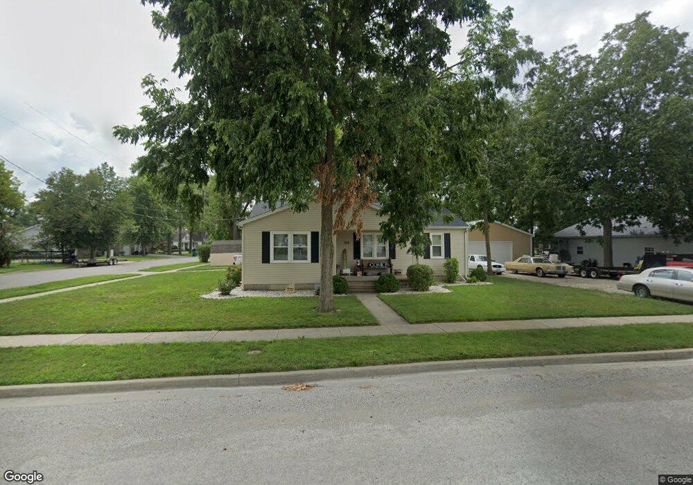
510 W 3rd St Beckemeyer, IL 62219
Estimated Value: $161,000 - $176,000
3
Beds
2
Baths
1,232
Sq Ft
$137/Sq Ft
Est. Value
About This Home
This home is located at 510 W 3rd St, Beckemeyer, IL 62219 and is currently estimated at $169,104, approximately $137 per square foot. 510 W 3rd St is a home located in Clinton County with nearby schools including Breese ESD #12, Beckemeyer Elementary School, and Central Community High School.
Ownership History
Date
Name
Owned For
Owner Type
Purchase Details
Closed on
Dec 21, 2012
Sold by
Kolb Constance and Peppenhorst Ronald
Bought by
Mearns Derek
Current Estimated Value
Home Financials for this Owner
Home Financials are based on the most recent Mortgage that was taken out on this home.
Original Mortgage
$82,800
Outstanding Balance
$57,286
Interest Rate
3.34%
Mortgage Type
New Conventional
Estimated Equity
$111,818
Create a Home Valuation Report for This Property
The Home Valuation Report is an in-depth analysis detailing your home's value as well as a comparison with similar homes in the area
Purchase History
We collect this data history from publicly available records. To have your information removed, we recommend requesting removal directly through your county’s website.
| Date | Buyer | Sale Price | Title Company |
|---|---|---|---|
| Mearns Derek | $80,000 | None Available |
Source: Public Records
Mortgage History
We collect this data history from publicly available records. To have your information removed, we recommend requesting removal directly through your county’s website.
| Date | Status | Borrower | Loan Amount |
|---|---|---|---|
| Open | Mearns Derek | $82,800 |
Source: Public Records
Tax History
| Year | Tax Paid | Tax Assessment Tax Assessment Total Assessment is a certain percentage of the fair market value that is determined by local assessors to be the total taxable value of land and additions on the property. | Land | Improvement |
|---|---|---|---|---|
| 2024 | $2,865 | $48,640 | $7,590 | $41,050 |
| 2023 | $2,865 | $44,220 | $6,900 | $37,320 |
| 2022 | $2,649 | $35,330 | $6,760 | $28,570 |
| 2021 | $2,041 | $34,640 | $6,630 | $28,010 |
| 2020 | $2,037 | $33,960 | $6,500 | $27,460 |
| 2019 | $2,002 | $33,960 | $6,500 | $27,460 |
| 2018 | $1,900 | $30,810 | $5,460 | $25,350 |
| 2017 | $1,924 | $30,810 | $5,460 | $25,350 |
| 2016 | $1,927 | $30,810 | $5,460 | $25,350 |
| 2015 | $1,571 | $30,810 | $5,460 | $25,350 |
| 2013 | $1,571 | $34,080 | $5,460 | $28,620 |
Source: Public Records
Map
Nearby Homes
- 651 Dora St
- 221 Sharp St
- 940 E First St
- 13426 Stolletown Rd
- 16617 Pembrooke Ct
- 16743 Ashland Ct
- 1910 Franklin St
- 0 Redwood St
- 10520 Vonder Haar Ln
- 1491 Clinton St
- 1311 Franklin St
- 13005 Oil Field Rd
- 10675 Buckingham Ct
- 1111 Mulliken St
- 15207 Business Highway 127
- 791 Clinton St
- 730 Jefferson St
- 320 N Oak St
- 2750 Governors Dr
- 10004 Holy Cross Ln
Your Personal Tour Guide
Ask me questions while you tour the home.