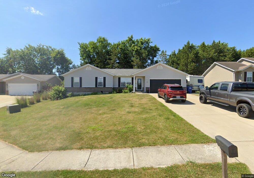
512 Candlestick Ct Warrenton, MO 63383
Estimated Value: $260,745 - $281,000
3
Beds
2
Baths
1,240
Sq Ft
$216/Sq Ft
Est. Value
About This Home
This home is located at 512 Candlestick Ct, Warrenton, MO 63383 and is currently estimated at $268,436, approximately $216 per square foot. 512 Candlestick Ct is a home located in Warren County with nearby schools including Warrior Ridge Elementary School, Black Hawk Middle School, and Warrenton High School.
Ownership History
Date
Name
Owned For
Owner Type
Purchase Details
Closed on
Jan 6, 2012
Sold by
Schien Kenneth and Schien Joyce
Bought by
Barton Aaron W
Current Estimated Value
Home Financials for this Owner
Home Financials are based on the most recent Mortgage that was taken out on this home.
Original Mortgage
$2,921
Outstanding Balance
$1,972
Interest Rate
4.04%
Mortgage Type
New Conventional
Estimated Equity
$266,464
Purchase Details
Closed on
Sep 29, 2008
Sold by
Cannon Builders Inc
Bought by
Schien Kenneth and Schien Joyce
Create a Home Valuation Report for This Property
The Home Valuation Report is an in-depth analysis detailing your home's value as well as a comparison with similar homes in the area
Home Values in the Area
Average Home Value in this Area
Purchase History
We collect this data history from publicly available records. To have your information removed, we recommend requesting removal directly through your county’s website.
| Date | Buyer | Sale Price | Title Company |
|---|---|---|---|
| Barton Aaron W | -- | None Available | |
| Schien Kenneth | -- | None Available |
Source: Public Records
Mortgage History
We collect this data history from publicly available records. To have your information removed, we recommend requesting removal directly through your county’s website.
| Date | Status | Borrower | Loan Amount |
|---|---|---|---|
| Open | Barton Aaron W | $2,921 |
Source: Public Records
Tax History
| Year | Tax Paid | Tax Assessment Tax Assessment Total Assessment is a certain percentage of the fair market value that is determined by local assessors to be the total taxable value of land and additions on the property. | Land | Improvement |
|---|---|---|---|---|
| 2025 | $1,646 | $25,688 | $5,797 | $19,891 |
| 2024 | $1,646 | $22,732 | $5,130 | $17,602 |
| 2023 | $1,431 | $22,732 | $5,130 | $17,602 |
| 2022 | $1,307 | $20,704 | $4,750 | $15,954 |
| 2021 | $1,307 | $20,704 | $4,750 | $15,954 |
| 2020 | $1,313 | $20,704 | $4,750 | $15,954 |
| 2019 | $1,312 | $20,704 | $0 | $0 |
| 2017 | $1,298 | $20,704 | $0 | $0 |
| 2016 | $1,295 | $20,704 | $0 | $0 |
| 2015 | -- | $20,704 | $0 | $0 |
| 2011 | -- | $20,700 | $0 | $0 |
Source: Public Records
Map
Nearby Homes
- 1025 Cambden Yard Dr
- 1005 Busch Dr
- 0 Unknown Unit MIS26024454
- 915 Pine Ave
- 400 Chantilly Ct
- 910 Aspen Ave
- 26147 N Carol St
- 19922 Mockingbird Ln
- 2 Brune Business Park Ct
- 850 Navajo Trail
- 13.77 + - Acres
- 27471 Forest Ridge Ct
- 43.35 Ac Pinckney St
- 21323 E Lakeview Dr Unit 18
- 1 Rochester @ Pinckney Ridge
- 1 Westbrook @ Pinckney Ridge
- 1 Tremont @ Pinckney Ridge
- 1 Rockport @ Pinckney Ridge
- 1 Canterbury @ Pinckney Ridge
- 1 Quincy @ Pinckney Ridge
- 510 Candlestick Ct
- 514 Candlestick Ct
- 508 Candlestick Ct
- 516 Candlestick Ct
- 507 Candlestick Ct
- 1020 Fenway Ct
- 509 Candlestick Ct
- 511 Candlestick Ct
- 506 Candlestick Ct
- 1023 Comiskey Ct
- 1018 Fenway Ct
- 504 Candlestick Ct
- 1025 Wrigley Cir
- 1023 Wrigley Cir
- 503 Candlestick Ct
- 1025 Comiskey Ct
- 1021 Wrigley Cir
- 1021 Comiskey Ct
- 1019 Fenway Ct
- 1021 Fenway Ct
Your Personal Tour Guide
Ask me questions while you tour the home.