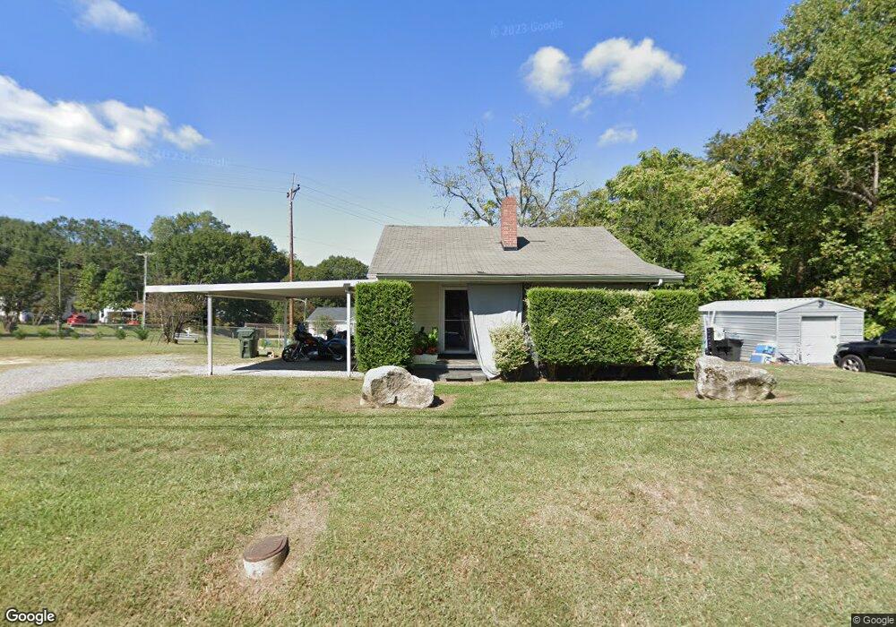
512 E Davidson Ave Gastonia, NC 28054
Estimated Value: $123,000 - $169,229
About This Home
This home is located at 512 E Davidson Ave, Gastonia, NC 28054 and is currently estimated at $149,807, approximately $148 per square foot. 512 E Davidson Ave is a home located in Gaston County with nearby schools including Woodhill Elementary School, W P Grier Middle School, and Ashbrook High School.
Ownership History
We collect this data history from publicly available records. To have your information removed, we recommend requesting removal directly through your county’s website.
Purchase Details
Home Financials for this Owner
Home Financials are based on the most recent Mortgage that was taken out on this home.Home Values in the Area
Average Home Value in this Area
Purchase History
We collect this data history from publicly available records. To have your information removed, we recommend requesting removal directly through your county’s website.
| Date | Buyer | Sale Price | Title Company |
|---|---|---|---|
| $51,500 | None Available |
Mortgage History
We collect this data history from publicly available records. To have your information removed, we recommend requesting removal directly through your county’s website.
| Date | Status | Borrower | Loan Amount |
|---|---|---|---|
| Open | $38,625 |
Tax History
We collect this data history from publicly available records. To have your information removed, we recommend requesting removal directly through your county’s website.
| Year | Tax Paid | Tax Assessment Tax Assessment Total Assessment is a certain percentage of the fair market value that is determined by local assessors to be the total taxable value of land and additions on the property. | Land | Improvement |
|---|---|---|---|---|
| 2025 | $1,405 | $131,460 | $15,760 | $115,700 |
| 2024 | $1,405 | $131,460 | $15,760 | $115,700 |
| 2023 | $1,420 | $131,460 | $15,760 | $115,700 |
| 2022 | $769 | $57,820 | $12,890 | $44,930 |
| 2021 | $781 | $57,820 | $12,890 | $44,930 |
| 2019 | $802 | $58,970 | $12,890 | $46,080 |
| 2018 | $696 | $49,698 | $12,800 | $36,898 |
| 2017 | $682 | $49,698 | $12,800 | $36,898 |
| 2016 | $682 | $48,679 | $0 | $0 |
| 2014 | $897 | $64,049 | $17,190 | $46,859 |
Map
- 921 Green Circle Dr
- 826 N Avon St
- 1121 N Broad St
- 408 E Park Ave
- 985 Sundance Dr
- 504 N Broad St
- 408 N Broad St
- 630 Ratchford Ave
- 1005 Glenview Ave
- 620 Ratchford Ave
- 318 N Avon St
- 305 N Poplar St
- 409 W Norment Ave
- 411 W Sullivan St
- 412 W Davidson Ave
- 431 W Norment Ave
- 633 Grace St
- 627 Grace St
- 722 E Airline Ave
- 930 E Mauney Ave
- 910 Green Circle Dr
- 513 E Davidson Ave
- 520 E Davidson Ave
- 918 Green Circle Dr
- 905 Green Circle Dr
- 909 Green Circle Dr
- 901 Green Circle Dr
- 913 Green Circle Dr
- 524 E Davidson Ave
- 917 Green Circle Dr
- 926 Green Circle Dr
- 423 E Davidson Ave
- 418 E Davidson Ave
- 311 Linden Cir
- 526 E Davidson Ave
- 416 E Davidson Ave
- 419 E Davidson Ave
- 309 Linden Cir
- 934 Green Circle Dr
- 313 Linden Cir
Ask me questions while you tour the home.