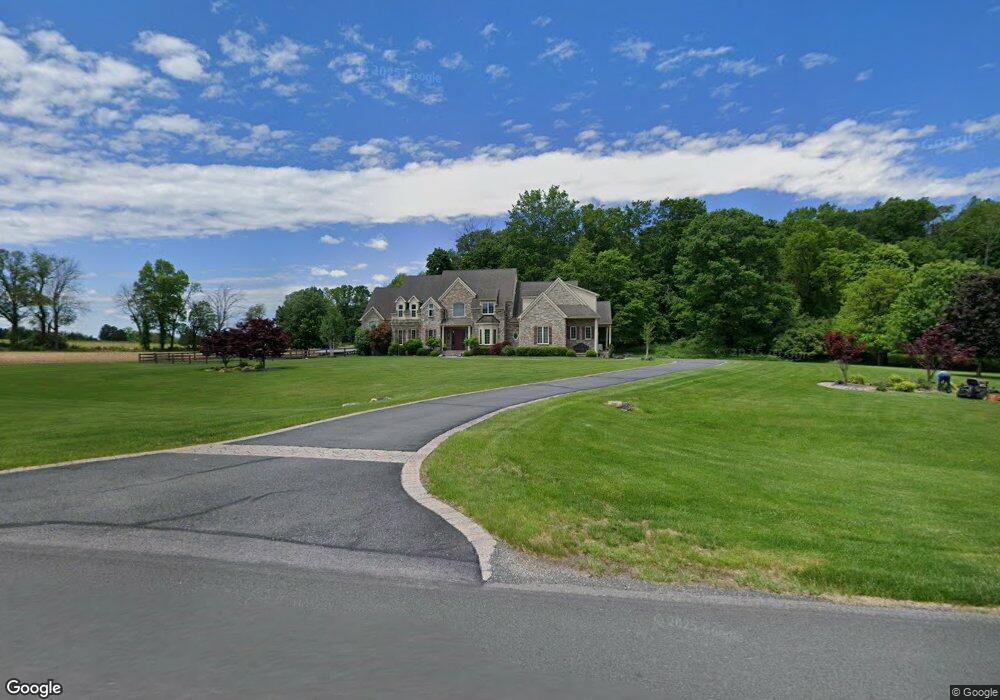
512 Maple Ln Andover, NJ 07821
Estimated Value: $487,000 - $886,686
Studio
--
Bath
4,452
Sq Ft
$159/Sq Ft
Est. Value
About This Home
This home is located at 512 Maple Ln, Andover, NJ 07821 and is currently estimated at $706,895, approximately $158 per square foot. 512 Maple Ln is a home located in Warren County with nearby schools including Mountain Villa School, Allamuchy Township Elementary School, and Tranquility Adventist School.
Ownership History
Date
Name
Owned For
Owner Type
Purchase Details
Closed on
May 22, 2007
Sold by
Mcgoldrick Peter and Mcgoldrick Hillary Bellings
Bought by
Mcgoldrick Hillary Bellings
Current Estimated Value
Purchase Details
Closed on
Oct 31, 2006
Sold by
Mcgoldrick Peter and Bellings Hillary
Bought by
Mcgoldrick Peter and Bellings Hillary
Purchase Details
Closed on
May 7, 2004
Sold by
Mcgoldrick Peter and Mcgoldrick Nancy
Bought by
Mcgoldrick Peter
Purchase Details
Closed on
Feb 9, 1999
Sold by
Sterling Paul F
Bought by
Sterling Paul F and Fleet Bank Na
Create a Home Valuation Report for This Property
The Home Valuation Report is an in-depth analysis detailing your home's value as well as a comparison with similar homes in the area
Home Values in the Area
Average Home Value in this Area
Purchase History
| Date | Buyer | Sale Price | Title Company |
|---|---|---|---|
| Mcgoldrick Hillary Bellings | -- | None Available | |
| Mcgoldrick Peter | -- | None Available | |
| Mcgoldrick Peter | -- | -- | |
| Sterling Paul F | -- | -- |
Source: Public Records
Tax History
| Year | Tax Paid | Tax Assessment Tax Assessment Total Assessment is a certain percentage of the fair market value that is determined by local assessors to be the total taxable value of land and additions on the property. | Land | Improvement |
|---|---|---|---|---|
| 2025 | $20,220 | $629,900 | $111,700 | $518,200 |
| 2024 | $19,812 | $629,900 | $111,700 | $518,200 |
Source: Public Records
Map
Nearby Homes
- 8 Spring Hunter Ct
- 112 Kennedy Rd
- 203 Johnsonburg Rd
- 26 Fox Hollow Way
- 14 Misty Ln
- 83 Creek Rd
- 37 Pequest Rd
- 195 Allamuchy Rd
- 14 Golden Crowned Kinglet Unit 7
- 0 Decker Pond Airport Rd Unit 3945534
- 9 Nuthatch Ct
- 300 Alphano Rd
- 144 Allamuchy Rd
- 15 Mountainview Dr
- 10 Sunny Ln
- 30 Cardinal Rd
- 79 Indigo Rd
- 31 Mockingbird
- 34 Saddle Ridge Rd
- 411 Shades of Death Rd
- 510 Maple Ln
- 520 Maple Ln
- 506 Maple Ln
- 508 Maple Ln
- 502 Maple Ln
- 7 Blueberry Ln
- 9 Maple Lane Rd E
- 5 Blueberry Ln
- 3 Spring Hunter Ct
- 1 Spring Hunter Ct
- 3 Blueberry Ln
- 5 Spring Hunter Ct
- 2 Spring Hunter Ct
- 7 Spring Hunter Ct
- 11 Maple Lane Rd E
- 1 Blueberry Ln
- 4 Spring Hunter Ct
- 9 Spring Hunter Ct
- 13 Stone Bridge Dr
- 11 Stone Bridge Dr
Your Personal Tour Guide
Ask me questions while you tour the home.