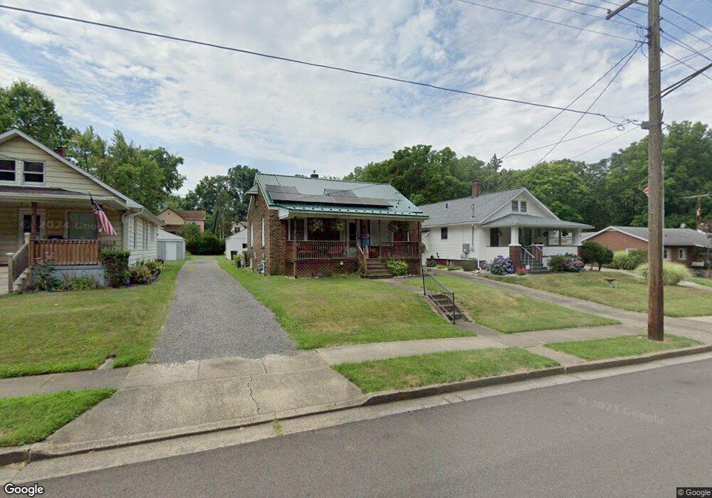
512 W Wayne St Alliance, OH 44601
Estimated Value: $72,000 - $104,000
2
Beds
1
Bath
843
Sq Ft
$106/Sq Ft
Est. Value
About This Home
This home is located at 512 W Wayne St, Alliance, OH 44601 and is currently estimated at $89,264, approximately $105 per square foot. 512 W Wayne St is a home located in Stark County with nearby schools including Alliance Early Learning School, Alliance Intermediate School at Northside, and Alliance Middle School.
Ownership History
Date
Name
Owned For
Owner Type
Purchase Details
Closed on
Oct 13, 2017
Sold by
Dickerhoff Allan E and Dickerhoff Paula K
Bought by
Albright Mark
Current Estimated Value
Home Financials for this Owner
Home Financials are based on the most recent Mortgage that was taken out on this home.
Original Mortgage
$49,094
Outstanding Balance
$26,678
Interest Rate
3.82%
Mortgage Type
FHA
Estimated Equity
$62,586
Purchase Details
Closed on
Jun 12, 1999
Sold by
Heinlein Cheryl L
Bought by
Dickerhoff Paula K and Dickerhoff Allan E
Purchase Details
Closed on
Sep 8, 1993
Create a Home Valuation Report for This Property
The Home Valuation Report is an in-depth analysis detailing your home's value as well as a comparison with similar homes in the area
Home Values in the Area
Average Home Value in this Area
Purchase History
| Date | Buyer | Sale Price | Title Company |
|---|---|---|---|
| Albright Mark | $50,000 | Heritage Union Title Co Ltd | |
| Dickerhoff Paula K | $25,000 | -- | |
| -- | -- | -- |
Source: Public Records
Mortgage History
| Date | Status | Borrower | Loan Amount |
|---|---|---|---|
| Open | Albright Mark | $49,094 |
Source: Public Records
Tax History
| Year | Tax Paid | Tax Assessment Tax Assessment Total Assessment is a certain percentage of the fair market value that is determined by local assessors to be the total taxable value of land and additions on the property. | Land | Improvement |
|---|---|---|---|---|
| 2025 | -- | $22,440 | $4,590 | $17,850 |
| 2024 | -- | $21,640 | $4,590 | $17,050 |
| 2023 | $755 | $18,770 | $4,520 | $14,250 |
| 2022 | $760 | $18,770 | $4,520 | $14,250 |
| 2021 | $761 | $18,770 | $4,520 | $14,250 |
| 2020 | $683 | $15,750 | $3,920 | $11,830 |
| 2019 | $674 | $15,760 | $3,920 | $11,840 |
Source: Public Records
Map
Nearby Homes
- 717 Garfield Ave
- 1004 Ridgefield Ave
- 33 S Lincoln Ave
- 432 Johnson Ave
- 171 1/2 W Main St
- 550 Johnson Ave
- 000 Meadowbrook Ave
- 118 S Mckinley Ave
- 505 N Union Ave
- 343 W Columbia St
- 163 W Market St
- 0 Meadowbrook Ave
- 710 N Freedom Ave
- 160 Bonnieview Ave
- 479 W High St
- 62 E Market St
- 11335 Meadowbrook Ave NE
- 319 W Oxford St
- 849 Walnut Ave
- 430 W Oxford St
- 504 W Wayne St
- 518 W Wayne St
- 484 W Wayne St
- 474 W Wayne St
- 509 W Washington St
- 491 W Washington St
- 466 W Wayne St
- 532 Mckinley Ct
- 509 W Wayne St
- 538 W Wayne St
- 538 W Wayne St
- 445 W Washington St
- 473 W Wayne St
- 551 W Wayne St
- 471 W Wayne St
- 504 W Washington St
- 490 W Washington St
- 441 W Wayne St
- 468 W Washington St
- 605 N Rockhill Ave
Your Personal Tour Guide
Ask me questions while you tour the home.