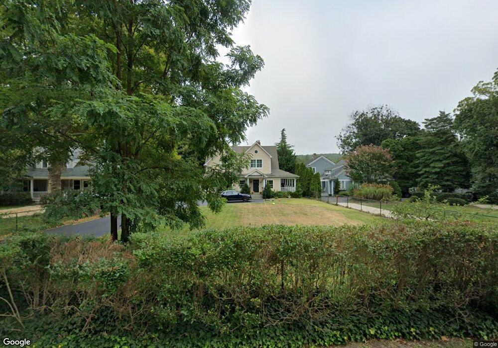
513 Locust Point Rd Rumson, NJ 07760
Estimated Value: $1,469,541 - $1,940,000
4
Beds
3
Baths
3,229
Sq Ft
$499/Sq Ft
Est. Value
About This Home
This home is located at 513 Locust Point Rd, Rumson, NJ 07760 and is currently estimated at $1,612,135, approximately $499 per square foot. 513 Locust Point Rd is a home located in Monmouth County with nearby schools including Navesink Elementary School, Bayshore Middle School, and Middletown - South High School.
Ownership History
Date
Name
Owned For
Owner Type
Purchase Details
Closed on
Feb 17, 2020
Sold by
Malley Thomas P O and Malley Abby O
Bought by
Malley Abby F O
Current Estimated Value
Purchase Details
Closed on
Apr 24, 2009
Sold by
Oxley John
Bought by
Oxley John and Oxley Dina
Purchase Details
Closed on
Apr 13, 1998
Sold by
Kolesar William
Bought by
O'Malley Thomas and O'Malley Abby
Home Financials for this Owner
Home Financials are based on the most recent Mortgage that was taken out on this home.
Original Mortgage
$196,000
Outstanding Balance
$37,044
Interest Rate
7.05%
Mortgage Type
Purchase Money Mortgage
Estimated Equity
$1,575,091
Create a Home Valuation Report for This Property
The Home Valuation Report is an in-depth analysis detailing your home's value as well as a comparison with similar homes in the area
Home Values in the Area
Average Home Value in this Area
Purchase History
| Date | Buyer | Sale Price | Title Company |
|---|---|---|---|
| Malley Abby F O | -- | None Available | |
| Oxley John | -- | None Available | |
| O'Malley Thomas | $245,000 | -- |
Source: Public Records
Mortgage History
| Date | Status | Borrower | Loan Amount |
|---|---|---|---|
| Open | O'Malley Thomas | $196,000 |
Source: Public Records
Tax History
| Year | Tax Paid | Tax Assessment Tax Assessment Total Assessment is a certain percentage of the fair market value that is determined by local assessors to be the total taxable value of land and additions on the property. | Land | Improvement |
|---|---|---|---|---|
| 2025 | $18,319 | $1,122,400 | $603,500 | $518,900 |
| 2024 | $17,017 | $1,113,600 | $604,200 | $509,400 |
| 2023 | $17,017 | $979,100 | $578,700 | $400,400 |
| 2022 | $16,390 | $844,300 | $463,000 | $381,300 |
| 2021 | $16,390 | $788,000 | $448,900 | $339,100 |
| 2020 | $16,685 | $780,400 | $448,900 | $331,500 |
| 2019 | $15,952 | $755,300 | $472,500 | $282,800 |
| 2018 | $16,081 | $742,100 | $472,500 | $269,600 |
| 2017 | $16,083 | $734,700 | $472,500 | $262,200 |
| 2016 | $16,076 | $754,400 | $472,500 | $281,900 |
| 2015 | $16,619 | $753,000 | $472,500 | $280,500 |
| 2014 | $16,495 | $728,900 | $472,500 | $256,400 |
Source: Public Records
Map
Nearby Homes
- 942 Navesink River Rd
- 934 Navesink River Rd
- 96 East Ave Unit 82
- 26 King James Ln
- 9 King James Ln
- 96 E East Ave Unit 37
- 48 Starr Ct
- 171 Grand Ave
- 114 Memorial Pkwy
- 502 Central Ave
- 498 Central Ave
- 7100 Prospect Ave
- 6998 Prospect Ave
- 500 Central Ave
- 20 Brianna Ct Unit 20
- 244 Van Kirk Ave
- 49 Pape Dr
- 258 Ocean Blvd
- 50 Memorial Pkwy
- 104 E Washington Ave
- 517 Locust Point Rd
- 509 Locust Point Rd
- 521 Locust Point Rd
- 525 Locust Point Rd
- 529 Locust Point Rd
- 501 Locust Point Rd
- 531 Locust Point Rd
- 508 Locust Point Rd
- 28 Red Coach Ln
- 535 Locust Point Rd
- 504 Locust Point Rd
- 500 Locust Point Rd
- 539 Locust Point Rd
- 491 Locust Point Rd
- 207 Locust Ave
- 524 Locust Point Rd
- 30 Red Coach Ln
- 528 Locust Point Rd
- 211 Locust Ave
- 543 Locust Point Rd
Your Personal Tour Guide
Ask me questions while you tour the home.