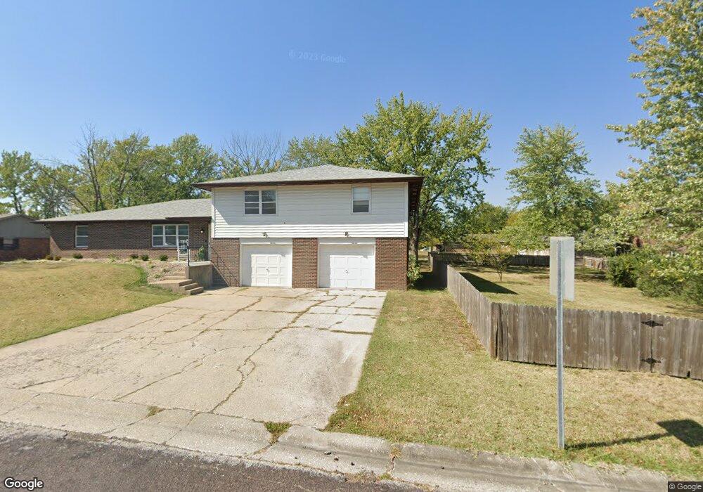
513 Pear Tree Cir Unit 515 Columbia, MO 65203
Cedar Lake NeighborhoodEstimated Value: $290,000 - $318,125
3
Beds
2
Baths
1,408
Sq Ft
$218/Sq Ft
Est. Value
About This Home
This home is located at 513 Pear Tree Cir Unit 515, Columbia, MO 65203 and is currently estimated at $306,531, approximately $217 per square foot. 513 Pear Tree Cir Unit 515 is a home located in Boone County with nearby schools including Mill Creek Elementary School, Ann Hawkins Gentry Middle School, and Rock Bridge High School.
Ownership History
Date
Name
Owned For
Owner Type
Purchase Details
Closed on
Aug 21, 2025
Sold by
Wyatt Family Trust and Wyatt Richard S
Bought by
Maurizi Tina
Current Estimated Value
Purchase Details
Closed on
Apr 12, 2024
Sold by
Wyatt Richard Stephen
Bought by
Wyatt Family Trust and Wyatt
Create a Home Valuation Report for This Property
The Home Valuation Report is an in-depth analysis detailing your home's value as well as a comparison with similar homes in the area
Home Values in the Area
Average Home Value in this Area
Purchase History
| Date | Buyer | Sale Price | Title Company |
|---|---|---|---|
| Maurizi Tina | -- | None Listed On Document | |
| Wyatt Family Trust | -- | None Listed On Document | |
| Wyatt Family Trust | -- | None Listed On Document | |
| Wyatt Family Trust | -- | None Listed On Document |
Source: Public Records
Tax History
| Year | Tax Paid | Tax Assessment Tax Assessment Total Assessment is a certain percentage of the fair market value that is determined by local assessors to be the total taxable value of land and additions on the property. | Land | Improvement |
|---|---|---|---|---|
| 2025 | $1,853 | $28,291 | $4,237 | $24,054 |
| 2024 | $1,736 | $25,726 | $4,237 | $21,489 |
| 2023 | $1,721 | $25,726 | $4,237 | $21,489 |
| 2022 | $1,653 | $24,738 | $4,237 | $20,501 |
| 2021 | $1,656 | $24,738 | $4,237 | $20,501 |
| 2020 | $1,632 | $22,900 | $4,237 | $18,663 |
| 2019 | $1,632 | $22,900 | $4,237 | $18,663 |
| 2018 | $1,522 | $0 | $0 | $0 |
| 2017 | $1,501 | $21,204 | $4,237 | $16,967 |
| 2016 | $1,501 | $21,204 | $4,237 | $16,967 |
| 2015 | $1,378 | $21,204 | $4,237 | $16,967 |
| 2014 | $1,383 | $21,204 | $4,237 | $16,967 |
Source: Public Records
Map
Nearby Homes
- 4759 Lake Valley Ln
- 4806 Forum Blvd
- 4405 Fall River Dr
- LOT 129 Clear Creek Estates
- LOT 101 Clear Creek Estates
- LOT 128 Clear Creek Estates
- 1110 Brookedale Ct
- 5109 Rosewood Ct
- 29 N Cedar Lake Dr E Unit 307
- 1201 Sutton Dr
- 1208 Tartan Place
- 4403 Glen Eagle Dr
- 3 ACRES W Bethel Dr
- 1317 Troon Dr
- 4905 Glencairn Dr
- 3808 Barrington Dr
- 4301 Glen Eagle Dr
- 4304 Royal Aberdeen St
- 400 S Brookline Dr
- 1317 Sedona Villas Dr
- 515 Pear Tree Cir
- 523 Pear Tree Cir Unit 525
- 523-525 Pear Tree Cir
- 558-560 W Southampton Dr
- 558 Southampton Dr Unit 560
- 560 Southampton Dr
- 562 Southampton Dr Unit 564
- 4634 Southampton Ct
- 4632 Southampton Ct Unit 4634
- 512 Pear Tree Cir Unit 514
- 522 Pear Tree Cir Unit 524
- 534 W Southampton Dr
- 4658 Southampton Ct Unit 4660
- 545 Pear Tree Cir
- 532 Southampton Dr Unit 534
- 543 Pear Tree Cir Unit 545
- 532 W Southampton Dr
- 4606 Southampton Ct
- 532 Pear Tree Cir Unit 534
- 603 Pear Tree Cir Unit 605
Your Personal Tour Guide
Ask me questions while you tour the home.