Estimated Value: $393,000 - $494,000
4
Beds
4
Baths
2,519
Sq Ft
$179/Sq Ft
Est. Value
About This Home
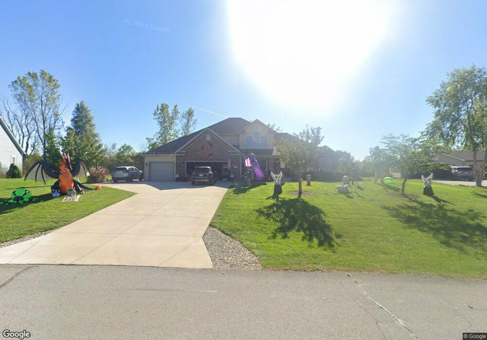
This home is located at 5135 Shoshone Trail, Lima, OH 45805 and is currently estimated at $451,447, approximately $179 per square foot. 5135 Shoshone Trail is a home located in Allen County with nearby schools including Maplewood Elementary School, Elmwood Elementary School, and Shawnee Middle School.
Ownership History
Date
Name
Owned For
Owner Type
Purchase Details
Closed on
Aug 29, 2007
Sold by
A & B Contracting
Bought by
Hovest Amy S and Hovest Richard B
Current Estimated Value
Home Financials for this Owner
Home Financials are based on the most recent Mortgage that was taken out on this home.
Original Mortgage
$65,000
Interest Rate
6.79%
Mortgage Type
FHA
Purchase Details
Closed on
Oct 19, 2006
Sold by
Indianbrook West Co
Bought by
A & B Contracting
Create a Home Valuation Report for This Property
The Home Valuation Report is an in-depth analysis detailing your home's value as well as a comparison with similar homes in the area
Purchase History
We collect this data history from publicly available records. To have your information removed, we recommend requesting removal directly through your county’s website.
| Date | Buyer | Sale Price | Title Company |
|---|---|---|---|
| Hovest Amy S | $325,000 | None Available | |
| A & B Contracting | $31,000 | None Available |
Source: Public Records
Mortgage History
We collect this data history from publicly available records. To have your information removed, we recommend requesting removal directly through your county’s website.
| Date | Status | Borrower | Loan Amount |
|---|---|---|---|
| Closed | Hovest Amy S | $65,000 |
Source: Public Records
Tax History
| Year | Tax Paid | Tax Assessment Tax Assessment Total Assessment is a certain percentage of the fair market value that is determined by local assessors to be the total taxable value of land and additions on the property. | Land | Improvement |
|---|---|---|---|---|
| 2025 | $6,216 | $127,130 | $16,140 | $110,990 |
| 2024 | $6,213 | $127,130 | $16,140 | $110,990 |
| 2023 | $5,799 | $104,200 | $13,230 | $90,970 |
| 2022 | $5,812 | $104,200 | $13,230 | $90,970 |
| 2021 | $5,849 | $104,200 | $13,230 | $90,970 |
| 2020 | $4,532 | $93,210 | $12,670 | $80,540 |
| 2019 | $4,532 | $93,210 | $12,670 | $80,540 |
| 2018 | $4,170 | $86,240 | $12,670 | $73,570 |
| 2017 | $4,130 | $82,740 | $12,670 | $70,070 |
| 2016 | $4,069 | $82,740 | $12,670 | $70,070 |
| 2015 | $4,258 | $82,740 | $12,670 | $70,070 |
| 2014 | $4,258 | $85,510 | $11,660 | $73,850 |
| 2013 | $4,176 | $85,510 | $11,660 | $73,850 |
Source: Public Records
Map
Nearby Homes
- 128 Tolowa Trail
- 845 Atalan Trail
- 849 Yakima Trail
- 4875 Wenatchi Trail
- 4848 W Elm St
- 4095 Spencerville Rd
- 2350 S Wapakoneta Rd
- 2670 S Wapak Rd
- 00 Seriff
- 1455 Riverview Dr
- 1515 Riverview Dr
- 1540 Adak Ave
- 123 Eagles Point W
- 110 Eagles Point St W
- 0 Springview Dr
- 1452 W Shore Dr
- 3462 Makley Dr
- 3136 Juliette Dr
- 000 N Stevick Rd
- 0000 N Stevick Rd
- 5117 Shoshone Trail
- 5141 Shoshone Trail
- 1063 S Wapakoneta Rd
- 1063 S Wapak Rd
- N/A Kiowa
- 892 Kiowa
- 5159 Shoshone Trail
- 5091 Shoshone Trail
- 5154 Shoshone Trail
- 889 Kiowa Trail
- 5177 Shoshone Trail
- 876 Kiowa Trail
- 5067 Shoshone Trail
- 5062 Shoshone Trail
- 5195 Shoshone Tl
- 5043 Shoshone Trail
- 873 Algonkin Trail
- 5040 Shoshone Trail
- 1035 S Wapakoneta Rd
- 5217 Shoshone Trail
Your Personal Tour Guide
Ask me questions while you tour the home.