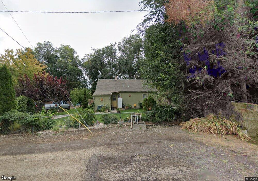
514 Kent St Marsing, ID 83639
Estimated Value: $215,646 - $281,000
2
Beds
1
Bath
831
Sq Ft
$292/Sq Ft
Est. Value
About This Home
This home is located at 514 Kent St, Marsing, ID 83639 and is currently estimated at $242,412, approximately $291 per square foot. 514 Kent St is a home with nearby schools including Marsing Elementary School, Marsing Middle School, and Marsing High School.
Ownership History
Date
Name
Owned For
Owner Type
Purchase Details
Closed on
May 13, 2020
Sold by
Alvarez Ribelino Jimenez
Bought by
Alvarez Ribelino Jimenez and Jimenez Ma Carmen
Current Estimated Value
Purchase Details
Closed on
Sep 1, 2017
Sold by
Calderon Ma Carmen
Bought by
Alverez Ribelion Jimenez
Purchase Details
Closed on
Jul 31, 2007
Sold by
Bowen Richard R and Bowen Pat L
Bought by
Calderon Jose
Home Financials for this Owner
Home Financials are based on the most recent Mortgage that was taken out on this home.
Original Mortgage
$91,675
Interest Rate
6.66%
Mortgage Type
New Conventional
Create a Home Valuation Report for This Property
The Home Valuation Report is an in-depth analysis detailing your home's value as well as a comparison with similar homes in the area
Purchase History
| Date | Buyer | Sale Price | Title Company |
|---|---|---|---|
| Alvarez Ribelino Jimenez | -- | None Available | |
| Alverez Ribelion Jimenez | -- | Pioneer Title Company Owyhee | |
| Calderon Jose | -- | -- |
Source: Public Records
Mortgage History
| Date | Status | Borrower | Loan Amount |
|---|---|---|---|
| Previous Owner | Calderon Jose | $91,675 |
Source: Public Records
Tax History
| Year | Tax Paid | Tax Assessment Tax Assessment Total Assessment is a certain percentage of the fair market value that is determined by local assessors to be the total taxable value of land and additions on the property. | Land | Improvement |
|---|---|---|---|---|
| 2025 | -- | $183,139 | $56,959 | $126,180 |
| 2024 | -- | $183,139 | $56,959 | $126,180 |
| 2023 | $754 | $201,019 | $56,959 | $144,060 |
| 2022 | $934 | $201,049 | $56,959 | $144,090 |
| 2021 | $838 | $134,649 | $43,769 | $90,880 |
| 2020 | $697 | $100,635 | $37,101 | $63,534 |
| 2019 | $731 | $90,391 | $37,101 | $53,290 |
| 2018 | $631 | $92,054 | $30,944 | $61,110 |
| 2017 | $1,076 | $68,654 | $30,944 | $37,710 |
| 2016 | $801 | $48,835 | $25,374 | $23,461 |
| 2014 | $449 | $38,283 | $18,872 | $19,411 |
| 2011 | -- | $26,050 | $10,522 | $15,528 |
Source: Public Records
Map
Nearby Homes
- 523 Morning Dove Way
- 912 W Main St
- TBD Canal St
- 604 Bobwhite
- 6617 Red Rock Rd
- 20056 Sunny Slope Rd
- TBD N Bruneau Rd
- 12730 Sunny Slope Rd
- TBD N Edison Rd
- TBD Lot 5 Cabernet Ln
- TBD Cabernet Ln - Lot 5 Parcel A
- 19151 Symms Rd
- 20796 Lowell Rd
- 101 Twilight Trail
- TBD Riverside Rd
- TBD Oak River Ln
- 10430 Randall Ln
- 11267 W Rio Rd
- TBD Randall Ln
- 20169 Hoskins Rd
Your Personal Tour Guide
Ask me questions while you tour the home.