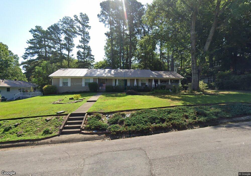
515 McCright St Benton, AR 72015
Estimated Value: $251,715 - $278,000
Studio
2
Baths
1,840
Sq Ft
$146/Sq Ft
Est. Value
About This Home
This home is located at 515 McCright St, Benton, AR 72015 and is currently estimated at $267,929, approximately $145 per square foot. 515 McCright St is a home located in Saline County with nearby schools including Ringgold Elementary School, Benton Middle School, and Benton Junior High School.
Ownership History
Date
Name
Owned For
Owner Type
Purchase Details
Closed on
Sep 9, 2009
Sold by
Steele Ralph Kennth and Steele Joan M
Bought by
Shelby Paul B
Current Estimated Value
Home Financials for this Owner
Home Financials are based on the most recent Mortgage that was taken out on this home.
Original Mortgage
$128,800
Outstanding Balance
$84,959
Interest Rate
5.36%
Mortgage Type
New Conventional
Estimated Equity
$182,970
Purchase Details
Closed on
May 1, 1987
Bought by
Steele
Create a Home Valuation Report for This Property
The Home Valuation Report is an in-depth analysis detailing your home's value as well as a comparison with similar homes in the area
Home Values in the Area
Average Home Value in this Area
Purchase History
We collect this data history from publicly available records. To have your information removed, we recommend requesting removal directly through your county’s website.
| Date | Buyer | Sale Price | Title Company |
|---|---|---|---|
| Shelby Paul B | $161,000 | -- | |
| Steele | $67,000 | -- |
Source: Public Records
Mortgage History
We collect this data history from publicly available records. To have your information removed, we recommend requesting removal directly through your county’s website.
| Date | Status | Borrower | Loan Amount |
|---|---|---|---|
| Open | Shelby Paul B | $128,800 |
Source: Public Records
Tax History
| Year | Tax Paid | Tax Assessment Tax Assessment Total Assessment is a certain percentage of the fair market value that is determined by local assessors to be the total taxable value of land and additions on the property. | Land | Improvement |
|---|---|---|---|---|
| 2025 | $1,947 | $41,800 | $7,500 | $34,300 |
| 2024 | $1,992 | $41,800 | $7,500 | $34,300 |
| 2023 | $1,437 | $41,800 | $7,500 | $34,300 |
| 2022 | $1,402 | $41,800 | $7,500 | $34,300 |
| 2021 | $1,317 | $31,530 | $5,000 | $26,530 |
| 2020 | $1,182 | $31,530 | $5,000 | $26,530 |
| 2019 | $1,182 | $31,530 | $5,000 | $26,530 |
| 2018 | $1,137 | $31,530 | $5,000 | $26,530 |
| 2017 | $1,070 | $31,530 | $5,000 | $26,530 |
| 2016 | $1,386 | $24,450 | $4,200 | $20,250 |
| 2015 | $1,372 | $24,450 | $4,200 | $20,250 |
| 2014 | $1,022 | $24,450 | $4,200 | $20,250 |
Source: Public Records
Map
Nearby Homes
- 524 W Cross St
- 607 W Conway St
- 1026 Whitewood Dr
- 617 Edgemoor
- 412 A Ave
- 324 W North St Unit 328
- 123 N Olive St
- 305 W Cross St
- 1107 J Cove W
- 708 W Ashley St
- Lot 2 Woodland
- 1200 W South St
- 1000 Kenwood
- Lot 25 Lake St
- Lot 29R Lake St
- Lot 28 Lake St
- Lot 30R Lake St
- 1225 Windsor Ct
- 621 Kenwood
- 213 E Narroway
Your Personal Tour Guide
Ask me questions while you tour the home.